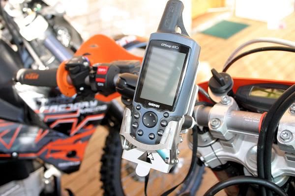
Zone-5 wrote:I can only go by the satellite numbers on the screen of the Etrex 'H' and the 'D' that appears in the signal strength bars.
The two numbers that also appear on the sky view screen when WAAS is enabled coincide with those satellites allocated to the WAAS implementation.
That's really interesting. I am curious if it happens again if you can note the Satellite ID number that shows up on your Etrex H. There was some talk about the Japanese SBAS being tested in our region on the pilot forums sometime back, but I don't know if they show up on Garmins with WAAS/EGNOS enabled. Maybe the Japanese SBAS being trialled is showing up as WAAS/EGNOS satellites on Garmins. The "D" should only show up when the WAAS differential data has been received by the GPS and corrected with the signal from ground reference stations.
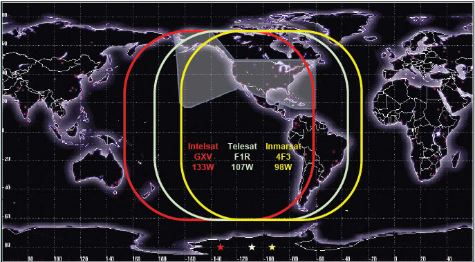
This map is similar to the earlier one I linked, but also has the extend of the signal from the ground reference stations (shown in light grey overlay). This is the distance of around 200 nm from the nearest ground ref station.

Older Garmin units like the H allowed for 19 WAAS/EGNOS/MSAS satellites as specified in the FAA TSO C-146
http://www.airweb.faa.gov/Regulatory_an ... /C146a.pdfIf you see WAAS satellites on the screen it shouldn't move like the other GPS low earth orbit satellites. Satellite ID numbers on the Garmin use a sligtly modified unique NMEA IDs to identify the sats being tracked.
PRN Sat Type
01-32 GPS
33-63 GPS
64-96 GBAS
97-119 GBAS
120-158 SBAS
159-210 Future GNSS
Garmin Sat ID
01-32 GPS
33-63 SBAS (which is derived from the actual SBAS designation - 87)
65-88 Glonass (which is derived from the Glosnass slot number + 64)
The one closest to the east coast of Aus and NZ is the Intersat's Galaxy 15 which has a geostationary orbit on longitude of 133W. It fell out of orbit a few years ago when they lost control of the satellite, but they managed to recover it and it is back in it's original orbit.
So the Intersat Galaxy 15 133W satellite which has a PRN identifier of 135, should show up as satellite ID 48 on the Garmin.
So if you notice yours picking up WAAS again, it would be cool to note which satellite it is.
EDIT: I forgot about the Indian SBAS network GAGAN. They have a couple of satellites up there now, with another launch later this year. Their grid was to extend down to cover parts of south east asia as well, but I'll have to look up what their satellites PRNs are and their orbit longitudes. It's possible the Indian satellites can be seen from Australia.
EDIT 2; Reading up about the Gagan system, the two Indian GAGAN sats up now, positioned at the equator; the GSAT-8 (PRN 128 NMEA41 55°E) and GSAT-10 (PRN 127 NMEA 40 82°E). They have a combined coverage from Africa to Australia, and the system can support 45 ground stations, with room for 30 new stations in neighbouring countries within the GAGAN satellite footprint. There is another launch intended for December this year of the GSAT-15. However, without a ground reference station in Australia, the signal is still useless (similarly people in South America can see the WAAS satellites, but as there are no ground reference stations there, the GPS signal isn't corrected so the accuracy isn't improved).
So if your eTrex H picks up satellite 40 or 41, that's the Indian GAGAN system.


