Walking round Lake St Clair

Discussion specifically about the Overland Track should be posted in this subforum, including side trips and the Cradle Mountain day walk area. Alternative access routes and connecting routes belong in the parent forum.
Forum rules
Overland Track App
An electronic guidebook for planning and walking the Overland Track.
Download this app for loads of information about planning, gear, food, accommodation and much more about the Overland Track.
You will also find topo maps, terrain profiles and track notes for offline use.
$10 -- Discount to $3 until December 15
Image

Re: Walking round Lake St Clair

Postby DaveNoble » Tue 19 Mar, 2013 5:48 pm

eggs wrote:Amazing photos in your link rimair.
It highlights something we were discussing on our last walk - how the track from Windy Ridge to Narcissus used to go over button grass plains and was actually part of the track which now goes to Gould Plateau.
And how the track to Pine Valley had an option up the river valley rather than in the forest.
When I went to Pine Valley this time I could not see Geryon from the helipad.
In fact it felt quite different to my first visit back in 1980 - when you could see the mountain covered in February snow towering above the forest.


There were two different tracks to Pine Valley - via Nicholls Junction or via the Overland Track (the present track). The former track was probably a bit more direct - but in practice it was slower once large sections of the Overland Track were duck boarded (around 1974 - due to Whitlam Government RED scheme money). The old Nicholls Junction track can still be used to go to lake Marion and Gould Plateau. There was also an old track from south of Windy Ridge directly to near the suspension bridge over Cephissus Creek at the end of Pine Valley. This track left the Overland Track about half way between Windy Ridge and the present Pine Valley turn off.

And from that Cephissus suspension bridge - there were two tracks up to the hut - the Forest Track (the existing track) and the Valley Track - that went up the open valley. The Forest Track was the better option in bad weather. The valley track startes from the west side of Cephissus Creek at the suspension bridge - and starts with a very nice sheltered campsite ( with good views too) .

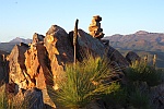
You could never see the Geryon or the Acropolis from the helipad site in Pine Valley - but if you walk down the valley about 50m - you get some amazing views - especially at sunset) - no one seems to do this walk! Perhaps it is too swampy? or perhaps people don't know what they are missing?

Dave
DaveNoble
Athrotaxis selaginoides
 
Posts: 1032
Joined: Sun 03 Feb, 2008 3:56 pm

Re: Walking round Lake St Clair

Postby eggs » Tue 19 Mar, 2013 9:38 pm

Thanks Dave

I knew I had the option of valley or forest when we first went to Pine Valley [it was very wet so we were on the forest route both ways] - and I am pretty sure we came in from Narcissus via Nicholls Junction on that walk.
My friend who remembered the open walking would have been coming from Pine Valley, not Windy Ridge, although I think they must have got to Pine Valley via that more direct route from Windy Ridge.

As for the view, I have an old photo of Geryon from the plain - I don't know how far out I walked, but it didn't seem very far.
In contrast, I reckon I went a few 10s of metres past the helipad this time and still no view. It looked pretty marshy out there.
This is the shot you took from that spot:
http://bushwalk.com/forum/viewtopic.php?f=34&t=2307&p=20879&hilit=geryon+pine+valley#p20879

Did you ever come across the direct route to Mt Gould from Pine Valley?

Brian
User avatar
eggs
Lagarostrobos franklinii
 
Posts: 10736
Joined: Fri 23 May, 2008 2:58 pm
Location: Para Vista, South Australia
Region: South Australia

Re: Walking round Lake St Clair

Postby DaveNoble » Wed 20 Mar, 2013 10:19 pm

eggs wrote:Did you ever come across the direct route to Mt Gould from Pine Valley?

Brian


No - never heard of this track. And I have some old maps and guide books (such as Peaks and High Places) - and I am pretty sure none of them have it marked. Are you sure it ever existed? There are tracks up onto Gould Plateau from Nicholls Junction and a rough pad along the tops from the Labyrinth Track - at the Parthenon/Minotaur saddle that heads over the Minotaur towards Gould and the Guardians. Thats all I know of.

But, then again, there are some other tracks in the area that aren't marked anywhere in maps or guides.

Dave
DaveNoble
Athrotaxis selaginoides
 
Posts: 1032
Joined: Sun 03 Feb, 2008 3:56 pm

Re: Walking round Lake St Clair

Postby eggs » Wed 20 Mar, 2013 11:16 pm

All I know is the pictures and captions as shown on the link to the Melbourne Bushwalkers above..

They show them heading south down the open valley from Pine Valley marked as "Setting off from Pine Valley Hut to climb Mt Gould"
Then looking back to the Acropolis and Geryon from the open valley floor - as "on the way to Gould"
Then an open side high up but south of the Parthenon as 'on the side of Gould'
Then "Descending Mt Gould" which looks a lot like the base of the Minotaur cliffs with the Gould Saddle behind.

Comparing my photos - it looks a lot clearer back then. The scrub looks very thick now in comparison.
User avatar
eggs
Lagarostrobos franklinii
 
Posts: 10736
Joined: Fri 23 May, 2008 2:58 pm
Location: Para Vista, South Australia
Region: South Australia

Re: Walking round Lake St Clair

Postby Nuts » Thu 21 Mar, 2013 5:43 am

The old Windy Ridge-PV track was ok 5/6yrs ago. I'd imagine it could be a bit of a jumble now. We once came down from the Gould saddle, I was with someone who would very likely have been aware of an older track (a track makes sense, perhaps just more a route used now and then) but we went straight to the valley iirc, south of the creek on the Gould side, not along the Parthenon cliffs.

Some great old photos on those pages :)
User avatar
Nuts
Lagarostrobos franklinii
 
Posts: 8555
Joined: Sat 05 Apr, 2008 12:22 pm
Region: Tasmania

Re: Walking round Lake St Clair

Postby Taurë-rana » Thu 21 Mar, 2013 7:58 am

I just assumed that we would take the boat last week but got guilted into walking out by multiple people including my walking partners! And they all told me how pretty the walk was, and it is, with hardly any mud and no fallen trees to climb over currently. Mind you, I did limp all the way - for some reason my boots decided to cause me excruciating pain that day. I was even fantasizing about trying to hitch a lift on the ferry from the lakeside.
My perception of the track which was formed many, many years ago was that it was just a hard, muddy slog that was not necessary to complete the OT, but whether that was ever the case, it isn't now.

rucksack could tell you about the track to Mt Gould Ithink - we met him at Pine Valley Hut and he had walked in from Lake Marion around Mt Gould and was telling me about the old tracks.
Peak bagging points: 170ish
Recent walks - Picton, Wylds Crag, Rogoona
User avatar
Taurë-rana
Phyllocladus aspleniifolius
 
Posts: 960
Joined: Mon 14 Jan, 2008 8:28 pm
Location: Devonport
Region: Tasmania

Re: Walking round Lake St Clair

Postby rucksack » Thu 21 Mar, 2013 1:59 pm

See Chapman, Chapman & Siseman, Cradle Mountain Lake St Clair and Walls of Jerusalem National Parks, 5th edition (2006) pp. 96 & 105

Yes, there are routes both up and over Mount Gould from the Gould Plateau and across the eastern face of Gould, which then continue up and over the Minotaur to connect with the track into The Labyrinth at the southern end of The Parthenon. There is also a 'side' route between Mount Gould and the Minotaur out to The Guardians. Over the years, there have been a number of tracks and routes in and out of Pine Valley. Most are now well overgrown. There was a fairly wet track north of the current Overland Track sidetrack to Pine Valley and there was also a valley track from the old Pine Valley hut down the western side of Cephissus Creek to Nichols Junction. This track was often either flooded or very muddy at its northern end. Both would be difficult to follow these days. I have walked all of these at different times.

rucksack
Last edited by rucksack on Fri 22 Mar, 2013 8:01 pm, edited 1 time in total.
User avatar
rucksack
Athrotaxis cupressoides
 
Posts: 277
Joined: Tue 25 Dec, 2007 9:16 pm
Location: Cygnet
Region: Tasmania
Gender: Male

Re: Walking round Lake St Clair

Postby eggs » Thu 21 Mar, 2013 2:59 pm

Yes rucksack - I had the 'pleasure' of going around Mt Gould from the Plateau a few weeks ago - and then over the Minotaur down to the Labyrinth track.
The old photos seem to show a track to Gould directly up from Pine Valley - going south along the open valley and then up under the cliffs of the Minotaur - not over the top.
I suspect that it is now long gone due to the regrowth.
User avatar
eggs
Lagarostrobos franklinii
 
Posts: 10736
Joined: Fri 23 May, 2008 2:58 pm
Location: Para Vista, South Australia
Region: South Australia

Re: Walking round Lake St Clair

Postby rucksack » Thu 21 Mar, 2013 4:47 pm

Yes eggs, I have a vague recollection of reading somewhere that there was a route passing to the south of the Minotaur, but I cannot recollect where that originated. You may well be right that it was part of a route up from Pine Valley, but as you say, it would likely be long grown over now. Last week, I was up that way, as Taurë-rana remarked. I had a slightly damp night at Lake Marion, (but wonderfully atmospheric views of the Guardians in the morning, swathed in mist and reflected in a perfectly still Lake Marion), and then a very nice late summer night's camp at the smaller of the two tarns up on the Gould Plateau. It is an interesting (and different) route into The Labyrinth, I think. I have been musing over the idea of adding the reverse (Minotaur then Gould) to a Du Cane Range traverse, popping out at Nichols Junction and thence on to Narcissus.

rucksack
User avatar
rucksack
Athrotaxis cupressoides
 
Posts: 277
Joined: Tue 25 Dec, 2007 9:16 pm
Location: Cygnet
Region: Tasmania
Gender: Male

Re: Walking round Lake St Clair

Postby merlin » Mon 25 Mar, 2013 9:15 pm

tibboh wrote:First did OLT in 95 and caught the ferry as had time constraints. Last week finished the track by walking around the lake and this was one of the most enjoyable parts of the week. It was blowing a gale with showers. We were protected from the wind and the rainforest canopy overhead was our umbrella. As the 1pm boat went past we felt sorry for them as it was crashing into the huge windswept swell. I felt seasick just watching them. There are plenty of spots to slip down to the shore....great views and a sense of achievement at walking all the way. With sidetrips walked over 100km.

The ferry trip was a bit rough but not too bad. Congratulations on finishing the whole track and especially the total km's walked
In every walk with nature one receives far more than he seeks ~ John Muir
merlin
Nothofagus gunnii
Nothofagus gunnii
 
Posts: 24
Joined: Sun 24 Mar, 2013 11:54 pm
Location: Cygnet
Region: Tasmania
Gender: Male

Re: Walking round Lake St Clair

Postby north-north-west » Wed 27 Mar, 2013 6:08 pm

Nuts wrote:Just to clear this up, the Overland Track is not technically from Ronny Creek to Cynthia Bay. The Overland Track as promoted by parks is 65klm's long, it therefore starts at Ronny Creek and ends at Narcissus with the lakeside walk mentioned as an extra. Neither is it the historical route, the track from Ronny Ck is a recent addition. !!


Now, yes.
Historically, it's not quite that simple.
For instance, my mid-70s vintage CM-LSC Map & Notes give the OT's length as 50 miles/80km, and say that the official southern end is Cynthia Bay.
My GPS maps, which are wildly out of date, label the Lakeside Track as part of the OT. So does my 1:25,000 Tasmap (or do I mean 'so do the Tasmaps'? They're till in the car and I can't recall whether the Olympus map covers the whole thing or whether it goes onto Rufus.)
Plus the track signs along the lake call the lakeside route the Overland Track.

Like it or not, there's nothing technically wrong with insisting that the real end/start of the OT is Cynthia Bay. Or saying that Cynthia Bay is in the Southern Reserve . . .
"Mit der Dummheit kämpfen Götter selbst vergebens."
User avatar
north-north-west
Lagarostrobos franklinii
 
Posts: 15378
Joined: Thu 14 May, 2009 7:36 pm
Location: The Asylum
ASSOCIATED ORGANISATIONS: Social Misfits Anonymous
Region: Tasmania

Re: Walking round Lake St Clair

Postby Nuts » Wed 27 Mar, 2013 6:35 pm

My historical reference was to the Nth end. I don't much care what old timers want to call the park ('reserve' just seems a less common term the closer you get) or how parks choose to promote the track ( http://www.parks.tas.gov.au/?base=7771 ) Personally, I'd prefer 10 days became the norm :)
User avatar
Nuts
Lagarostrobos franklinii
 
Posts: 8555
Joined: Sat 05 Apr, 2008 12:22 pm
Region: Tasmania

Previous

Return to Overland Track and Cradle Mountain

Who is online

Users browsing this forum: No registered users and 19 guests