Hello All
Does anyone know of a route from the northern end of Lake Meston area up onto Chinamans Plains? It appears to be a possibility looking on the maps and google earth, but it is always different on the ground, as we all know.
This end of Meston, with its beaches and aspect looking down the lake, is one of the great camp spots in the area.
Any comments or information will be much appreciated
Tony Robinson
Meston to Chinamans Plains
Forum rules
Tasmania specific bushwalking discussion. Please avoid publishing details of access to sensitive areas with no tracks.
Tasmania specific bushwalking discussion. Please avoid publishing details of access to sensitive areas with no tracks.
12 posts
• Page 1 of 1
Meston to Chinamans Plains
![]() by Robbo » Sat 23 Aug, 2008 8:02 pm
by Robbo » Sat 23 Aug, 2008 8:02 pm
"The place between your comfort zone and your dream is where your life takes place." Nick Vujicic.
-
Robbo - Athrotaxis cupressoides

- Posts: 288
- Joined: Sat 07 Jun, 2008 8:31 pm
- Location: Melbourne
- ASSOCIATED ORGANISATIONS: Gilson College
- Region: Victoria
- Gender: Male
Re: Meston to Chinamans Plains
![]() by DaveNoble » Sat 23 Aug, 2008 11:36 pm
by DaveNoble » Sat 23 Aug, 2008 11:36 pm
Hi Tony
I have never done that route - but I know it is not too far - so it should I think be a feasible route. The scrub up high is not too bad - so perhaps there is a good route down. If so - then it would be a very nice trip.
Dave
I have never done that route - but I know it is not too far - so it should I think be a feasible route. The scrub up high is not too bad - so perhaps there is a good route down. If so - then it would be a very nice trip.
Dave
- DaveNoble
- Athrotaxis selaginoides

- Posts: 1032
- Joined: Sun 03 Feb, 2008 3:56 pm
Re: Meston to Chinamans Plains
![]() by NickD » Tue 26 Aug, 2008 1:06 pm
by NickD » Tue 26 Aug, 2008 1:06 pm
Howdy
We traversed from Ada to Meston in 2005 with a medium sized party, so we hiked from Three Arm Lake to Lake Meston via lakes Penah & Toorah and popped out of the scrub just north of Meston.
The walking was fairly clear and open, although it was dense low vegetation after Penah, and for about five hundred metres as we descended to the flat north of Meston it became very thick tea tree scrub which took more effort.
It depends on whether you take the north end or south end of Meston, I haven't headed east from the southern end but on maps it looks a little more open.
Hope that answers some questions, its pretty cool up there. Worth a couple of scratches at least anyways.
-
NickD - Athrotaxis cupressoides
- Posts: 185
- Joined: Mon 07 Jul, 2008 4:20 pm
- Location: Travellers Retreat
- Region: Tasmania
Re: Meston to Chinamans Plains
![]() by Robbo » Tue 26 Aug, 2008 5:06 pm
by Robbo » Tue 26 Aug, 2008 5:06 pm
Thanks for this info, NB, all very useful to put in the memory bank. I'm looking to explore that area a little early in January next year, so any information will be of use.
Thanks again
Tony Robinson
Thanks again
Tony Robinson
"The place between your comfort zone and your dream is where your life takes place." Nick Vujicic.
-
Robbo - Athrotaxis cupressoides
- Posts: 288
- Joined: Sat 07 Jun, 2008 8:31 pm
- Location: Melbourne
- ASSOCIATED ORGANISATIONS: Gilson College
- Region: Victoria
- Gender: Male
Re: Meston to Chinamans Plains
![]() by rucksack » Sat 30 Aug, 2008 10:21 pm
by rucksack » Sat 30 Aug, 2008 10:21 pm
I haven't gone up onto Chinaman's Plains from the northern end of Lake Meston, but I have wandered south right across Chinaman's Plains from Lake Ball. We walked as far south as Lake Olive via Lake Nugara and Three Arm Lake, then headed west to Lake Malbena and up to Triangle Lake before dropping down on top of Junction Lake. We struck that thick band of tea tree too (on the way off Chinaman's Plains), but otherwise, it was a very pleasant amble. If you headed up from the northern end of Meston, once you are on top, the navigation is easy.
-

rucksack - Athrotaxis cupressoides
- Posts: 277
- Joined: Tue 25 Dec, 2007 9:16 pm
- Location: Cygnet
- Region: Tasmania
- Gender: Male
Re: Meston to Chinamans Plains
![]() by Robbo » Sun 31 Aug, 2008 9:37 am
by Robbo » Sun 31 Aug, 2008 9:37 am
rucksack wrote:to Triangle Lake before dropping down on top of Junction Lake. We struck that thick band of tea tree too (on the way off Chinaman's Plains)
Thanks Rucksack - BTW, where is Shanghai, other than China?
All such information is helpful to me. It seems there is scrub to work through no matter which way you head once you get closer to Ling Roth Lakes and the Mersey.
Thanks again
Tony Robinson
"The place between your comfort zone and your dream is where your life takes place." Nick Vujicic.
-
Robbo - Athrotaxis cupressoides
- Posts: 288
- Joined: Sat 07 Jun, 2008 8:31 pm
- Location: Melbourne
- ASSOCIATED ORGANISATIONS: Gilson College
- Region: Victoria
- Gender: Male
Re: Meston to Chinamans Plains
![]() by rucksack » Sun 31 Aug, 2008 10:48 am
by rucksack » Sun 31 Aug, 2008 10:48 am
Shanghai is indeed in China and me with it!
Barry
Barry
-
rucksack - Athrotaxis cupressoides
- Posts: 277
- Joined: Tue 25 Dec, 2007 9:16 pm
- Location: Cygnet
- Region: Tasmania
- Gender: Male
Re: Meston to Chinamans Plains
![]() by Robbo » Sun 31 Aug, 2008 1:53 pm
by Robbo » Sun 31 Aug, 2008 1:53 pm
rucksack wrote:Shanghai is indeed in China and me with it!
Well Barry, that's great. You holidaying, been over there for the Olympics, or work there and visit Tassie in your holidays? I note that you've been a member for a while but haven't used the forum that much.
But, thanks again for the information and hope to catch you in the bush some time.
Tony
"The place between your comfort zone and your dream is where your life takes place." Nick Vujicic.
-
Robbo - Athrotaxis cupressoides
- Posts: 288
- Joined: Sat 07 Jun, 2008 8:31 pm
- Location: Melbourne
- ASSOCIATED ORGANISATIONS: Gilson College
- Region: Victoria
- Gender: Male
Re: Meston to Chinamans Plains
![]() by Son of a Beach » Sun 31 Aug, 2008 3:24 pm
by Son of a Beach » Sun 31 Aug, 2008 3:24 pm
I've walked from the North end of Lake Meston up the ridge to the east and along the edge of the plateau of Chinamans Plains just east of Lake Meston (only for a short distance). As posted in reply to a PM earlier, I thought I may as well add this to the public forum too...
My original plan was to do a long day walk through Chinamans Plains, or at least to Triangle Lake, from the hut at Lake Meston. However, I ended up being a bit crook that weekend (the tail end of a nasty flu), and was not up to doing a big walk that day.
I did still manage a reasonable day walk in the general area, albeit somewhat smaller than what I'd originally intended...
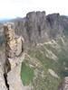
Most of the route I walked is marked approximately (no GPS) on the attached map. I returned via a slightly different route (closer to the top of the ridge beside the lake), but it was more difficult, due to a couple of deep gullies to cross.
Climbing up from the lake was a bit thick and scrubby, but not as bad as I'd expected. When returning down that same slope, I thought I was taking much the same route, but it turned out to be very scrubby indeed, and very difficult to get through. So you have to take your luck a bit as to which route you find, but it's certainly achievable at least as far as marked on the attached map. Once up, it is mostly open and easy as far as the eye can see.
So the thick scrubby section I bashed through matches in with what others have said here. But the density of the vegetation varies a lot depending on exactly where you ascend the ridge.
I hope all this helps!
My original plan was to do a long day walk through Chinamans Plains, or at least to Triangle Lake, from the hut at Lake Meston. However, I ended up being a bit crook that weekend (the tail end of a nasty flu), and was not up to doing a big walk that day.
I did still manage a reasonable day walk in the general area, albeit somewhat smaller than what I'd originally intended...
Most of the route I walked is marked approximately (no GPS) on the attached map. I returned via a slightly different route (closer to the top of the ridge beside the lake), but it was more difficult, due to a couple of deep gullies to cross.
Climbing up from the lake was a bit thick and scrubby, but not as bad as I'd expected. When returning down that same slope, I thought I was taking much the same route, but it turned out to be very scrubby indeed, and very difficult to get through. So you have to take your luck a bit as to which route you find, but it's certainly achievable at least as far as marked on the attached map. Once up, it is mostly open and easy as far as the eye can see.
So the thick scrubby section I bashed through matches in with what others have said here. But the density of the vegetation varies a lot depending on exactly where you ascend the ridge.
I hope all this helps!
- Attachments
-
- Meston to Chinamans.png (346.81 KiB) Viewed 6511 times
- Son of a Beach
- Lagarostrobos franklinii

- Posts: 6916
- Joined: Thu 01 Mar, 2007 7:55 am
- ASSOCIATED ORGANISATIONS: Bit Map (NIXANZ)
- Region: Tasmania
- Gender: Male
Re: Meston to Chinamans Plains
![]() by rucksack » Sun 31 Aug, 2008 4:38 pm
by rucksack » Sun 31 Aug, 2008 4:38 pm
Tony, I live here in Shanghai. Have for some time. I come down to Tasmania 2 or 3 times a year. Did a solo to Federation in January this year (great weather the whole time and spectacular views of course, just pity about the burnt bits on the Arthur Plains). I have been fairly well over most of Tasmania over the past 30 years ... first trip was in 1977. I'm keener on off-track, but not stubborn about it. I do walk here in China too. Belong to a club in Shanghai. Their walks program is different(!) They include 6,000m and 7,000m peaks (mainly Sichuan & Tibet) in their normal walks program. Puts a whole different perspective on club walks, that's for sure. Anyway, maybe we'll bump into each other some time. Regards, Barry
-
rucksack - Athrotaxis cupressoides
- Posts: 277
- Joined: Tue 25 Dec, 2007 9:16 pm
- Location: Cygnet
- Region: Tasmania
- Gender: Male
Re: Meston to Chinamans Plains
![]() by Robbo » Sun 31 Aug, 2008 6:40 pm
by Robbo » Sun 31 Aug, 2008 6:40 pm
...Son of a Beach wrote:I've walked from the North end of Lake Meston up the ridge to the east and along the edge of the plateau of Chinamans Plains
Thanks for posting this information, Nik. It is most helpful to me, and maybe of interest or use to others.
rucksack wrote:Did a solo to Federation in January this year (great weather the whole time and spectacular views of course
Thanks for this, Barry. My son and I did the Western Arthurs Traverse in early January this year, and yes the weather was magnificent - and the burnt bits were saddening, putting a 'downer' on the walk back to Junction Creek. But I guess we can't have it both ways... the payback for getting so much 'good' weather is dry and fire-prone bush and grasslands which burn well when lightening strikes.
Thanks again
Tony Robinson
"The place between your comfort zone and your dream is where your life takes place." Nick Vujicic.
-
Robbo - Athrotaxis cupressoides
- Posts: 288
- Joined: Sat 07 Jun, 2008 8:31 pm
- Location: Melbourne
- ASSOCIATED ORGANISATIONS: Gilson College
- Region: Victoria
- Gender: Male
Re: Meston to Chinamans Plains
![]() by rodb2013 » Wed 26 Mar, 2025 9:46 am
by rodb2013 » Wed 26 Mar, 2025 9:46 am
I know this reply is about 16 years too late! We've crossed the Mersey and gone up onto Chinamans Plains twice from the north end of Lake Meston. The TasMap topo shows a small marsh with a creek down to the Mersey River. You need to be on the south side of that creek and on the ridge north of the creek that flows into Lake Meston. Need to stay right on the ridge as if you go off either side it is hard to regain the ridge. Go all the way to the top of the ridge. It will be tempting to contour around, however, you will get stuck in vegetation. When at the top of that ridge you will see a long ridge with a downwards gradient heading to the south-east. Follow that and you will end at Old Pine Tarn which has a good camp spot.
- rodb2013
- Nothofagus gunnii

- Posts: 36
- Joined: Thu 28 Nov, 2013 1:51 pm
- Region: Victoria
- Gender: Male
12 posts
• Page 1 of 1
Who is online
Users browsing this forum: No registered users and 17 guests