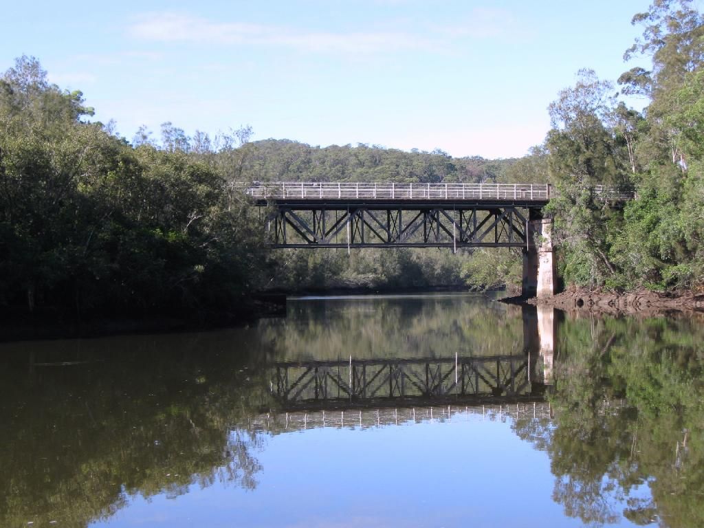
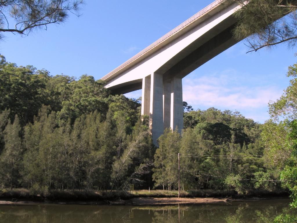
A beautiful morning this morning so I decided to check this out as I hadn't been up that way for more than 10 years. I parked just past the bridge on the Old Pac. Hwy. where the GNW sign is. Backtracked across the bridge which I note was built in 1930. Just upstream and towering overhead was the massive 6 lane freeway bridge built less than 60 years later. How life has changed in less than one human lifespan?
Anyway I turned right once across and followed the road beside the creek. This soon led to a gate where the track went uphill and then down the other side to a campsite beside the creek. The track narrowed after that keeping close to the creek till another, better camp site, was passed on a high bank. Not far past here was the tidal head of the creek. The track then crossed a side creek and then climbed before descending to cross the creek on large open rock slabs. Not far past here is the old Mooney Mooney Ck Dam.
I turned around here and retraced my steps. A very pleasant round trip of about 2 hours.
K.
Mooney Mooney Ck. - GNW.
Forum rules
NSW & ACT specific bushwalking discussion. Please avoid publishing details of access to sensitive areas with no tracks.
NSW & ACT specific bushwalking discussion. Please avoid publishing details of access to sensitive areas with no tracks.
12 posts
• Page 1 of 1
Re: Mooney Mooney Ck. - GNW.
C'mon my half-namesake....- PHOTOS -( that's what we want), especially us that don't know the GNW
I spent probabaly 4-5 years as a teenager exploring parts of the GNW - not knowing at the time.
My mates and I would go off exploring and making "secret forts" and just keep walking until we basically had to go home
I have a few friends that have base-jumped the bridge - it's one of the "standard" initiation jumps if you are part of the base community.
GNW - is a great hike.
-
KANANGRABOYD - Athrotaxis cupressoides

- Posts: 255
- Joined: Wed 06 Feb, 2013 6:59 pm
- Location: Sydney
- ASSOCIATED ORGANISATIONS: none
- Region: New South Wales
- Gender: Male
-

GPSGuided - Lagarostrobos franklinii

- Posts: 6801
- Joined: Mon 13 May, 2013 2:37 pm
- Location: Sydney
- Region: New South Wales
Re: Mooney Mooney Ck. - GNW.
KANANGRABOYD wrote:C'mon my half-namesake....- PHOTOS -( that's what we want), especially us that don't know the GNW. GNW - is a great hike.
yep totally agree.....the GNW is a great hike
AND here ya go......cupla photos i took a few months back Mooney to Somersby. the crossing over Mooney creek on the rock flats is something special (ggrrrrrr the right side of my PhotoBucket hosted photos have been nipped off).
on the GNW leaving the Old Pacific Highway bridge
on the GNW going under the F3 (M1) Freeway road bridge
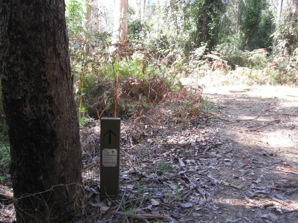
on the GNW
alongside Mooney Creek
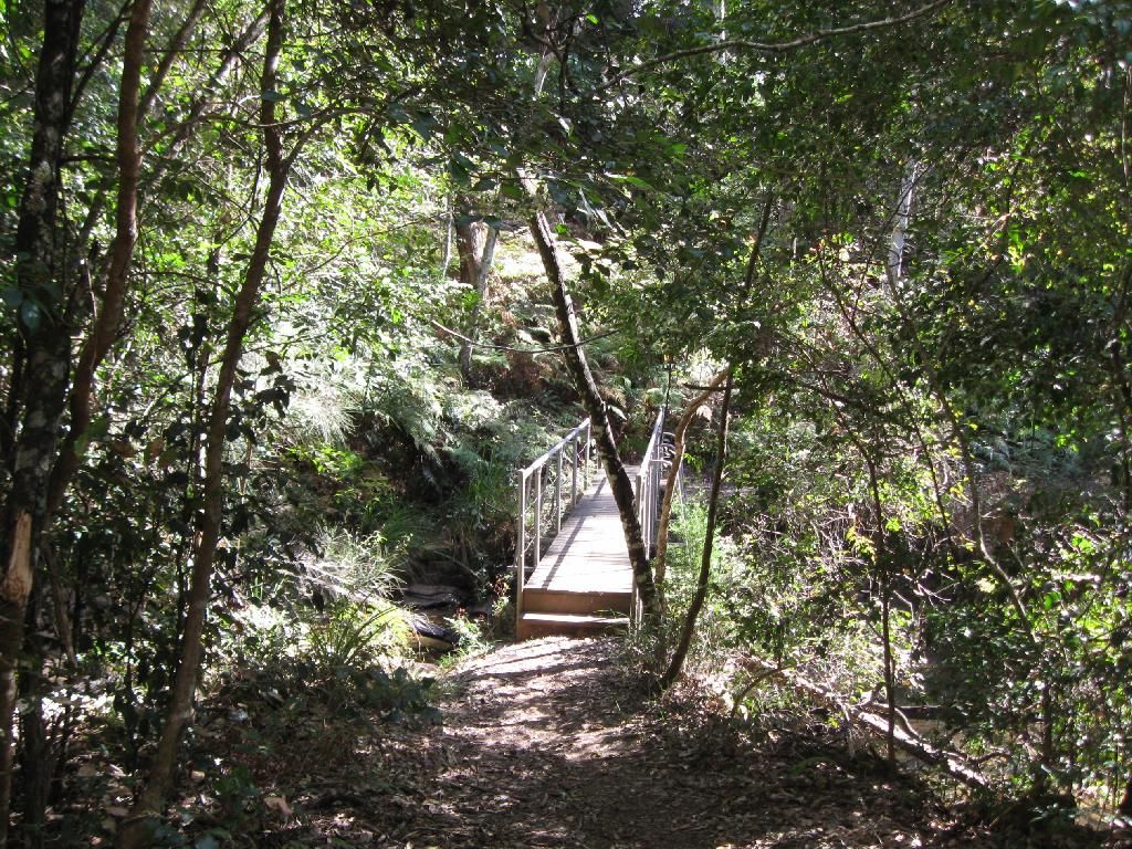
alongside Mooney Creek
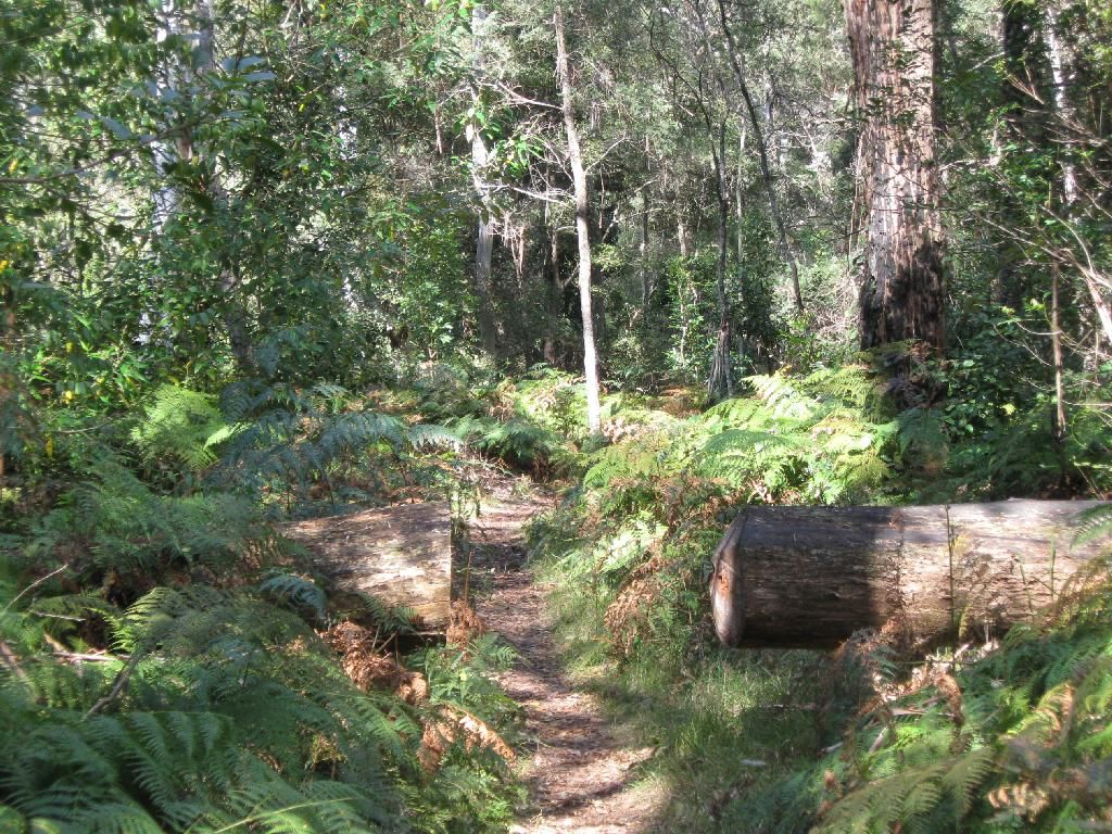
crossing Mooney Creek on the rock flats
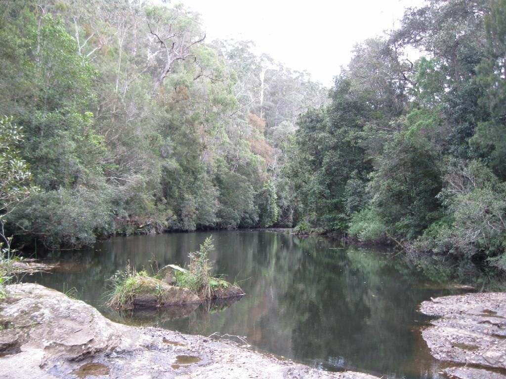
crossing Mooney Creek on the rock flats
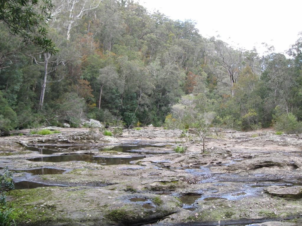
Lower Mooney Dam
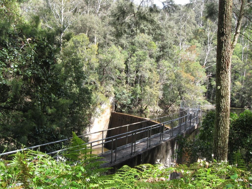
Lower Mooney Dam
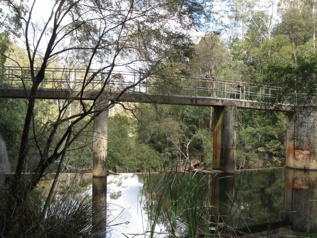
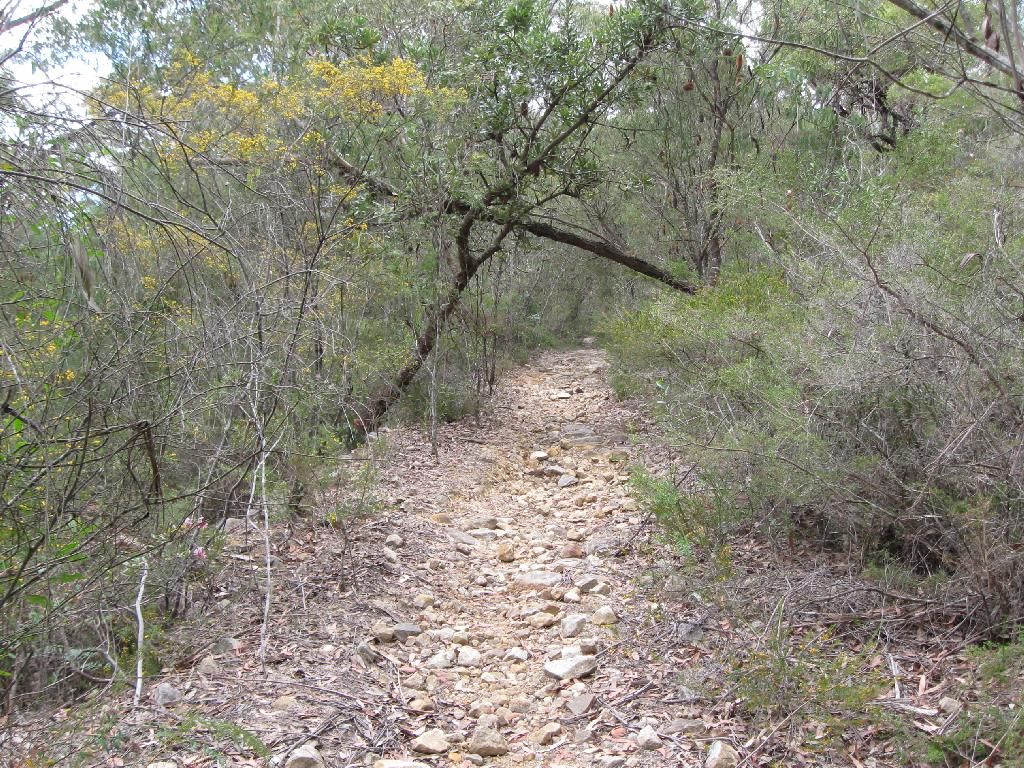
and onwards north to Somersby........
-

Rob Gosford - Athrotaxis cupressoides

- Posts: 185
- Joined: Mon 24 Sep, 2012 7:27 am
- Location: Kariong, Central Coast
- Region: New South Wales
- Gender: Male
Re: Mooney Mooney Ck. - GNW.
Gee those shots are nice. I'll have to start taking a few. You mean they actually jump off that bridge? You're kiddding right? 

K.
K.
- kanangra
- Athrotaxis selaginoides

- Posts: 1340
- Joined: Sun 25 May, 2008 3:52 pm
Re: Mooney Mooney Ck. - GNW.
Ahhhh those rock flats. Memories. I once dropped my pack in them (with nine days worth of gear). It landed harness side down and absorbed a whooooole lotta water. I gained some unwanted weight for the hill ascent (though it was lovely and cool 
Such pretty walking through there. Thanks for sharing.
Sent from my GT-I9505 using Tapatalk 2
Such pretty walking through there. Thanks for sharing.
Sent from my GT-I9505 using Tapatalk 2
-

Bluegum Mic - Athrotaxis selaginoides

- Posts: 1535
- Joined: Fri 08 Oct, 2010 10:24 am
- Region: New South Wales
- Gender: Female
Re: Mooney Mooney Ck. - GNW.
kanangra wrote:You mean they actually jump off that bridge? You're kiddding right?
K.
yeah nah, its not a bad place "to end it all"...... WAIT ! SORRY ! (MY BAD ! i just reread)..... you mean BUNGY JUMP don't you LOL ?
kanangra wrote:Gee those shots are nice. I'll have to start taking a few. K.
hi K.
wish i wus a better photography tho. ALWAYS take a camera with you K. maybe a small compact digital ? just wack it into your pocket.
-

Rob Gosford - Athrotaxis cupressoides

- Posts: 185
- Joined: Mon 24 Sep, 2012 7:27 am
- Location: Kariong, Central Coast
- Region: New South Wales
- Gender: Male
Re: Mooney Mooney Ck. - GNW.
Bluegum Mic wrote:Ahhhh those rock flats. Memories. I once dropped my pack in them (with nine days worth of gear). It landed harness side down and absorbed a whooooole lotta water.
hi BlueGum,
i can just picture it.....sorry to hear that LOL.
yeah, doesn't that hill ascent go on FOREVER ! its not steep, but just a gentle hill that goes on and on and on and on FOREVER ! and rocky too.....
-

Rob Gosford - Athrotaxis cupressoides

- Posts: 185
- Joined: Mon 24 Sep, 2012 7:27 am
- Location: Kariong, Central Coast
- Region: New South Wales
- Gender: Male
Re: Mooney Mooney Ck. - GNW.
Lovely pictures  still a section im yet to complete
- perfectlydark
- Phyllocladus aspleniifolius

- Posts: 921
- Joined: Tue 04 Jun, 2013 6:13 pm
- Region: New South Wales
- Gender: Male
Re: Mooney Mooney Ck. - GNW.
Another great walk Kanangara. When I used to live at Gosford a few years back there were complaints in the paper about a community of ferals that had established themselves on the flats below the freeway bridge. Have they been moved on?
-

Lindsay - Phyllocladus aspleniifolius

- Posts: 680
- Joined: Thu 01 Oct, 2009 3:00 pm
- Location: Sydney
- Region: New South Wales
- Gender: Male
Re: Mooney Mooney Ck. - GNW.
Lindsay wrote:When I used to live at Gosford a few years back there were complaints in the paper about a community of ferals that had established themselves on the flats below the freeway bridge. Have they been moved on?
haven't seen any ferals along there Lindsay, BUT 'bout 3 or 4 years ago there were reported sightings of a black panther up Penrith way. Not long after that the radio stations were reporting that a black panther was seen
-

Rob Gosford - Athrotaxis cupressoides

- Posts: 185
- Joined: Mon 24 Sep, 2012 7:27 am
- Location: Kariong, Central Coast
- Region: New South Wales
- Gender: Male
Re: Mooney Mooney Ck. - GNW.
No they are no longer there. There are a couple of houses and a house boat up on stilts but that is it. A very nice place on the other side of the river with rolling lawns and jetty.
K.
K.
- kanangra
- Athrotaxis selaginoides

- Posts: 1340
- Joined: Sun 25 May, 2008 3:52 pm
12 posts
• Page 1 of 1
Return to New South Wales & ACT
Who is online
Users browsing this forum: No registered users and 4 guests
