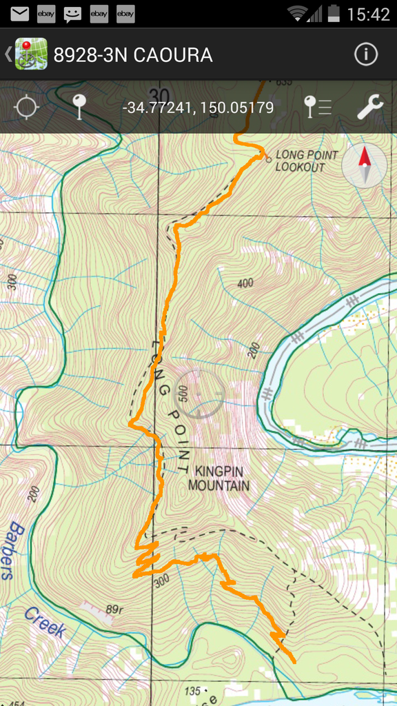
I thought I might create a thread where folks who track their route while using NSW LPI eTopo mapping can post inaccuracies via screenshots.
Here's the one from today - McCallum's walking track from Long Point near Tallong NSW, down onto McCallum's flat on the Shoalhaven River. According to the GPS track this well-formed track is way off course on the map.
MAP - 8928-3N CAOURA 1:25k eTopo
ERROR/S - McCallum's Walking track is shown way off course after it passes Kingpin Mountain.
SCREENSHOT OF TRACK -