Rob Gosford wrote:hi David,
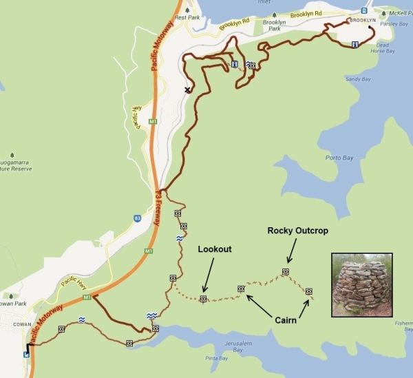
i think that track is known as Taffys Rock track (not sure tho). You might like to Google "Taffys Rock" to get some more info and history.
michael_p wrote:That is the Taffys Rock track.
Have a look at this link: https://maps.google.com.au/maps/ms?ie=UTF8&t=h&source=embed&oe=UTF8&msa=0&msid=115656553351945206550.000457df842003d3255fd
Google image search: http://www.google.com.au/search?tbm=isch&hl=en-AU&q=taffy%27s+rock&gbv=2&spell=1&sa=X&ei=i-rdUfefG8PAkAWPq4DoCA&ved=0CCoQBSgA
DaveNoble wrote:There is also an article in the Bushwalker (page 15) -
http://www.bushwalkermagazine.org/the%2 ... ker263.pdf
Dave
michael_p wrote:I have read of people using the Campbells Crater track as a shortcut for the Taffys Track. Not sure about parking on the F3 though. I have also read of a risky shortcut that uses a tunnel (most likely a drain) under the F3 from the Pacific Highway but I have no idea where this is.
GPSGuided wrote:...I've just entered the correct label for this track in OSM...
Lindsay wrote:...Problem was, I couldn't find the memorial plaque that is meant to be somewhere on the rock, which is a very large platform with lots of nooks and crannies. After searching for over half an hour I gave it up and just enjoyed the view instead...
GPSGuided wrote:michael_p wrote:I have read of people using the Campbells Crater track as a shortcut for the Taffys Track. Not sure about parking on the F3 though. I have also read of a risky shortcut that uses a tunnel (most likely a drain) under the F3 from the Pacific Highway but I have no idea where this is.
That may explain why there's the occasional "abandoned" car on the F3. Have always wondered what weirdo would leave their apparently functioning car by the freeway. Not so weird after all.
Taking a closer look on street view, there's actually a small emergency parking bay.
http://goo.gl/maps/8K5U3
Rob Gosford wrote:that GoogleMap photo of that parking bay GPS, is the Jerusalem Bay Firetrail which takes you down to Jerusalem Bay and the lone palm tree, linking up with the GNW. The "Campbells Crater track F3 Parking Bay" is about 930 meters before that parking bay
GPSGuided wrote:What I am not sure about is, are we allowed to use these emergency bays to park our vehicles for walks? It would not be nice if we come back to an infringement notice from the regular highway patrols on that section.
michael_p wrote:Lindsay wrote:...Problem was, I couldn't find the memorial plaque that is meant to be somewhere on the rock, which is a very large platform with lots of nooks and crannies. After searching for over half an hour I gave it up and just enjoyed the view instead...
Have a look at this set of photos: http://grindlay.org/bushwalking/20110924_taffys_photos.html. It appears to be on the side of the platform.
Cheers,
Michael.
Lindsay wrote:michael_p wrote:Lindsay wrote:...Problem was, I couldn't find the memorial plaque that is meant to be somewhere on the rock, which is a very large platform with lots of nooks and crannies. After searching for over half an hour I gave it up and just enjoyed the view instead...
Have a look at this set of photos: http://grindlay.org/bushwalking/20110924_taffys_photos.html. It appears to be on the side of the platform.
Cheers,
Michael.
Thanks for that Michael, still can't identify the spot though
perfectlydark wrote:Probably just easier to walk from cowan?
michael_p wrote:I've found some coordinates for the plaque for future reference: S33 35.115 E151 13.719. It appears to be off to the side a bit, looking at the location it could easily be missed.
It is on the eastern side of the rock. Just follow across the rock from where the track reaches it ... then head north about halfway up the rock for about 20-30m.
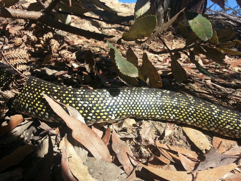
Rob Gosford wrote:ooooooops ! i thought snakes were asleep now.....
Return to New South Wales & ACT
Users browsing this forum: No registered users and 81 guests