Page 1 of 1

Girrakool - is very cool!

PostPosted: Wed 09 Oct, 2013 2:31 pm
by kanangra
Beautiful morning today so I drove up to Girrakool in Brisbane Water NP. The gate wasn't open yet so I made my way in on foot. They really have done some good work in there with electric bar-b -ques and tiled toilet block. Shame about the noise from the 6 lane freeway roaring overhead only about 200m away. :x I followed the track down across the falls and then around to the junction with the GNW. I followed this down to the creek to take a look at the new swing bridge. Very impressive with timber deck. I noted the concrete foundations of the old bridge and the camp site in the forest on the far bank. I then retraced my steps up the hill and followed the GNW out over Leochares Pk and Scopas Pk. Some great views from up there right out to the ocean. Some terrific rock platforms through there too. Returned to the car via the Kariong Scout Camp site. (Boy do they have some infrastructure in there.)

A great morning.

K.

Re: Girrakool - is very cool!

PostPosted: Thu 10 Oct, 2013 11:33 am
by Rob Gosford
itsa great walk isn't it K. That's my backyard. How kool is it driving thru the tunnel :shock: under the F3. The view looking south over Brisbane Water NP from Scopas Peak is special. As you went over Leochares, did you notice the F3 Mooney Creek Bridge sitting in the valley down there. I'll go fetch a photo i took from Scopas, back in a minute....... :D

Re: Girrakool - is very cool!

PostPosted: Thu 10 Oct, 2013 11:42 am
by kanangra
Mate I did. Isn't that the most amazing view? It just seems to sit there suspended in the air in the middle of the wilderness. I even stopped to take a photo. It is just about the only man made structure you can see. Shame about the rumble from all the traffic though. It does somewhat spoil the ambience of the picnic area but haven't parks done an excellent job with that. First rate facilities.

K.

Re: Girrakool - is very cool!

PostPosted: Thu 10 Oct, 2013 11:48 am
by forest
Nice place isn't it. I often do the loop walk too down to the swing bridge (piles creek) and back up the other side of the valley.
I stealth camped a Girrakool last year when my wife dropped me off to complete a section of the GNW. Man the Rd noise gets old at night. Ended up wearing ear plugs.

What tracks did you take to loop around to the scout camp. I'll have to look into that one. Does it stay outside of the rifle range zone on the return leg. How far is that loop. MMM I'm down that way on Tuesday arvo........

Re: Girrakool - is very cool!

PostPosted: Thu 10 Oct, 2013 11:58 am
by Rob Gosford
kanangra wrote:Mate I did. Isn't that the most amazing view? It just seems to sit there suspended in the air in the middle of the wilderness.


yes exactly K. it just sits there "suspended" in the valley.

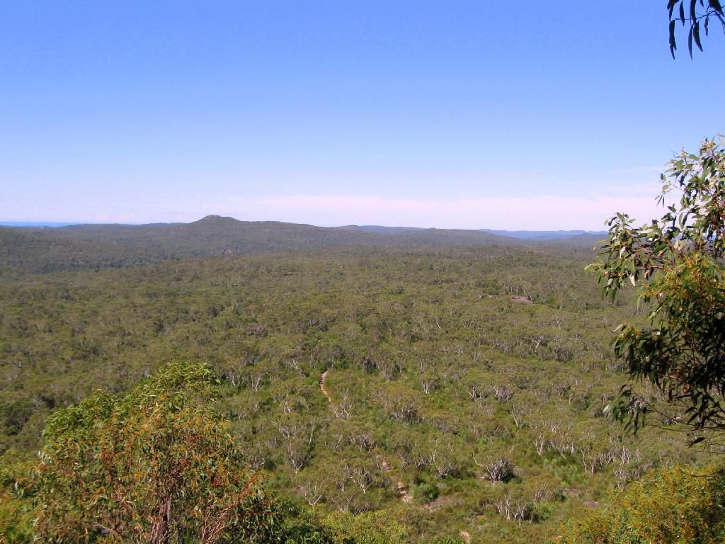
here is a pic (for the uninitiated) of the view south towards the sea and Mt. Wondabyne from Scopas Peak on the GNW

Image

its a wonderful walk south from Girrakool picnic area to Scopas and then on to Kariong Brook waterfall finishing at Staples Lookout on Woy Woy Rd. For those who haven't, then you must.......

:D

.

Re: Girrakool - is very cool!

PostPosted: Thu 10 Oct, 2013 12:06 pm
by Rob Gosford
forest wrote:What tracks did you take to loop around to the scout camp.


when you leave Girrakool picnic area Forest, travel south and (i think) just before the descent into Rat Gulley, there is a fenced lookout over the valley (looking west). Well, just before that there is a hidden entrance to a trail heading east (off your left heading south) . That hidden trail heads towards the Scout Camp and also Kariong. The track heading east into Kariong is very closed in, hard to pick up, very scratchy. Google Earth it......

Re: Girrakool - is very cool!

PostPosted: Thu 10 Oct, 2013 12:14 pm
by forest
I have seen that track multiple times and wondered where it ended up, Now I know, cool. So you guys just return after via a loop on Tommos Loop trail (where it crosses the GNW just after Kariong Brook), Woy Woy Rd Fire Trail, Then down into the Scout Camp ??
Quick look and it's a nice little 17.6km loop if that's the route.

Re: Girrakool - is very cool!

PostPosted: Thu 10 Oct, 2013 12:16 pm
by Rob Gosford
here is the track info at Wild Walks, Forest........

http://www.wildwalks.com/bushwalking-and-hiking-in-nsw/brisbane-water-national-park/girrakool-to-staples-lookout-via-kariong-brook-falls.html

on the Map Of Walk tab, the red arrow on the yellow marked track just above distance marker 1.38 klms, is where the Scout Camp (and also Kariong) track joins

:D

Re: Girrakool - is very cool!

PostPosted: Thu 10 Oct, 2013 1:16 pm
by kanangra
Rob,

That is a great shot of the view to the south. Incredible to think you are actually looking towards Sydney and yet not a mark of man in sight.

K.

Re: Girrakool - is very cool!

PostPosted: Thu 10 Oct, 2013 1:24 pm
by Rob Gosford
my first time there at that Scopas view a few years back, i almost wept :cry: hahahahaha. On a clear still day the feeling is spiritual.........and if you look closely too K., standing there you can see the Ba'hai Temple at Terry Hills in Sydney.

Re: Girrakool - is very cool!

PostPosted: Thu 10 Oct, 2013 1:26 pm
by Rob Gosford
forest wrote:I have seen that track multiple times and wondered where it ended up, Now I know, cool. So you guys just return after via a loop on Tommos Loop trail (where it crosses the GNW just after Kariong Brook), Woy Woy Rd Fire Trail, Then down into the Scout Camp ??
Quick look and it's a nice little 17.6km loop if that's the route.


no i don't "loop it" Forest. Just one way from Girrakool picnic area to Scopas to Kariong Brook to Staples.........have a car waiting there. But your suggestion of a loop from Girrakool to Kariong Brook, up and left onto Tommos, Woy Woy Rd, then Scout camp, then back to Girrakool is workable.....but there is a Woy Woy Rd road slog involved. i hate those slogs lol.

:D

Re: Girrakool - is very cool!

PostPosted: Thu 10 Oct, 2013 1:39 pm
by forest
Rd "slog should only be 250m off the maps I've just looked at (not including the section down to the scout camp). That's not too bad.

Re: Girrakool - is very cool!

PostPosted: Thu 10 Oct, 2013 1:59 pm
by kanangra
Yes if you take the rough road that follows the power lines and which runs parallel to the highway you avoid all but a few hundred metres of the highway.

K.

Re: Girrakool - is very cool!

PostPosted: Thu 10 Oct, 2013 2:03 pm
by kanangra
Rob I know what you mean there for sure. How about those large open rock platforms that must be the size of a football field. With pockets of moss and small shrubs they are just magic. Shame in a way they've posted GNW signs every 30m or so through some of them. Couldn't people just poke around a bit to find the track on the other side? Is it really necessary to have those signs stuck in the rock?

K.

Re: Girrakool - is very cool!

PostPosted: Fri 11 Oct, 2013 1:13 pm
by Rob Gosford
kanangra wrote:Yes if you take the rough road that follows the power lines and which runs parallel to the highway you avoid all but a few hundred metres of the highway.

K.


by golly gosh, you are both correct !
Where you start on Tommos Loop heading west from Woy Woy Rd firetrail gate (just south of Staples Lookout), after about 200m you actually cross that north-south track that you mention.......i have never bothered to investigate that north-south track over the past few years lol.

So arriving at Tommos Loop at the top of Kariong Brook, you turn left, and THEN 200m before reaching Woy Woy Rd turn north onto that track. THEN up Scout Camp Rd. That WOULD make a vg loop walk starting from Girrakool picnic area........long way tho of nearly 18Ks with a few steep climbs. But no road slog :D


.

Re: Girrakool - is very cool!

PostPosted: Fri 11 Oct, 2013 1:35 pm
by Rob Gosford
kanangra wrote:How about those large open rock platforms that must be the size of a football field. With pockets of moss and small shrubs they are just magic.
K.


yep as you said K. "MAGIC" for sure!
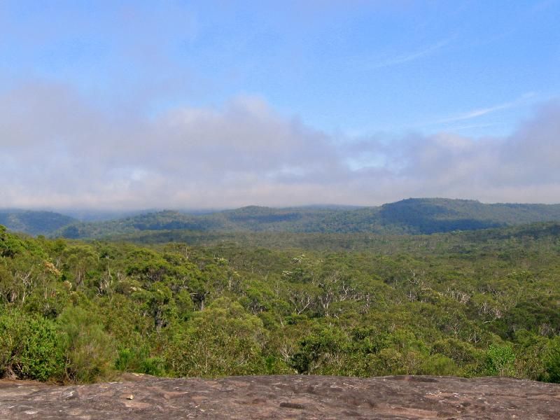
here is a pic from the rock ledges at Leochares looking west as the fog lifted. Ona clear day you can see the Blue Mts.
Image

kanangra wrote:Shame in a way they've posted GNW signs every 30m or so through some of them. Is it really necessary to have those signs stuck in the rock?
K.


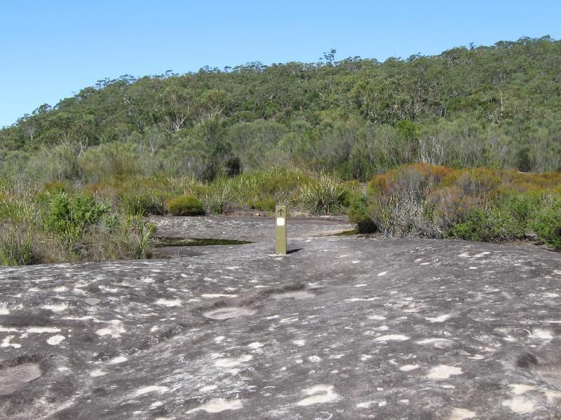
i don't agree K. It is the GNW, so the more signs the better especially for the mums 'n dads taking their lill kiddies for a sunday walk. Here is a signage pic i took at Leochares ........
Image


8)

Re: Girrakool - is very cool!

PostPosted: Fri 11 Oct, 2013 3:35 pm
by kanangra
Gee they're good shots. Don't you think that GNW sign sticking up in the middle of a pristine rock platform rather spoils things?

K.

Re: Girrakool - is very cool!

PostPosted: Fri 11 Oct, 2013 5:43 pm
by kjbeath
Rob Gosford wrote:its a wonderful walk south from Girrakool picnic area to Scopas and then on to Kariong Brook waterfall finishing at Staples Lookout on Woy Woy Rd. For those who haven't, then you must.......


One of the nicest daywalks around, especially nice in September with the wildflowers.