As you can see by the Synoptic Chart, the Cold Front is vigorously moving through Eastern Victoria and Southern New South Wales today, bringing with it Strong Winds, Rain and Hail. However, its not over for those areas behind the Front.
A Trough linked to a Weak LOW Pressure System in Bass Strait is moving in behind the Front. This Trough is expected to add some Instability to what is already Very Cold Air. This should mean that Damaging Winds, Heavy Rain and Hail are all possible with the Trough that is trailing in.
Damaging Winds in excess of 100km/h are possible over open areas in South Australia, along with elevated and open areas of Western and Eastern Victoria - this does include the Snowy Mountains. Heavy Rain could produce minor Flash Flooding to some areas, again in both Country Victoria, Southern New South Wales and Southern South Australia. While Hail could really hit anywhere, since there is so much Cold Air in the atmosphere now - Rain could very easily turn to Hail, and although it should be Small Hail, there is the possibility of some areas receiving a nice accumulation.
Snow is also on the forecast today. Snow is expected to go down to at least 800m, with the Alps receiving 10-20cm. However, it is more likely than not, that the Alps will receive more than 20cm. There is a possibility that parts of Canberra (mainly the Canberra Hills) could receive a flurry of Snow today, while places like Cooma and maybe elevated parts of Goulburn in the ACT could also see a flurry. Areas of Central Tasmania, mainly around the Central Districts, could be in for a Snowy Treat too. They are forecast for Snow Showers though, so how good the Snow is could be a question to ponder. Edit: Snow is possible down to 600m this evening in parts of Victoria, so some unlikely places may receive some.
Along with all of this, is of course the frigid Maximums.
Adelaide is heading for just 12ºc, as is Melbourne. Hobart is going to struggle to break out of the single digits with a top of 10ºc, and well Canberra is just freezing... with a max of 9ºc. The Snowy Mountains probably won't get above 0ºc today.
Stay warm, and safe, and I'll have all the details on what happened where tomorrow morning once they're finalised.
Chance of snow in Canberra Hills today 17 July
Forum rules
NSW & ACT specific bushwalking discussion. Please avoid publishing details of access to sensitive areas with no tracks.
NSW & ACT specific bushwalking discussion. Please avoid publishing details of access to sensitive areas with no tracks.
12 posts
• Page 1 of 1
Chance of snow in Canberra Hills today 17 July
From Thomas Hinterdorfer: Extreme Weather Chaser
-

NathanaelB - Athrotaxis cupressoides

- Posts: 106
- Joined: Thu 10 Jul, 2014 5:13 pm
- Location: Canberra, Australia
- Region: Australian Capital Territory
- Gender: Male
Re: Chance of snow in Canberra Hills today 17 July
It has been snowing on the hills in the west of the ACT off-n-on over the past two weeks. The winter gates have been locked at Smokers Gap stopping vehicle access to Corin Dam and and there are two road blocks, that I'm aware of. One just past the Cotter Road junction opposite Uriarra Station and the another one about 5 kilometres before the Bulls Head locked gate. If you're keen the guys manning the road blocks will let you through, but they will give you a warning that no help is possible if your vehicle gets into difficulties. Somewhat of a Nanny State over-reaction by the ACT Government, me'thinks. I found that the road was perfectly fine.
Some shots taken during the past two weeks from the Bicentennial National Trail in the ACT.
Snowing on the Bullen, Tidbinbilla, Hardy, Blue and Brindabella Ranges. The Brindabella Range is the just visible soft shadow towards the top of the frame. Taken two days ago, during the afternoon of the 17th July. The prediction was right.
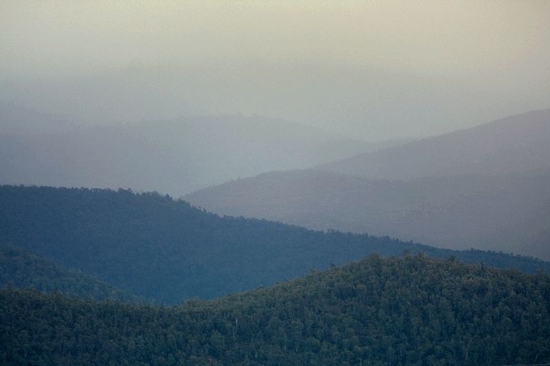
Mount Tennant.
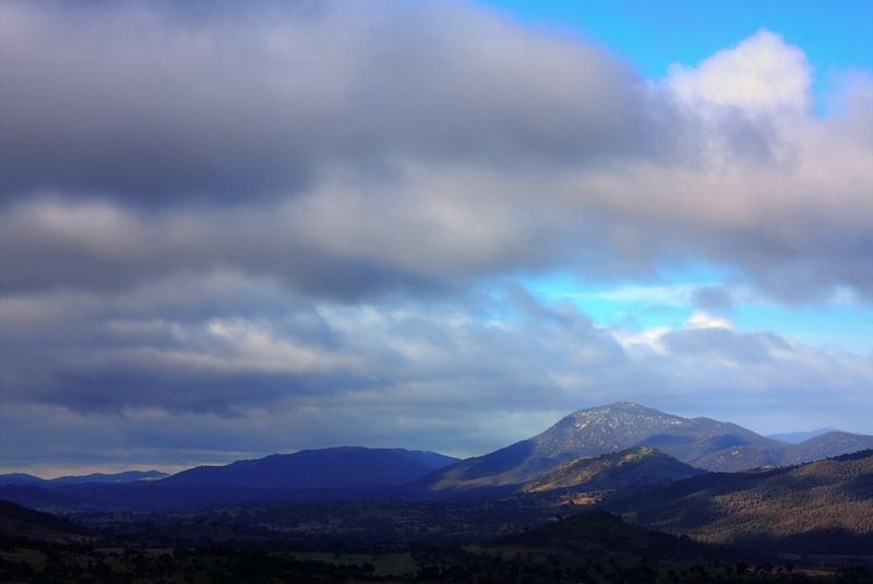
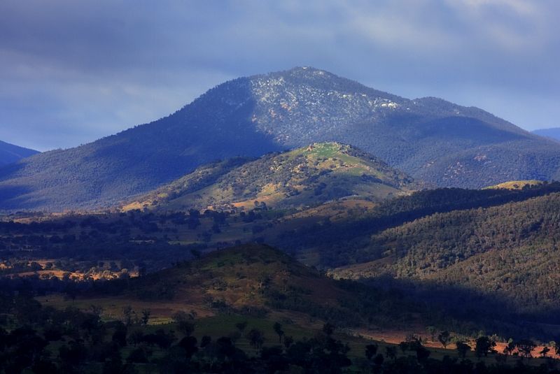
Mount Domain on the Tidbinbilla Range.
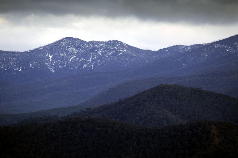
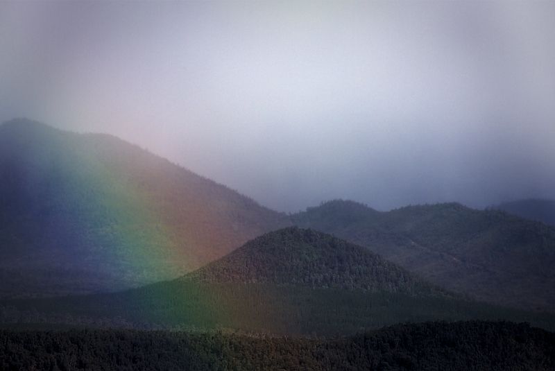
Rain drops can afford a rainbow. Snow flurries can afford a bit more. A snowbow at Sugarloaf.
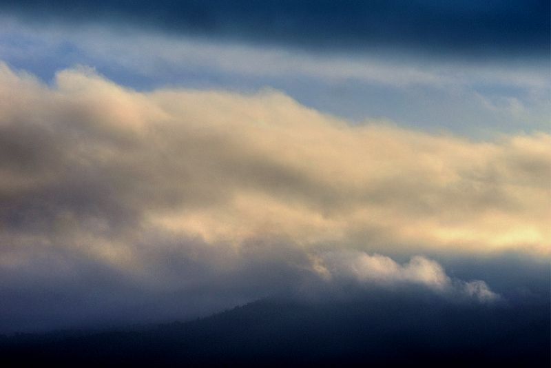
A buttermilk brume and late afternoon fog at Pleasant Hill.
Mount Gingera from Worlds End and Mount Gingera past the Bullen and Tidbinbilla Ranges. These shot were taken on the 10th and 11th July ... after a bit of rain on the 11th the snow thinned out.
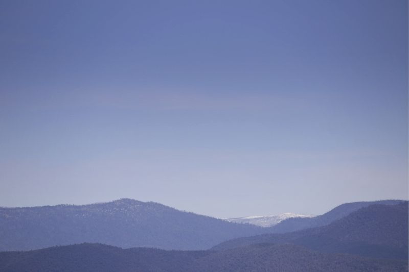

I didn't take a shot of last nights snow fall today the 19th July , which was a cracker. This shot of a late snowfall taken last Spring of the Tidbinbilla and Brindabella Ranges, was similar to how this morning looked, certainly North of Mount Franklin. Again shot from the Bicentennial National Trail, at Holt. Gingera looked a brilliant Persil White this morning.

Warren.
Some shots taken during the past two weeks from the Bicentennial National Trail in the ACT.
Snowing on the Bullen, Tidbinbilla, Hardy, Blue and Brindabella Ranges. The Brindabella Range is the just visible soft shadow towards the top of the frame. Taken two days ago, during the afternoon of the 17th July. The prediction was right.

Mount Tennant.


Mount Domain on the Tidbinbilla Range.

Rain drops can afford a rainbow. Snow flurries can afford a bit more. A snowbow at Sugarloaf.

A buttermilk brume and late afternoon fog at Pleasant Hill.

Mount Gingera from Worlds End and Mount Gingera past the Bullen and Tidbinbilla Ranges. These shot were taken on the 10th and 11th July ... after a bit of rain on the 11th the snow thinned out.


I didn't take a shot of last nights snow fall today the 19th July , which was a cracker. This shot of a late snowfall taken last Spring of the Tidbinbilla and Brindabella Ranges, was similar to how this morning looked, certainly North of Mount Franklin. Again shot from the Bicentennial National Trail, at Holt. Gingera looked a brilliant Persil White this morning.

Warren.
- WarrenH
- Phyllocladus aspleniifolius

- Posts: 990
- Joined: Thu 07 Jan, 2010 6:54 pm
- Region: Australian Capital Territory
Re: Chance of snow in Canberra Hills today 17 July
Mount Gingera from the Canberra Centenary Trail at Isaacs Ridge on the 25th July.
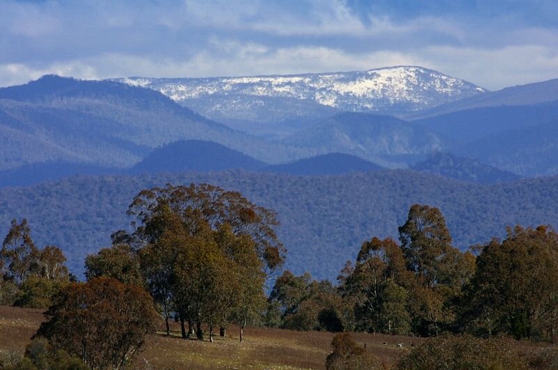
For those who might not know? ... the Canberra Centenary Trail is the third major trail in the ACT. The two other major trails are the Bicentennial National Trail and the Australian Alps Walking Track.
Warren.

For those who might not know? ... the Canberra Centenary Trail is the third major trail in the ACT. The two other major trails are the Bicentennial National Trail and the Australian Alps Walking Track.
Warren.
- WarrenH
- Phyllocladus aspleniifolius

- Posts: 990
- Joined: Thu 07 Jan, 2010 6:54 pm
- Region: Australian Capital Territory
Re: Chance of snow in Canberra Hills today 17 July
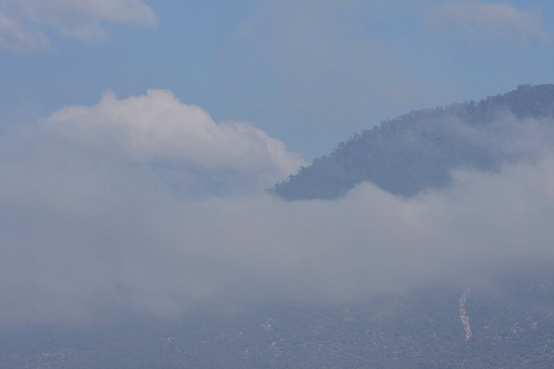
I took this shot of Tennant from a lower slope of Rob Roy last Friday. Looking through fog, to more fog to see far-off fog.
On Tuesday next (the 29th) I'm going to walk up Tennant, to see what snow I can see and shoot on Bimberi and the other high ranges. I'll be at the Australian Alps Walking Track carpark immediately below Mount Tennant at 9.00am, if anyone would like to join me for a day of photography and absolutely slow-walking up Mount Tennant. Hopefully I wont need to climb to the top to find a good view of snow. Also I must be off Tennant by about 3.30pm, I've a commitment in town at 4.00.
If anyone would like to join me, you're more than welcome. Give me a call at anytime, before 7.30am on Tuesday (the 29th), so we can to get the day well sorted ... 62540295.
Warren.
PS, By the way, stand 3 or 4 metres away from your monitor to view my landscape images. They're not about looking at retail detail ... they're about the design principals of size, shape, scale, alternation and most importantly, the diminishing values crated by the aerial perspective ... standing back gives a better illusion, somewhat similar to being there.
- WarrenH
- Phyllocladus aspleniifolius

- Posts: 990
- Joined: Thu 07 Jan, 2010 6:54 pm
- Region: Australian Capital Territory
Re: Chance of snow in Canberra Hills today 17 July
Bimberi Peak ... today. Another 15cm is due on Friday, with more snow expected over the weekend.
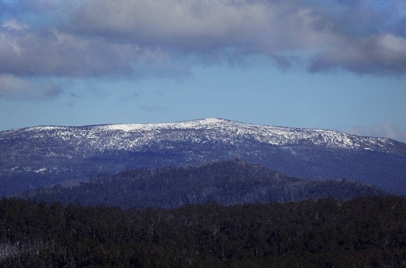
The wind was brutal ... gusting to 50 kts at times, and not abating below 34 kts. The App Temp between midday and 2.30pm hung around -7.0°C, if you can believe the BOM. Just right for climbing, but the wind was terrible for photography.
Warren.

The wind was brutal ... gusting to 50 kts at times, and not abating below 34 kts. The App Temp between midday and 2.30pm hung around -7.0°C, if you can believe the BOM. Just right for climbing, but the wind was terrible for photography.
Warren.
- WarrenH
- Phyllocladus aspleniifolius

- Posts: 990
- Joined: Thu 07 Jan, 2010 6:54 pm
- Region: Australian Capital Territory
Re: Chance of snow in Canberra Hills today 17 July
A few more shots from the 29th July.
The twin peaks of Little Bimberi ... and the tors of Coronet Peak.
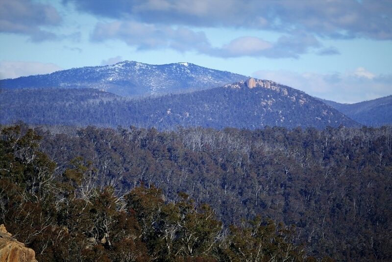
When I couldn't stand the wind any longer, I looked for calmer waters, 500 metres lower down. With the road to Corin Dam again open, I drove to Corin.
Bimberi Peak from Corin. The gusts were slightly calmer at Corin, down to 40 knots. Although the wind was a westerly, at Corin the wind was descending vertically, flattening the water and splaying out to all the points of the compass.
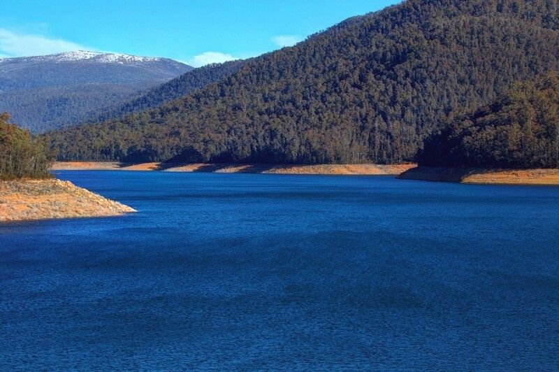
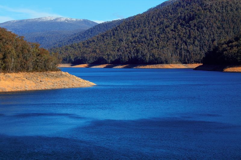
I live in the NW of the ACT and I can still see snow on the ranges North of Mount Franklin, at the edge of the Bramina Wilderness, in NSW.
Warren.
The twin peaks of Little Bimberi ... and the tors of Coronet Peak.

When I couldn't stand the wind any longer, I looked for calmer waters, 500 metres lower down. With the road to Corin Dam again open, I drove to Corin.
Bimberi Peak from Corin. The gusts were slightly calmer at Corin, down to 40 knots. Although the wind was a westerly, at Corin the wind was descending vertically, flattening the water and splaying out to all the points of the compass.


I live in the NW of the ACT and I can still see snow on the ranges North of Mount Franklin, at the edge of the Bramina Wilderness, in NSW.
Warren.
- WarrenH
- Phyllocladus aspleniifolius

- Posts: 990
- Joined: Thu 07 Jan, 2010 6:54 pm
- Region: Australian Capital Territory
Re: Chance of snow in Canberra Hills today 17 July
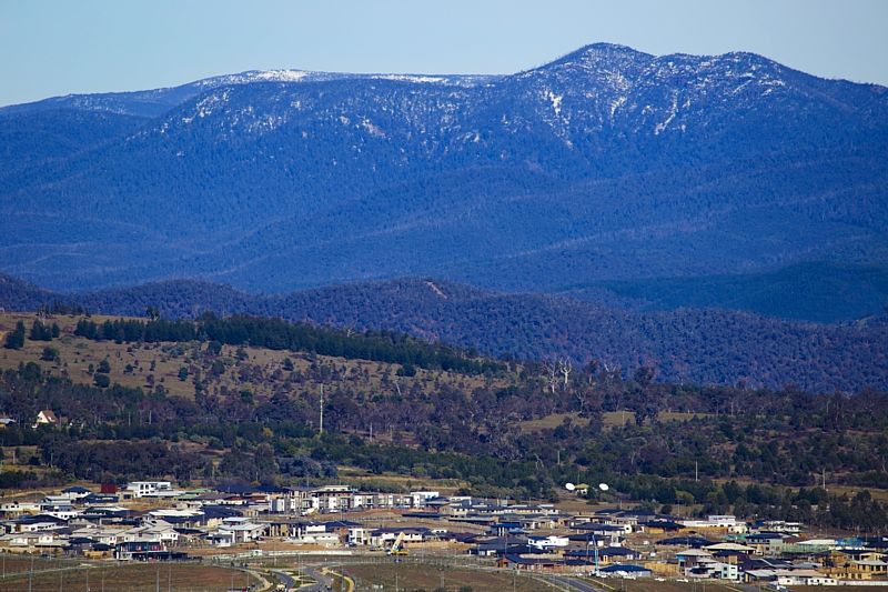
Maybe this is the shot ... that best shows, Chance of Snow in Canberra Hills ... Mount Domain keeping an over-watch of a rapidly expanding Capital.
Warren.
PS, Mount Gingera makes up the skyline ... shot from the Bicentennial National Trail.

Warren.
PS, Mount Gingera makes up the skyline ... shot from the Bicentennial National Trail.
- WarrenH
- Phyllocladus aspleniifolius

- Posts: 990
- Joined: Thu 07 Jan, 2010 6:54 pm
- Region: Australian Capital Territory
Re: Chance of snow in Canberra Hills today 17 July
Thanks Warren.
You're a champ!
You're a champ!
-

hikingoz - Athrotaxis cupressoides

- Posts: 306
- Joined: Fri 18 Feb, 2011 4:21 pm
- Location: Canberra, ACT
- Region: Australian Capital Territory
- Gender: Male
Re: Chance of snow in Canberra Hills today 17 July
Thanks Warren.
Some great shots. Really liked the photos of the wind on the water of Corin Dam.
Cheers,
Michael.
Some great shots. Really liked the photos of the wind on the water of Corin Dam.
Cheers,
Michael.
One foot in front of the other.
-

michael_p - Athrotaxis selaginoides

- Posts: 1391
- Joined: Sun 15 Nov, 2009 6:58 pm
- Location: Macarthur Region of Sydney.
- Region: New South Wales
- Gender: Male
Re: Chance of snow in Canberra Hills today 17 July
hikingoz and michael_p, thankyou and Cheers.
Warren.
Warren.
- WarrenH
- Phyllocladus aspleniifolius

- Posts: 990
- Joined: Thu 07 Jan, 2010 6:54 pm
- Region: Australian Capital Territory
Re: Chance of snow in Canberra Hills today 17 July
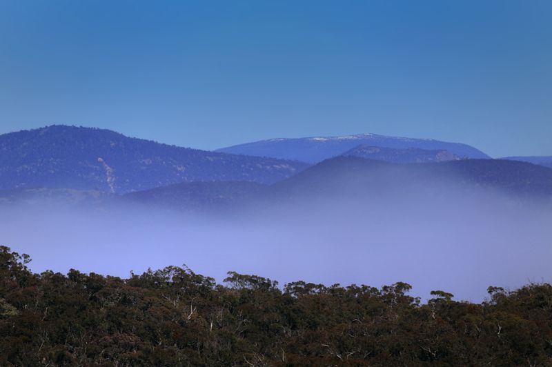
Early morning about 8.00am on the 1st September, I took a shot of Bimberi on a stunning day. I was thinking then about the small amount of snow that I could see on Bimberi.
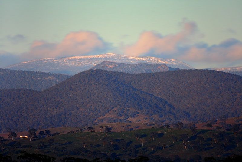
The following morning the 2nd Sept at sunrise, it was a totally different story. It was too cold to comfortably enjoy the overnight's snow fall, in freezing big winds.
Then yesterday morning the 3rd Sept, the cold-snap was even more horrid. The BOM Station on mount Ginini, at sunrise recorded an Apparent Temperature of -16.7°C. Yesterday was cold and windy and it didn't warm up all day.
The Botanist, Professor Tim Entwistle, thinks that four European seasons make no sense in most parts of Australia, and he suggests that we need to include a fifth season. I'm coming around to his way of thinking ... welcome to Sprinter.
Warren.

The following morning the 2nd Sept at sunrise, it was a totally different story. It was too cold to comfortably enjoy the overnight's snow fall, in freezing big winds.

Then yesterday morning the 3rd Sept, the cold-snap was even more horrid. The BOM Station on mount Ginini, at sunrise recorded an Apparent Temperature of -16.7°C. Yesterday was cold and windy and it didn't warm up all day.
The Botanist, Professor Tim Entwistle, thinks that four European seasons make no sense in most parts of Australia, and he suggests that we need to include a fifth season. I'm coming around to his way of thinking ... welcome to Sprinter.
Warren.
- WarrenH
- Phyllocladus aspleniifolius

- Posts: 990
- Joined: Thu 07 Jan, 2010 6:54 pm
- Region: Australian Capital Territory
Re: Chance of snow in Canberra Hills today 17 July
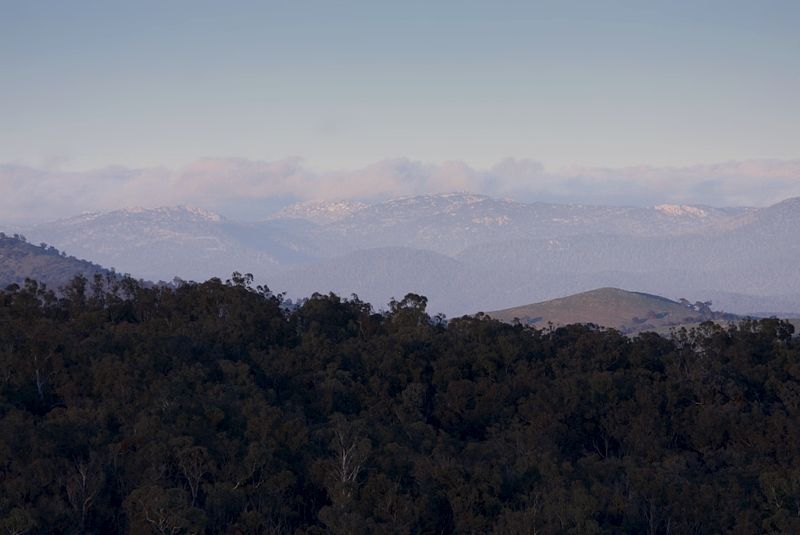
It is definitely Sprinter in the hills of the Southern Australian Capital Teritory.
3rd September, snow on the tors between Mount Gudgenby and Kelly Spur.
Warren.
3rd September, snow on the tors between Mount Gudgenby and Kelly Spur.

Warren.
- WarrenH
- Phyllocladus aspleniifolius

- Posts: 990
- Joined: Thu 07 Jan, 2010 6:54 pm
- Region: Australian Capital Territory
12 posts
• Page 1 of 1
Return to New South Wales & ACT
Who is online
Users browsing this forum: No registered users and 17 guests
