Went down to the Kowmung via Brumby Ridge to Orange Bluff on the weekend. Having read various reports from here, and from other people, we were prepared for the worst.
There are several slow sections on Brumby Ridge with vegetation over head height - the first 100m off First Top, about 300m across the saddle leading to the lower peak of Brumby Mountain, and about 500m below the higher peak of Brumby Mountain. Good route finding will make the difference between these being a bit slow and very slow. For the 500m section, there is a trampled route through the regrowth, and picking up this will make your life easier.
The remainder of the ridge is in fairly similar condition to what it used to be. Don't try and short cut the first peak of Brumby Mountain - stay high on the ridge - for now.
It took us 2 hours of walking to descend and 2:50 to ascend (ignoring lunch/morning tea stops), which is not that different to what it would have been previously.
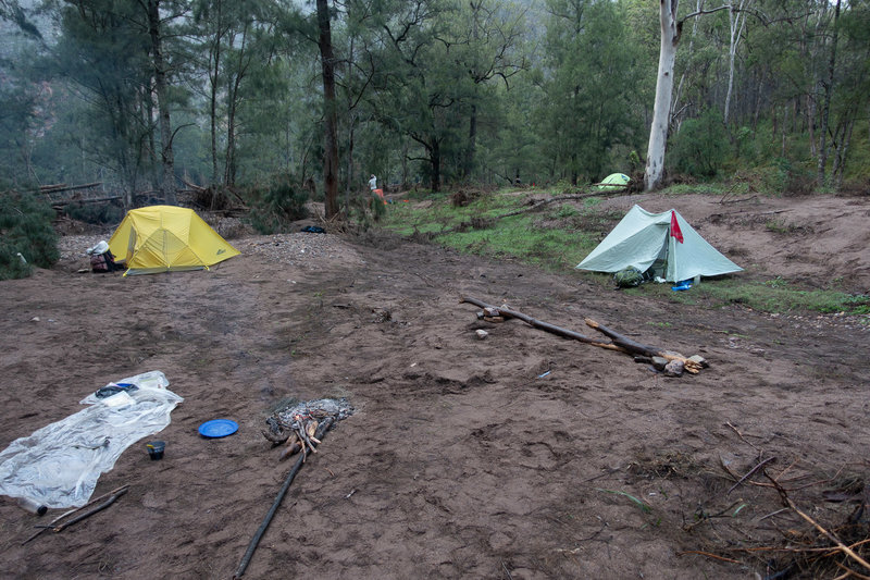
The intention was to go downstream, camp near Rainbow Bluff, and exit up Roots or Hughes Ridge the next day, but the Kowmung was up considerably after heavy rain on Thursday, so we exited back up Brumby Ridge. The recent floods have completely cleared the vegetation from the river flats - we camped on sand near the river.
Route finding on the ascent was easier than the descent, as it's easier to keep to the ridge on the way up, and we'd probably cleared the route a bit on the way down.
The Gingra Range track is mostly easy enough to follow to First Top, other than the 200m around where it branches off to Bullhead Ridge.

- Orange Bluff campsite - May 2021

- Regrowth on Brumby Ridge - May 2021