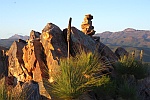
I am looking for assistance from anyone who may have a map of the route from Mt Jaithmatang north to Fainter Firetrail. BTAC plan to clear a route through here after winter. SV and some other maps have an indicative line of roughly where it goes. Parts of it have a definite footpad but in other parts, regrowth has completely obscured the route. I would appreciate if anyone can point me in the direction of anything semi-official, to assist us in taking the best line.
Thankyou.
Map Jaithmathang to Fainter FT
Forum rules
Victoria specific bushwalking discussion. Please avoid publishing details of access to sensitive areas with no tracks.
Victoria specific bushwalking discussion. Please avoid publishing details of access to sensitive areas with no tracks.
11 posts
• Page 1 of 1
Re: Map Jaithmathang to Fainter FT
Will this be an official Parks Victoria-sanctioned working bee?
If so then surely PV would have a GPX file or similar???
If so then surely PV would have a GPX file or similar???
- JamesMc
- Athrotaxis cupressoides

- Posts: 304
- Joined: Wed 09 Dec, 2009 5:24 pm
- Region: Victoria
- Gender: Male
Re: Map Jaithmathang to Fainter FT
I have walked that route last decade but it is now very overgrown as is the route from Tawonga Huts up to the summit of Mt. Jaithmatang.
I hope to be available to take part in the working bee.
I hope to be available to take part in the working bee.
- paidal_chalne_vala
- Lagarostrobos franklinii

- Posts: 2744
- Joined: Sun 22 Jan, 2012 10:30 pm
- ASSOCIATED ORGANISATIONS: VNPA.BTAC.Friends of Baw Baw.Mt.Bogong Club.
- Region: Victoria
- Gender: Male
Re: Map Jaithmathang to Fainter FT
Eyeball the topography and follow your nose. 
- stry
- Athrotaxis selaginoides

- Posts: 1429
- Joined: Mon 10 Jun, 2013 6:28 pm
- Region: Victoria
- Gender: Male
Re: Map Jaithmathang to Fainter FT
I don't remember any real track through there - but really quite open going - like stry says.
-

eggs - Lagarostrobos franklinii

- Posts: 10832
- Joined: Fri 23 May, 2008 2:58 pm
- Location: Para Vista, South Australia
- Region: South Australia
Re: Map Jaithmathang to Fainter FT
Ditto. It is (in my increasingly out-of-date) experience, a straightforward line-of-sight walk, no vegetational challenge.
"Mit der Dummheit kämpfen Götter selbst vergebens."
-

north-north-west - Lagarostrobos franklinii

- Posts: 15486
- Joined: Thu 14 May, 2009 7:36 pm
- Location: The Asylum
- ASSOCIATED ORGANISATIONS: Social Misfits Anonymous
- Region: Tasmania
Re: Map Jaithmathang to Fainter FT
I walked from Little Plain to Jaitmathang last summer. No track was found, and it's a bit scrubby in places. I've done this walk a few times and found no track. The 4WD/management track fromBogong Jack to Tawonga Huts is no longer viable for vehicles in many places. South of Little Plain it's wet and muddy. Approval from PV is needed before doing track maintenance. I'm not sure that PV will approve track cutting.
-

Lophophaps - Auctorita modica

- Posts: 3475
- Joined: Wed 09 Nov, 2011 9:45 am
- Region: Victoria
- Gender: Male
Re: Map Jaithmathang to Fainter FT
The Fainter fire trail was cleared in late Oct. 2024 from Tawonga huts to Little Plain.That section is no longer feasible for 4x4 vehicle access.
The foot route from Tawonga huts to Mt. Jaithmathang was also cleared then.
The foot route from Tawonga huts to Mt. Jaithmathang was also cleared then.
- paidal_chalne_vala
- Lagarostrobos franklinii

- Posts: 2744
- Joined: Sun 22 Jan, 2012 10:30 pm
- ASSOCIATED ORGANISATIONS: VNPA.BTAC.Friends of Baw Baw.Mt.Bogong Club.
- Region: Victoria
- Gender: Male
Re: Map Jaithmathang to Fainter FT
The route is shown on the Bogong Alpine Area Outdoor Recreation Map. I think it is a victim of climate change. Scrub is growing higher and has covered what was a route in the grass.
- CaptainC
- Athrotaxis cupressoides

- Posts: 116
- Joined: Sat 07 Nov, 2009 8:06 pm
- Region: Victoria
- Gender: Male
Re: Map Jaithmathang to Fainter FT
Yeah was pretty scrubby a couple of years ago. Still doable but certainly not a clear padCaptainC wrote:The route is shown on the Bogong Alpine Area Outdoor Recreation Map. I think it is a victim of climate change. Scrub is growing higher and has covered what was a route in the grass.
Sent from my SM-S906E using Tapatalk
- Walk_fat boy_walk
- Lagarostrobos franklinii

- Posts: 2344
- Joined: Sat 21 Nov, 2009 6:59 am
- Gender: Male
Re: Map Jaithmathang to Fainter FT
There was a BTAC plan to clear the route from Mt. Jaithmathang to Little Plain but Parks Vic. said no.
They consider it to be a low priority route.
In late Oct. 2024
We BTAC volunteers cleared The Fainters Fire trail from Tawonga Huts to Little Plain
and the Mt. Jaithmathang foot track from Tawonga Huts to the summit.
They consider it to be a low priority route.
In late Oct. 2024
We BTAC volunteers cleared The Fainters Fire trail from Tawonga Huts to Little Plain
and the Mt. Jaithmathang foot track from Tawonga Huts to the summit.
- paidal_chalne_vala
- Lagarostrobos franklinii

- Posts: 2744
- Joined: Sun 22 Jan, 2012 10:30 pm
- ASSOCIATED ORGANISATIONS: VNPA.BTAC.Friends of Baw Baw.Mt.Bogong Club.
- Region: Victoria
- Gender: Male
11 posts
• Page 1 of 1
Who is online
Users browsing this forum: No registered users and 2 guests

