We thought we might walk into Cleve Cole hut for a day walk yesterday but things did not go well to start with. The plan was to drive up the Long Spur to the single track but too many big trees across the track so that plan was aborted early. We then drove down Snowy Log Road toward Mulhauser track. Cleared one big tree which had fallen since the dozer had been through and then when within 2km of the turnoff we struck another huge tree which was just too big and too dangerous to cut so we turned around and back onto the Omeo Highway to pick up the other end of Snowy Log Road off Dunstan's log road. This was clear and in good order. Loggin appears to have ceased in that area for the moment so do not expect much more work on the road. The Mulhauser track is also clear and in pretty good order but lots of timber has been cut to clear it. Although it was wet in places I managed to drive in 2wd until the last few hundred metres but this small hill would dry out soon and would not pose any problem. A front wheel drive or all wheel drive SUV would make it depending on the driver. Clearance is only a problem with one water rut near the logging reveg area but a quick fill in with a shovel would see it easily past. To stress it again, I would not drive any of these tracks without a good chainsaw. We took 2 but also spare chains, fuel, bar oil, tools to sharpen and a drag chain. My saw has a 20" bar and even then it could be a bit short. We also have UHF radio which can pick up the Omeo Highway if needed. You can stress to people about gear needed for walking in the mountains but a lot of good it will do if you are stuck for days without communication and no saw to clear the track out.
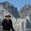
The walk up the spur is easy. It took 20 minutes with a steep section followed by a gentle slope which was repeated several times until the junction with the AAWT. Given we did not get started until 1330hrs we did not anticipate making Cleve Cole but we did make it to the T spur junction in 2 hours from the car. I have given report on the track here
viewtopic.php?f=64&t=21928&p=313248#p313248PCV - I read the posts on the ski forum and just to correct U/Steve on a minor point. There is no DSE in Mitta. The nearest would be Eskdale but I don't think they handle the logging in that area. VicForest in Swifts creek would have more information if you need. Michelle is the one to speak with there but I doubt you would need to now with the information provided. I still cannot see any walking track from the Omeo Highway along Mulhauser spur. I have the latest Rooftop may and it shows it a 4wd road to the camp and then a walking track. I can tell you it is a 4wd road and not a walking track so if your map has it marked with black dashes instead of red then it is wrong. The Bright/Dartmouth Rooftop map is all you would need.