Water levels in the Lerderderg gorge.
Victoria specific bushwalking discussion. Please avoid publishing details of access to sensitive areas with no tracks.
Water levels in the Lerderderg gorge.
![]() by Dreamer 61 » Mon 16 Jan, 2017 9:26 am
by Dreamer 61 » Mon 16 Jan, 2017 9:26 am
- Dreamer 61
- Nothofagus cunninghamii

- Posts: 2
- Joined: Sun 21 Feb, 2016 8:03 am
- Region: Victoria
- Gender: Male
Re: Water levels in the Lerderderg gorge.
![]() by overlandnoob » Sun 22 Jan, 2017 5:18 pm
by overlandnoob » Sun 22 Jan, 2017 5:18 pm
- overlandnoob
- Nothofagus gunnii

- Posts: 25
- Joined: Mon 27 Jan, 2014 2:20 pm
- Region: Victoria
Re: Water levels in the Lerderderg gorge.
![]() by Snowzone » Mon 23 Jan, 2017 11:28 am
by Snowzone » Mon 23 Jan, 2017 11:28 am
-
Snowzone - Phyllocladus aspleniifolius

- Posts: 519
- Joined: Sat 11 Dec, 2010 12:10 pm
- Region: Victoria
- Gender: Female
Re: Water levels in the Lerderderg gorge.
![]() by bigkev » Sun 05 Mar, 2017 7:41 pm
by bigkev » Sun 05 Mar, 2017 7:41 pm
-

bigkev - Athrotaxis cupressoides

- Posts: 445
- Joined: Sat 30 Jun, 2012 6:44 pm
- Region: Victoria
- Gender: Male
Re: Water levels in the Lerderderg gorge.
![]() by OllieVic » Fri 17 Mar, 2017 8:03 am
by OllieVic » Fri 17 Mar, 2017 8:03 am
- OllieVic
- Nothofagus gunnii
- Posts: 15
- Joined: Mon 15 Feb, 2016 9:17 pm
- Region: Victoria
- Gender: Male
Re: Water levels in the Lerderderg gorge.
![]() by Drew » Fri 24 Mar, 2017 8:30 pm
by Drew » Fri 24 Mar, 2017 8:30 pm
- Drew
- Phyllocladus aspleniifolius
- Posts: 788
- Joined: Fri 13 Jan, 2012 11:16 am
- Region: Victoria
- Gender: Male
Re: Water levels in the Lerderderg gorge.
![]() by Drew » Mon 27 Mar, 2017 8:06 am
by Drew » Mon 27 Mar, 2017 8:06 am
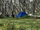
We started at Loh's Lane, descended Lower Chadwick Track, walked downstream along the river until the bottom of Bears Head Range Track, where we camped. The river was flowing from just upstream of our campsite (only just). Next day we climbed Bears Head Range Track, then returned to Loh's Lane via Blackwood Ranges Track and Foxy Gully Track.
It was only about 15km. We started walking about 2pm Saturday and were back at the car at midday Sunday, so a pretty short walk that could easily be done as a daywalk. However it was lovely to spend the night out there. It really is a nice place. Feels a million miles away from the city. And only two snake sightings!
- Drew
- Phyllocladus aspleniifolius
- Posts: 788
- Joined: Fri 13 Jan, 2012 11:16 am
- Region: Victoria
- Gender: Male
Re: Water levels in the Lerderderg gorge.
![]() by Eremophila » Mon 27 Mar, 2017 8:10 pm
by Eremophila » Mon 27 Mar, 2017 8:10 pm
-
Eremophila - Phyllocladus aspleniifolius
- Posts: 931
- Joined: Mon 24 Oct, 2011 5:15 pm
- Location: SW Vic
- Region: Victoria
- Gender: Female
Re: Water levels in the Lerderderg gorge.
![]() by GregR » Mon 03 Apr, 2017 1:47 pm
by GregR » Mon 03 Apr, 2017 1:47 pm
First time I have been able to walk right up to the tunnel (well almost -there was a pool of putrescent muck at the entrance itself)
Could have walked as far as we felt in the riverbed if we were so inclined.
-
GregR - Phyllocladus aspleniifolius
- Posts: 889
- Joined: Mon 07 Jan, 2013 11:24 am
- Region: Victoria
- Gender: Male
Re: Water levels in the Lerderderg gorge.
![]() by bigkev » Sat 13 Apr, 2019 6:36 pm
by bigkev » Sat 13 Apr, 2019 6:36 pm
- Looking downstream from the ford at O'Briens Crossing.
-
bigkev - Athrotaxis cupressoides
- Posts: 445
- Joined: Sat 30 Jun, 2012 6:44 pm
- Region: Victoria
- Gender: Male
Re: Water levels in the Lerderderg gorge.
![]() by rumblepants » Mon 29 Jul, 2019 3:58 pm
by rumblepants » Mon 29 Jul, 2019 3:58 pm
- Attachments
-
- rumblepants
- Nothofagus gunnii
- Posts: 40
- Joined: Tue 23 Oct, 2018 4:28 pm
- Region: Australia
- Gender: Male
Re: Water levels in the Lerderderg gorge.
![]() by Orbita_Serenitatem » Tue 06 Aug, 2019 2:11 pm
by Orbita_Serenitatem » Tue 06 Aug, 2019 2:11 pm
rumblepants wrote:I was up at Lerderderg last weekend and the water levels have come back a bit after the rains. Looks like there was some flash flooding along the river.
Rumblepants, I'm planning to do the Lerderderg Trail B'March to Daylesford this weekend etc. How deep was the water at O'Brian's?
-
Orbita_Serenitatem - Athrotaxis cupressoides
- Posts: 170
- Joined: Thu 02 Nov, 2017 9:04 pm
- Location: Victoria
- Region: Victoria
- Gender: Male
Re: Water levels in the Lerderderg gorge.
![]() by Drew » Mon 23 Sep, 2019 9:44 am
by Drew » Mon 23 Sep, 2019 9:44 am
Thanks.
- Drew
- Phyllocladus aspleniifolius
- Posts: 788
- Joined: Fri 13 Jan, 2012 11:16 am
- Region: Victoria
- Gender: Male
Re: Water levels in the Lerderderg gorge.
![]() by Drew » Mon 30 Sep, 2019 5:37 pm
by Drew » Mon 30 Sep, 2019 5:37 pm
Has anyone been down to the gorge in the past week or two? I'm thinking of walking a route that I've done in drier months but not sure how feasible it is in Spring. There would be a section of river walking from the bottom of Razorback Track to the weir (or could be shortened to come up Bears Head Range Track if the going is too slow along the river).
Thanks.
To answer my own question (hopefully for someone's benefit!) the river was flowing very nicely but it was easy enough to walk along. Slower going than when it's drier (with lots of criss-crossing required) but no thigh deep wading or anything near it - in fact my feet almost stayed dry.
- Drew
- Phyllocladus aspleniifolius
- Posts: 788
- Joined: Fri 13 Jan, 2012 11:16 am
- Region: Victoria
- Gender: Male
Re: Water levels in the Lerderderg gorge.
![]() by bigkev » Sat 22 Feb, 2020 6:58 pm
by bigkev » Sat 22 Feb, 2020 6:58 pm
I walked the middle section of the gorge today, downstream from McKenzie Track to Bears Head. There is a good amount of water down there for this time of the year. It's not flowing however there are numerous big pools, just treat it as there are also numerous goats
Cheers Kevin
- This long pool is just up stream of where Old River comes in.
-
bigkev - Athrotaxis cupressoides
- Posts: 445
- Joined: Sat 30 Jun, 2012 6:44 pm
- Region: Victoria
- Gender: Male
Re: Water levels in the Lerderderg gorge.
![]() by Pink Cap » Tue 05 Jan, 2021 8:18 am
by Pink Cap » Tue 05 Jan, 2021 8:18 am
- Pink Cap
- Atherosperma moschatum

- Posts: 61
- Joined: Tue 21 Apr, 2020 10:59 am
- Region: Australia
- Gender: Female
Re: Water levels in the Lerderderg gorge.
![]() by Drew » Tue 05 Jan, 2021 8:55 am
by Drew » Tue 05 Jan, 2021 8:55 am
Pink Cap wrote:I’m thinking of walking the Lerderderg Track between Daylesford and Bacchus Marsh as my final walk of the Goldfields Track. The website has no info about water; does anyone know the current water situation in this area? It’s a 4 day walk so I’d be needing to find water along the way. I’m assuming I’ll have to bush camp as I don’t see much in the way of official campsites. Has anyone else done this track recently?
I haven't been in the gorge lately but from past experience, and with the recent rain, I'd be confident that there will be plenty of good pools of water for swimming and drinking. You'll want to purify it though.
There are a few good campsites along the way. Most will have been discussed on the forum previously, but let me know if you can't find info and I can look on the map when I have time.
- Drew
- Phyllocladus aspleniifolius
- Posts: 788
- Joined: Fri 13 Jan, 2012 11:16 am
- Region: Victoria
- Gender: Male
Re: Water levels in the Lerderderg gorge.
![]() by DavidB » Tue 05 Jan, 2021 9:38 am
by DavidB » Tue 05 Jan, 2021 9:38 am
- DavidB
- Atherosperma moschatum
- Posts: 87
- Joined: Tue 11 Oct, 2016 9:06 am
- Region: New South Wales
- Gender: Male
Re: Water levels in the Lerderderg gorge.
![]() by Pink Cap » Tue 09 Feb, 2021 8:15 am
by Pink Cap » Tue 09 Feb, 2021 8:15 am
- Pink Cap
- Atherosperma moschatum
- Posts: 61
- Joined: Tue 21 Apr, 2020 10:59 am
- Region: Australia
- Gender: Female
Re: Water levels in the Lerderderg gorge.
![]() by bigkev » Tue 09 Feb, 2021 10:07 am
by bigkev » Tue 09 Feb, 2021 10:07 am
I'm thinking of doing this walk in the next couple of months.
-
bigkev - Athrotaxis cupressoides
- Posts: 445
- Joined: Sat 30 Jun, 2012 6:44 pm
- Region: Victoria
- Gender: Male
Re: Water levels in the Lerderderg gorge.
![]() by indented » Mon 22 Feb, 2021 8:24 am
by indented » Mon 22 Feb, 2021 8:24 am
- indented
- Atherosperma moschatum
- Posts: 60
- Joined: Wed 06 Jan, 2021 9:13 am
- Region: Victoria
- Gender: Male
Re: Water levels in the Lerderderg gorge.
![]() by BenBen » Sun 28 Feb, 2021 10:42 pm
by BenBen » Sun 28 Feb, 2021 10:42 pm
https://www.melbournewater.com.au/water ... er/231213A
There are a whole lot of other sites listed across the state too, so not just relevant for the Lerderderg.
Ben
- BenBen
- Nothofagus cunninghamii
- Posts: 1
- Joined: Sun 28 Feb, 2021 10:34 pm
- Region: Victoria
- Gender: Male
Who is online
Users browsing this forum: No registered users and 38 guests