Page 1 of 1

Hotham shelters

PostPosted: Tue 17 Sep, 2024 12:54 pm
by Lophophaps
Given the current cold conditions and snow falling down to 1000 metres a few days ago, I'm interested in a fallback plan if the weather is poor at the start. On the Omeo side of Hotham the only hut seems to be at JB Plain. Is this still standing? My map shows a shelter at Wire Plain. Is this left open in green season? Is this called Howards Hut?

At the bottom of Brandy Creek FT the route goes upstream through tussocks, swamp and snakes to a nice campsite at the bottom of Paling Spur, where the Cobungra River has a sharp bend from north-south to east-west. The intent is to go straight up the spur from the bottom of Brandy Creek FT, north-east. Does anyone know what the scrub is like for the first100 metres of climbing?

Re: Hotham shelters

PostPosted: Wed 18 Sep, 2024 8:27 pm
by paidal_chalne_vala
JB Hut is still there and it is quite a good public shelter , open all year round.
There is a public shelter at Wire Plain. Howard's hut is a different structure. The one at Wire Plain is more modern .
I don't know if Wire Plain shelter is left open in the non ski season. I have XC skied up to it and used it for a lunch venue when
snow camping at JB hut.The Whiskey Plain Biatholon/ XC skiing and shooting club house/ hut , [the new one] is shut in green season.
There is a public shelter with toilets at Dinner Plain Village that is open all year round.
The Blow hard hut is very draughty and not great nor is the Diamantina hut.
The Chimney on Lankey Plain hut was removed a few years ago.
The route up Paling Spur is overgrown and I have suggested to Parks Vic./BTAC that it be given a proper haircut. Even the signage
down there on the Cobungra river has seen better days , or so it seemed when I was last there.
I am planning to walk in that area again in December.

Re: Hotham shelters

PostPosted: Thu 19 Sep, 2024 7:09 am
by Xplora
Lophophaps wrote:Given the current cold conditions and snow falling down to 1000 metres a few days ago, I'm interested in a fallback plan if the weather is poor at the start. On the Omeo side of Hotham the only hut seems to be at JB Plain. Is this still standing? My map shows a shelter at Wire Plain. Is this left open in green season? Is this called Howards Hut?

At the bottom of Brandy Creek FT the route goes upstream through tussocks, swamp and snakes to a nice campsite at the bottom of Paling Spur, where the Cobungra River has a sharp bend from north-south to east-west. The intent is to go straight up the spur from the bottom of Brandy Creek FT, north-east. Does anyone know what the scrub is like for the first100 metres of climbing?

It is a nice spot to camp at the bottom of Paling spur. This is the junction of Swindlers Creek. It would be fairly sheltered also. I haven't done Paling for a while but it wasn't too bad. There shouldn't be any fire regrowth. Let me know if you see any horses. Shouldn't be any but take note if there are.

Re: Hotham shelters

PostPosted: Thu 19 Sep, 2024 1:15 pm
by Lophophaps
Thanks. I may need somewhere to hide is the weather is crook. Paling Spur is a route, not a tracks, and I cannot see PV devoting resources to clearing this. I've never seen horses on Paling Spur, but they were in evidence on the ridge, and near pole 267. I've seen mobs east of there, just below the plateau, at around 1700 metres on the north-east side facing Bundara.

Re: Hotham shelters

PostPosted: Fri 20 Sep, 2024 7:52 am
by Xplora
Lophophaps wrote:Thanks. I may need somewhere to hide is the weather is crook. Paling Spur is a route, not a tracks, and I cannot see PV devoting resources to clearing this. I've never seen horses on Paling Spur, but they were in evidence on the ridge, and near pole 267. I've seen mobs east of there, just below the plateau, at around 1700 metres on the north-east side facing Bundara.

There is a new boss at Mt. Beauty but the old one told me Paling spur would be left a little wild. He didn't want it to disappear though. It was more about keeping it more natural with no markings. I got the feeling he did not want to encourage less experienced people to go that way. The type of walker who can only follow a marked track.

Re: Hotham shelters

PostPosted: Fri 20 Sep, 2024 8:49 am
by Baeng72
Google Maps has a track starting from Dibbins, heading south-ish, more or less tracking the Cobungra, then more westerly, over a ridge to intersect and follow Swindlers Creek to where it intersects the Cobungra. It then crosses the river, and heads North-East to North-ish to intersect Brandy Creek firetrail at about 1660-1680 m. Is this the track we're talking about?
paling.png
Paling Spur track?

Re: Hotham shelters

PostPosted: Fri 20 Sep, 2024 9:29 am
by paidal_chalne_vala
Yes. This place.I have walked all of those routes before. Have you ?

Re: Hotham shelters

PostPosted: Fri 20 Sep, 2024 9:35 am
by Baeng72
paidal_chalne_vala wrote:Yes. This place.I have walked all of those routes before. Have you ?

Never done Paling Spur, on the to-do list. Just collecting info for future walks with my questions. :D

Re: Hotham shelters

PostPosted: Fri 20 Sep, 2024 10:15 am
by peregrinator
Baeng72 wrote:Google Maps has a track starting from Dibbins, heading south-ish, more or less tracking the Cobungra, then more westerly, over a ridge to intersect and follow Swindlers Creek to where it intersects the Cobungra. It then crosses the river, and heads North-East to North-ish to intersect Brandy Creek firetrail at about 1660-1680 m. Is this the track we're talking about?


No, it 's not. Nor is it a totally cleared "track".

Re: Hotham shelters

PostPosted: Fri 20 Sep, 2024 11:05 am
by Baeng72
OK, I've checked GetLost map, and that is Paling Spur according to it.
The only difference is the "track" follows the crest of the ridge, and you can see the track that Google indicates on the north side of the spur. Which may not exist, but just be there because the map makers "know" there's a route/pad there somewhere.
Apologies, was just trying to locate where we were talking about.
paling2.png
Paling

Re: Hotham shelters

PostPosted: Fri 20 Sep, 2024 4:03 pm
by Lophophaps
I have been to Paling Spur a few times over a decade or so. One possibility about the tracks is as follows. Someone does a walk on Paling Spur and reports with GPS markers. This off track route is then picked up by Google or the like as a track, and then marked as such on their maps.

I have seen similar errors on maps repeated until 10-20 years later the error ceases. One that come to mind is a map by a well-known publisher that had Charlotte's Pass. This is wrong on two counts. Apostrophes have not been used for a long time, and it's singular, Charlotte. Other publishers copied "Charlotte's Pass" until word got around that this form of words is incorrect. New maps, correct spelling, fixed

Google maps seems to have errors regarding Paling Spur. The most northerly route goes down a bit towards the top, avoided by keeping a bit more to the south. The Brandy Creek FT seems not to exist - I have not seen it and it's not on the aerial photos. Of course the FT could have been put in after my last visit and after the pictures were taken. The hill on the true left bank of the Cobungra River at the bottom of Brandy Creek FT coming from the Hotham road is very steep. The FT as shown on the left bank is unlikely in the position shown.

The Graphhopper map below shows the features that I have seen.
Bottom edge, red lines, Brandy Creek FT from the Hotham road.
Upstream (NW) from there, red dots, route.
Orange circle, campsite, quite nice, sheltered.
From there up Paling Spur, approximate route red dots.
At the top, yellow line, a short defined track.
NW of there, the orange lines shows the approximate route on the top

Paling Spur.png
Paling Spur


I've also got a few pictures from 2015.
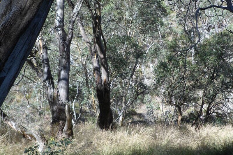
Paling Spur S.jpg
Paling Spur from FT

Paling Spur from the bottom of the Brandy Creek FT looking across the river. It's steep where the FT is shown on the map, unlikely.
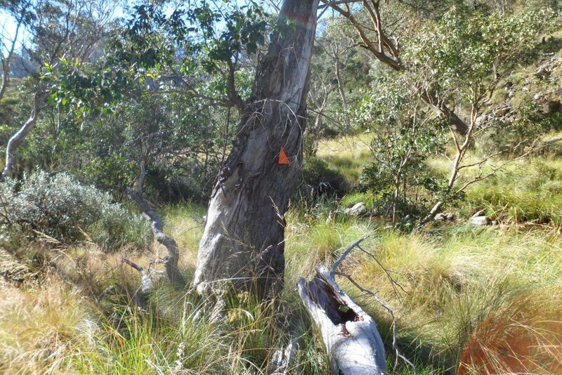


Marker S.jpg
Marker on river flats

The marker is half way between the bottom of the FT and the campsite, looking upstream. There were no more markers after that until the campsite.
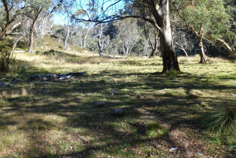


Campsite S.jpg
Swindlers Cobungra campsite

The clearing on the Cobungra River where Swindlers Creek come in, a nice place to camp. You can get an idea of the steepness in the background.
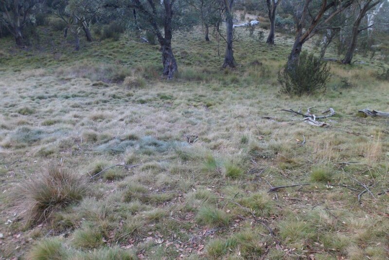


Start pad S.jpg
Start of Swindlers route

The start of the climb at the clearing. The caption says "start pad" so there must have been something there. There was one marker, the last for about four hours. After the start there was no pad either.
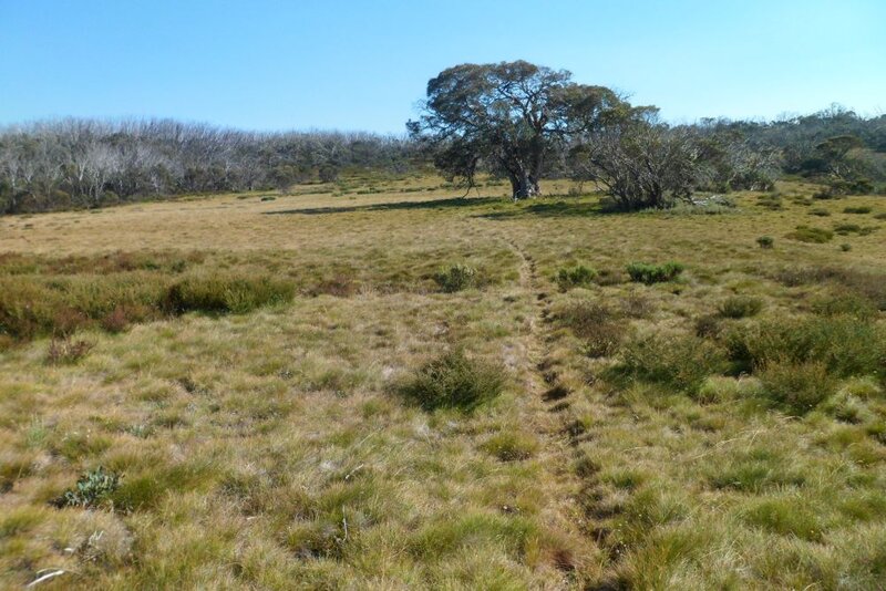


Near top S.jpg
Circa 1650 metres

At about 1650 metre looking north to NW. My map is wrong here as it shows the route going too far to the east, down then up.

Re: Hotham shelters

PostPosted: Fri 20 Sep, 2024 5:40 pm
by Xplora
Some to the discussion is getting a bit off topic but there is a marked and cleared track from the confluence of Swindlers creek and the Cobungra river that takes you along Swindlers Creek then up toward Swindlers gap then down to the Cobungra again. This track continues on also and is known as Dungey Track. Parks Vic maintains it to some degree and it is an easy walk. A little tussock to get over in some places.

Re: Hotham shelters

PostPosted: Fri 20 Sep, 2024 5:56 pm
by Camminata
Gaia maps app has it marked also, desired route taken would be a loop joining Youngs Hut and back around on AAWt pass Spargos to rejoin Alpine Rd am sure one of you have walked this route, or maybe ford Swindlers creek back would be interesting.

Re: Hotham shelters

PostPosted: Wed 16 Oct, 2024 9:05 am
by Lophophaps
Opposite the bottom of Brandy Creek FT Paling Spur is extremely steep. A vehicle track up that slope is impossible. There is no track between there and the campsite at the Swindlers-Cobungra junction at the foot of Paling Spur. From the bottom of Brandy Ck FT keep to the middle of the flats. It's slow. The route keeps to the west bank until just before the campsite.

Paling Spur has a track that is hard to follow in places. Baeng72’s Get Lost map of 29 September is wrong. From the last elbow coming down Brandy Creek FT there is no track going nearly due east down and up. On Paling Spur the northerly route blue and white seems not to exist. The dots in the middle are about right. There are on-off tracks on the Dinner Plain-Youngs Hut ridge. Youngs Hut has a new toilet. It's too far from the hut and crosses wet ground, so a number of people did not bother. Loch Car Park has a swish new day shelter with toilets and water.