Hi everyone, first time poster here!
OK so earlier this year, a bunch of us decided to climb Mt Kinabalu in Malaysia in December. We were all going there for a friend's wedding so hey, why not. Sure it's a bit touristy, but it's still a climb!
Fast forward to this month. I suddenly realized the climb is two months away and I need to get into bushwalking shape! I'm of average fitness (well .. maybe below average compared to some of you hardcore nuts) and have bushwalked ... mmm... maybe 5 times. In the past 25 years. Yes, embarrassing I know. I cycle semi-regularly (depending on the season) to keep some level of fitness, but I figured walking up and down a mountain will use a totally different set of muscles, so I'd better start working them.
I did Mt Warning with my friends 2 weeks ago (first 'proper' hike in maybe 8 years) and found it enjoyable... the first km was tiring, but after that it was quite OK. The final rock scramble was pretty fun. Going downhill wasn't very tiring but towards the end, my left knee and pelvis joint area was kinda hurting... maybe we were going down too quickly. If I remember right, we got to the top in about 2hrs and down in 1.5hrs.
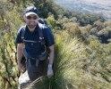
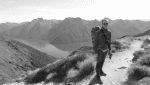
After doing some reading here, I decided to do Mt Edwards next. I went up solo yesterday (Monday).. it was deserted. The climb up was a bit tiring - after the halfway point it just kept going up and up and up! But once I got to the top, it felt very satisfying with the nice view. The walk took about 1.5hrs up and about an hour down. It didn't feel as tiring as Mt Warning. The dam wall was a bonus - I've never actually seen a dam close up.
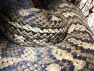
I've borrowed Take A Walk which was helpful for Mt Edwards (especially that indistinct junction!), but find forum posts more helpful for getting to know a track generally. Also thanks to the forums, I've learned that Kathmandu gear is to be avoided, North Face is mainly for fashion, never ask about sandshoes vs boots, Tassie is full of leeches (which should be scraped off with a fingernail, not salted), a PLB is important for longer hikes, keep to the trail to prevent erosion, and Mt Barney is for real men (and tough women). Hurrah for the internet!
OK, once you all stop laughing at the city boy whose legs are probably going to fall off at Mt Kinabalu, can anyone suggest other mountainesque half-day trails that I should check out? I was thinking of Mt Greville - how does that compare to Mt Edwards?
Also, when doing these trails solo, is there anything I should watch out for? Dangerous creepy crawlies? Plants? Ticks? I plan to only do them when the weather is awesome, i.e. no rain. I would let my friends know where I am, where I intend to go, an estimated return time, and leave all that info visible in my car with an emergency contact number and CB radio channel number which I would carry if it looks necessary.
Should newbies even be doing moderate trails solo?
Thanks!
Uh-oh. Need to train!
Forum rules
Queensland specific bushwalking discussion. Please avoid publishing details of access to sensitive areas with no tracks.
Queensland specific bushwalking discussion. Please avoid publishing details of access to sensitive areas with no tracks.
26 posts
• Page 1 of 1
Uh-oh. Need to train!
![]() by eug » Tue 16 Oct, 2012 9:57 pm
by eug » Tue 16 Oct, 2012 9:57 pm
- eug
- Nothofagus cunninghamii

- Posts: 9
- Joined: Tue 16 Oct, 2012 8:06 pm
- Region: Queensland
- Gender: Male
Re: Uh-oh. Need to train!
![]() by Pteropus » Wed 17 Oct, 2012 11:18 am
by Pteropus » Wed 17 Oct, 2012 11:18 am
Hi eug, interesting first post! Welcome.
I guess fitness is a subjective thing, where some people are happy with a gym and others will go and climb a mountain. However, depending on your base level of fitness, maintaining fitness is something that most people generally need to work on regularly (though, I did once know a bloke who never did any training of any sort, drank like a fish and smoked like a chimney, and still would be able to flog most people up a mountain!). Because hills and mountains are not always available in our busy lives, getting enough exercise through the week to maintain some level of fitness is necessary. Personally, I hate exercising for exercise sake, but I like incidental exercise that keeps me reasonably fit. Things such as climbing stairs instead of taking lifts or walking instead of car or bus etc...
But for a real mountain, you might be in need of something more than incidental exercise. If you are in the Brisbane area, there are some very good circuits on Mt Coot-tha. Sure, it’s not a big mountain (many would say it’s but a hill!), but there are some VERY STEEP tracks that will really test your heart, lungs and legs! There are always people training there for much more rugged walks such as Kokoda. Further out, there is the whole track system around Lamington NP, with some long walks with steep sections. Main Range too, and Moogerah NP, as you have discovered, is not bad. Mt Warning is a good one, but as you probably found out, it doesn’t really get your heart going, and is easier than it looks. Though running up it might make it more of a challenge
Since you say you are not experienced at bushwalking, it might be best to go through the Take a Walk book and find locations with well defined tracks. Mt Maroon, for example, is quite simple, and will give you a great workout. Greville might be just as simple, but I can’t comment on that since I have not been up it yet.
As far as walking solo, I would think it advisable to walk within your comfort zone until you have more experience. Once again, stay on well defined tracks, have a map, and be aware of your location. Being "aware" might be and ambiguous concept and might not come naturally, but basically to me, it’s about thinking about what direction you are going and have come from. Sometimes it is very easy to take a wrong turn on a well defined track, such as following an animal pad or where others have made wrong turns, and one might find themselves surrounded by thick bush and a little lost. In that situation, if you have been paying attention to your surroundings and spatial orientation, back tracking to the main track should be generally easy. However, this is tougher in dense vegetation, and that is why I say stick to locations that have well defined tracks. Off track in the rainforest Lamington, for example, is a tough place to remain spatially aware unless you had experience and knowledge of the region.
And as you know, telling people where you are going is probably the most important thing for safety though. Even if you popped up to Mt Coot-tha, it is a good idea to tell someone. Oh, and take a pocketknife, in case you get a limb caught up and need to amputate it, à la Aaron Ralston haha kidding!
Yep, check yourself for ticks after your walks is always a good idea. Don’t try to pick up snakes Watch out for giant stinging trees in the rainforest . Other than that, bushwalking is a learning experience, and don't forget to enjoy yourself! Stop and take a look at your surroundings!
Good luck with the training! And the Mt Kinabalu!! I bet it will be amazing.
Cheers
Andrew
I guess fitness is a subjective thing, where some people are happy with a gym and others will go and climb a mountain. However, depending on your base level of fitness, maintaining fitness is something that most people generally need to work on regularly (though, I did once know a bloke who never did any training of any sort, drank like a fish and smoked like a chimney, and still would be able to flog most people up a mountain!). Because hills and mountains are not always available in our busy lives, getting enough exercise through the week to maintain some level of fitness is necessary. Personally, I hate exercising for exercise sake, but I like incidental exercise that keeps me reasonably fit. Things such as climbing stairs instead of taking lifts or walking instead of car or bus etc...
But for a real mountain, you might be in need of something more than incidental exercise. If you are in the Brisbane area, there are some very good circuits on Mt Coot-tha. Sure, it’s not a big mountain (many would say it’s but a hill!), but there are some VERY STEEP tracks that will really test your heart, lungs and legs! There are always people training there for much more rugged walks such as Kokoda. Further out, there is the whole track system around Lamington NP, with some long walks with steep sections. Main Range too, and Moogerah NP, as you have discovered, is not bad. Mt Warning is a good one, but as you probably found out, it doesn’t really get your heart going, and is easier than it looks. Though running up it might make it more of a challenge
Since you say you are not experienced at bushwalking, it might be best to go through the Take a Walk book and find locations with well defined tracks. Mt Maroon, for example, is quite simple, and will give you a great workout. Greville might be just as simple, but I can’t comment on that since I have not been up it yet.
As far as walking solo, I would think it advisable to walk within your comfort zone until you have more experience. Once again, stay on well defined tracks, have a map, and be aware of your location. Being "aware" might be and ambiguous concept and might not come naturally, but basically to me, it’s about thinking about what direction you are going and have come from. Sometimes it is very easy to take a wrong turn on a well defined track, such as following an animal pad or where others have made wrong turns, and one might find themselves surrounded by thick bush and a little lost. In that situation, if you have been paying attention to your surroundings and spatial orientation, back tracking to the main track should be generally easy. However, this is tougher in dense vegetation, and that is why I say stick to locations that have well defined tracks. Off track in the rainforest Lamington, for example, is a tough place to remain spatially aware unless you had experience and knowledge of the region.
And as you know, telling people where you are going is probably the most important thing for safety though. Even if you popped up to Mt Coot-tha, it is a good idea to tell someone. Oh, and take a pocketknife, in case you get a limb caught up and need to amputate it, à la Aaron Ralston
Yep, check yourself for ticks after your walks is always a good idea. Don’t try to pick up snakes
Good luck with the training! And the Mt Kinabalu!! I bet it will be amazing.
Cheers
Andrew
- Pteropus
- Athrotaxis selaginoides

- Posts: 1045
- Joined: Sun 09 May, 2010 6:42 pm
- Location: Neither here nor there
- Region: Australia
- Gender: Male
Re: Uh-oh. Need to train!
![]() by Wolfix » Wed 17 Oct, 2012 11:28 am
by Wolfix » Wed 17 Oct, 2012 11:28 am
I am an extremely cautious person. I would take a PLB anywhere I go alone in the bush. Even if your hike is on a cliff top track, if you fall, you won't have reception at the bottom. PLB should be on your person at all times or its pointless.
If you don't mind the idea of dragging yourself out of a walk with a broken ankle, don't bother, but as feet and leg injuries are not unusual in the bush, especially for the inexperienced, I err on the side of caution.
If you don't mind the idea of dragging yourself out of a walk with a broken ankle, don't bother, but as feet and leg injuries are not unusual in the bush, especially for the inexperienced, I err on the side of caution.
-

Wolfix - Athrotaxis cupressoides

- Posts: 298
- Joined: Sun 09 May, 2010 10:29 am
- Region: New South Wales
Re: Uh-oh. Need to train!
![]() by cams » Wed 17 Oct, 2012 11:40 am
by cams » Wed 17 Oct, 2012 11:40 am
Great post Pteropus. Greville is higher than Edwards but if you take the Palm Gorge route it probably isn't as steep or as rough as the worst part of the Mt Edwards track (I can't believe you haven't been up it Andrew!!). It's a pity that Flinders Peak is technically off limits because it would be another good place to train that is closer.
As you found out descending can be a whole problem of its own. Not as tiring but can very quickly become the worst part through knee and other leg pain. Building leg muscles would help so you can step down with more support rather than just flopping down with each step if that makes sense. Carrying a pack makes this worse too. Experimenting with walking sticks can help.
I just looked up Mt. Kinabalu. Looks like great fun. What sort of package are you looking at doing? The Via Ferrata route looks like good fun.
-
cams - Phyllocladus aspleniifolius

- Posts: 695
- Joined: Tue 24 Aug, 2010 1:54 pm
- Region: Tasmania
- Gender: Male
Re: Uh-oh. Need to train!
![]() by Pteropus » Wed 17 Oct, 2012 12:20 pm
by Pteropus » Wed 17 Oct, 2012 12:20 pm
cams wrote:Great post Pteropus. Greville ...(I can't believe you haven't been up it Andrew!!)...
I know, neither can I. I will need to rectify this. I keep hearing it is quite a pretty walk up the gorge.
- Pteropus
- Athrotaxis selaginoides
- Posts: 1045
- Joined: Sun 09 May, 2010 6:42 pm
- Location: Neither here nor there
- Region: Australia
- Gender: Male
Re: Uh-oh. Need to train!
![]() by ofuros » Wed 17 Oct, 2012 1:19 pm
by ofuros » Wed 17 Oct, 2012 1:19 pm
eug wrote:Hi everyone, first time poster here!
OK so earlier this year, a bunch of us decided to climb Mt Kinabalu in Malaysia in December. We were all going there for a friend's wedding so hey, why not. Sure it's a bit touristy, but it's still a climb!
We cruised passed there on the last leg of a asian odyssey years ago, on our way to the Poring hot springs & Sepilok orangutan sanctuary.
It was a toss up between a strenuous prolonged climb or a relaxing soak in the hot springs hot tub with a couple of ice cold beers....
Kicking myself now.
I'll just have to add that to my international 'to do' list.....
Climb any & every mountain you can plant your boots on....your gonna need it.
Get those hairy legs conditioned & you'll be fine.........
Mountain views are good for my soul...& getting to them is good for my waistline !
https://ofuros.exposure.co/
https://ofuros.exposure.co/
-
ofuros - Athrotaxis selaginoides
- Posts: 1962
- Joined: Fri 05 Feb, 2010 4:42 pm
- Region: Queensland
- Gender: Male
Re: Uh-oh. Need to train!
![]() by deerndingo » Wed 17 Oct, 2012 8:31 pm
by deerndingo » Wed 17 Oct, 2012 8:31 pm
For walking fitness and leg strength look up Leg Lunges. Start out light and go from there.
- deerndingo
- Nothofagus gunnii

- Posts: 20
- Joined: Mon 01 Oct, 2012 9:26 pm
- Region: Queensland
- Gender: Male
Re: Uh-oh. Need to train!
![]() by eug » Wed 17 Oct, 2012 11:32 pm
by eug » Wed 17 Oct, 2012 11:32 pm
Thanks for all the replies!
Sigh, people like that are really lucky. I've got friends who can eat what they want and never put on weight!
Yup I'm in Brisbane. I should check out the tracks at Mt Cootha.. some of my friends have done them. They all look pretty short, but I guess the steepness makes up for it.
When we were going up Mt Warning, there was a guy who ran past us on the way up. When we were 3/4 of the way up, he was running back down past us. Now that's mad!
There was also a guy doing it barefoot. Those rocks look like they'd hurt!
I've been flipping through the book, but as I'm just starting out, I find it hard to compare the difficulty of tracks. e.g. before I did Mt Edwards, I was trying to find out how difficult it was compared to Mt Warning. I was also deciding between Mt Greville and Mt Edwards. The book doesn't give a comparison between tracks (which admittedly would be difficult to put into a book as there are so many permutations), so I opted for the shorter Mt Edwards track.
The book says Mt Greville is 12km and should take about 4 hours. Meanwhile, Mt Edwards is 6.5km but should take about 3 hours. Does that mean the track on Mt Greville is less steep, but longer? Or are there other factors involved?
On the last 2 walks I realized I'm always looking down at the trail to make sure I'm stepping on the right bits so I don't twist an ankle or something. Do more experienced people just ... walk?
I make a conscious effort to make sure I'm aware of where I am. I also carry my Garmin GPS loaded with tracks from everytrail.com just in case, although realistically the trails I'm planning on doing are pretty well defined, I think the Take A Walk book is good enough. But I'm a gadget freak, so ...
Brrr I remember reading about the book. Yeaaaah I think i'll leave that sorta hiking to all you hardcore people!
Stinging trees! OK I never knew about them. Are they common?
Are snakes common? I'm glad leeches only come out when it's wet! Ugh.
Thanks.. it's getting exciting now. The altitude sickness is what worries me the most though. I was on a 3,600m mountain last year (took a train up!) and found it more difficult to breathe. The incessant headache didn't help either. I'm definitely gonna look into some Diamox or something.
I'm a bit of a gadget nut.. if I had one, I'd most likely carry it on every walk, solo or not. It's probably a bit too expensive at this stage though, seeing that I don't know how often I'll be doing it!
Ahh, the book says go up via Palm Gorge and down via the SE Ridge. Aussiebushwalking does it the other way. I think I'll stick with the former if that's easier!
Aussiebushwalking.com says the Mr Greville track is 6km, but Take A Walk says it's 12km, nearly twice the length of the Mt Edwards track. Which is correct?
Lucky for me, one can actually hire porters to carry backpacks up! I've read crazy things about them. They'd walk up barefoot carrying gas tanks, pipes, food, all with minimal effort. I guess going up and down every day gets you used to it.
I was wondering about walking sticks. Are they common? They seem like such a hassle to carry. One or two sticks?
I'm just gonna do the regular 2-night package. I was quite interested in the via ferrata but my friends weren't too keen... then I found a photo of people walking over cables with nothing below and remembered that I'm a lil 'fraid of heights when there's nothing below me! My legs would probably be a bit jelly-like at that stage too. I read that if there's space on the day I can go for it without booking, so I'll see how it goes!
I’ll be looking forward to a relaxing soak after the climb. Don’t worry, I’ll make sure I post a few photos so you can see what you missed out on.
Ahh yes, I’ve been told that’s the exercise to do. 2 months .. I’d better start drawing up a plan.
Oh after Mt Edwards I decided to stay around for sunset. It was pretty serene.
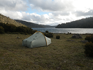
edit: The photo is of Lake Moogerah. Mt Greville is in the background.

Pteropus wrote:
I guess fitness is a subjective thing, where some people are happy with a gym and others will go and climb a mountain. However, depending on your base level of fitness, maintaining fitness is something that most people generally need to work on regularly (though, I did once know a bloke who never did any training of any sort, drank like a fish and smoked like a chimney, and still would be able to flog most people up a mountain!).
Sigh, people like that are really lucky. I've got friends who can eat what they want and never put on weight!
But for a real mountain, you might be in need of something more than incidental exercise. If you are in the Brisbane area, there are some very good circuits on Mt Coot-tha. Sure, it’s not a big mountain (many would say it’s but a hill!), but there are some VERY STEEP tracks that will really test your heart, lungs and legs! There are always people training there for much more rugged walks such as Kokoda.
Yup I'm in Brisbane. I should check out the tracks at Mt Cootha.. some of my friends have done them. They all look pretty short, but I guess the steepness makes up for it.
Further out, there is the whole track system around Lamington NP, with some long walks with steep sections. Main Range too, and Moogerah NP, as you have discovered, is not bad. Mt Warning is a good one, but as you probably found out, it doesn’t really get your heart going, and is easier than it looks. Though running up it might make it more of a challenge
When we were going up Mt Warning, there was a guy who ran past us on the way up. When we were 3/4 of the way up, he was running back down past us. Now that's mad!
There was also a guy doing it barefoot. Those rocks look like they'd hurt!
Since you say you are not experienced at bushwalking, it might be best to go through the Take a Walk book and find locations with well defined tracks. Mt Maroon, for example, is quite simple, and will give you a great workout. Greville might be just as simple, but I can’t comment on that since I have not been up it yet.
I've been flipping through the book, but as I'm just starting out, I find it hard to compare the difficulty of tracks. e.g. before I did Mt Edwards, I was trying to find out how difficult it was compared to Mt Warning. I was also deciding between Mt Greville and Mt Edwards. The book doesn't give a comparison between tracks (which admittedly would be difficult to put into a book as there are so many permutations), so I opted for the shorter Mt Edwards track.
The book says Mt Greville is 12km and should take about 4 hours. Meanwhile, Mt Edwards is 6.5km but should take about 3 hours. Does that mean the track on Mt Greville is less steep, but longer? Or are there other factors involved?
As far as walking solo, I would think it advisable to walk within your comfort zone until you have more experience. Once again, stay on well defined tracks, have a map, and be aware of your location. Being "aware" might be and ambiguous concept and might not come naturally, but basically to me, it’s about thinking about what direction you are going and have come from. Sometimes it is very easy to take a wrong turn on a well defined track, such as following an animal pad or where others have made wrong turns, and one might find themselves surrounded by thick bush and a little lost. In that situation, if you have been paying attention to your surroundings and spatial orientation, back tracking to the main track should be generally easy. However, this is tougher in dense vegetation, and that is why I say stick to locations that have well defined tracks. Off track in the rainforest Lamington, for example, is a tough place to remain spatially aware unless you had experience and knowledge of the region.
On the last 2 walks I realized I'm always looking down at the trail to make sure I'm stepping on the right bits so I don't twist an ankle or something. Do more experienced people just ... walk?
I make a conscious effort to make sure I'm aware of where I am. I also carry my Garmin GPS loaded with tracks from everytrail.com just in case, although realistically the trails I'm planning on doing are pretty well defined, I think the Take A Walk book is good enough. But I'm a gadget freak, so ...
And as you know, telling people where you are going is probably the most important thing for safety though. Even if you popped up to Mt Coot-tha, it is a good idea to tell someone. Oh, and take a pocketknife, in case you get a limb caught up and need to amputate it, à la Aaron Ralston
Brrr I remember reading about the book. Yeaaaah I think i'll leave that sorta hiking to all you hardcore people!
Yep, check yourself for ticks after your walks is always a good idea. Don’t try to pick up snakes
Stinging trees! OK I never knew about them. Are they common?
Are snakes common? I'm glad leeches only come out when it's wet! Ugh.
Good luck with the training! And the Mt Kinabalu!! I bet it will be amazing.
Thanks.. it's getting exciting now. The altitude sickness is what worries me the most though. I was on a 3,600m mountain last year (took a train up!) and found it more difficult to breathe. The incessant headache didn't help either. I'm definitely gonna look into some Diamox or something.
Wolfix wrote:I am an extremely cautious person. I would take a PLB anywhere I go alone in the bush. Even if your hike is on a cliff top track, if you fall, you won't have reception at the bottom. PLB should be on your person at all times or its pointless.
I'm a bit of a gadget nut.. if I had one, I'd most likely carry it on every walk, solo or not. It's probably a bit too expensive at this stage though, seeing that I don't know how often I'll be doing it!
cams wrote:Great post Pteropus. Greville is higher than Edwards but if you take the Palm Gorge route it probably isn't as steep or as rough as the worst part of the Mt Edwards track.
Ahh, the book says go up via Palm Gorge and down via the SE Ridge. Aussiebushwalking does it the other way. I think I'll stick with the former if that's easier!
Aussiebushwalking.com says the Mr Greville track is 6km, but Take A Walk says it's 12km, nearly twice the length of the Mt Edwards track. Which is correct?
As you found out descending can be a whole problem of its own. Not as tiring but can very quickly become the worst part through knee and other leg pain. Building leg muscles would help so you can step down with more support rather than just flopping down with each step if that makes sense. Carrying a pack makes this worse too. Experimenting with walking sticks can help.
Lucky for me, one can actually hire porters to carry backpacks up! I've read crazy things about them. They'd walk up barefoot carrying gas tanks, pipes, food, all with minimal effort. I guess going up and down every day gets you used to it.
I was wondering about walking sticks. Are they common? They seem like such a hassle to carry. One or two sticks?
I just looked up Mt. Kinabalu. Looks like great fun. What sort of package are you looking at doing? The Via Ferrata route looks like good fun.
I'm just gonna do the regular 2-night package. I was quite interested in the via ferrata but my friends weren't too keen... then I found a photo of people walking over cables with nothing below and remembered that I'm a lil 'fraid of heights when there's nothing below me! My legs would probably be a bit jelly-like at that stage too. I read that if there's space on the day I can go for it without booking, so I'll see how it goes!
It was a toss up between a strenuous prolonged climb or a relaxing soak in the hot springs hot tub with a couple of ice cold beers....
Kicking myself now.
I’ll be looking forward to a relaxing soak after the climb. Don’t worry, I’ll make sure I post a few photos so you can see what you missed out on.
deerndingo wrote:For walking fitness and leg strength look up Leg Lunges. Start out light and go from there.
Ahh yes, I’ve been told that’s the exercise to do. 2 months .. I’d better start drawing up a plan.
Oh after Mt Edwards I decided to stay around for sunset. It was pretty serene.
edit: The photo is of Lake Moogerah. Mt Greville is in the background.
Last edited by eug on Sat 20 Oct, 2012 1:23 am, edited 1 time in total.
- eug
- Nothofagus cunninghamii
- Posts: 9
- Joined: Tue 16 Oct, 2012 8:06 pm
- Region: Queensland
- Gender: Male
Re: Uh-oh. Need to train!
![]() by Strider » Wed 17 Oct, 2012 11:43 pm
by Strider » Wed 17 Oct, 2012 11:43 pm
eug wrote:On the last 2 walks I realized I'm always looking down at the trail to make sure I'm stepping on the right bits so I don't twist an ankle or something. Do more experienced people just ... walk?
I guess the best advise is to be confident in your foot placements. A weakly placed, unsure, step is when things tend to go from under you.
eug wrote:I was wondering about walking sticks. Are they common? They seem like such a hassle to carry. One or two sticks?
Trekking poles have completely changed the way I bushwalk, and most who have used them will say the same. Definitely two poles - why walk with two limbs when you can power yourself with four! Keep in mind their use is typically limited to open and clear, non-technical tracks. But they aren't any hassle to carry when not being used anyway. Mine fit very nicely in the ice axe attachments on my pack when not being used.
-
Strider - Lagarostrobos franklinii

- Posts: 5875
- Joined: Mon 07 Nov, 2011 6:55 pm
- Location: Point Cook
- Region: Victoria
- Gender: Male
Re: Uh-oh. Need to train!
![]() by Pteropus » Thu 18 Oct, 2012 10:29 am
by Pteropus » Thu 18 Oct, 2012 10:29 am
eug wrote:Yup I'm in Brisbane. I should check out the tracks at Mt Cootha.. some of my friends have done them. They all look pretty short, but I guess the steepness makes up for it.
Though the tracks on Mt Coot-tha are generally short, you would be surprised how extensive the tracks are up there. It is easy to make a 10ish km walk that would fill up a couple of hours. For example, if you park at the car park for JC Slaughter Falls picnic ground, there is a track called the 'Pinnacle Track' that goes from near the entrance to the car park, up to the middle ridge 'Powerful Owl Fire trail', then you keep walking till you get to the Channel 9 studio, then cross the road, head down the 'Jacksonia Track', 'Cockatoo Track,' then up the 'Bellbird Track' and 'Kokoda Track', back to Channel 9, down the 'Powerful Owl' and back down the 'Pinnacle Track' to your car. This would take ~2 - 2.5 hours and is ~8-10 km I would think. Check this map out -> http://www.brisbane.qld.gov.au/2010%20L ... ochure.pdf
I do these tracks every now and then, because I can't get away for a real bushwalk as much as I like, and I often run into people training for this trek or that. Sometimes people tell me they have been walking there for 5 hours! I personally would rather head off and do a walk in Lamington or Main Range instead of spending 5 hours on Coot-tha though! Each to their own...
eug wrote: I've been flipping through the book, but as I'm just starting out, I find it hard to compare the difficulty of tracks. e.g. before I did Mt Edwards, I was trying to find out how difficult it was compared to Mt Warning. I was also deciding between Mt Greville and Mt Edwards. The book doesn't give a comparison between tracks (which admittedly would be difficult to put into a book as there are so many permutations), so I opted for the shorter Mt Edwards track.
The book says Mt Greville is 12km and should take about 4 hours. Meanwhile, Mt Edwards is 6.5km but should take about 3 hours. Does that mean the track on Mt Greville is less steep, but longer? Or are there other factors involved?
I haven't got my copy of Take a Walk handy right now, but I think they give track gradings. I think there is an Australian standard for bush tracks. Maybe check out this -> http://www.npaq.org.au/index.php?option ... Itemid=161
I found this too, which suggests there is an Australian Standard -> http://www.dse.vic.gov.au/recreation-an ... Background
I am not sure if the Take a Walk uses this, but I think track notes by one person are comparable. However, comparing two different author's track notes might be more difficult. For example, if you have read track notes by Chapman, the times given are often a lot shorter than what most mere mortals can achieve. This is not the norm though, because the majority of the time you will find that times given for completing a walk are longer than what you will actually complete a walk in.
But comparing Mt Warning with other walks in the region would depend on the state of the tracks. As you would have seen, Mt warning has a highly maintained graded track, with stairs and few difficulties. Many smaller mountains might have something that is comparable to a goat track, so is technically more difficult. The difficulty and time factors will change due to the grade of the track.
eug wrote: On the last 2 walks I realized I'm always looking down at the trail to make sure I'm stepping on the right bits so I don't twist an ankle or something. Do more experienced people just ... walk?
I make a conscious effort to make sure I'm aware of where I am. I also carry my Garmin GPS loaded with tracks from everytrail.com just in case, although realistically the trails I'm planning on doing are pretty well defined, I think the Take A Walk book is good enough. But I'm a gadget freak, so ...
When I was a kid, my dad taught me to look down when bushwalking, to make sure I didn't tread on snakes! Walk the way you feel most comfortable. There is no right or wrong way to do it! Don't feel that you need to walk in any specific style.
As far as being aware, part of that is having a feel for the lay of the land. Are you going up, or down, or across a slope. Take note of features such as rocks or large distinctive trees. That helps.
eug wrote: Stinging trees! OK I never knew about them. Are they common?
Are snakes common? I'm glad leeches only come out when it's wet! Ugh.
Yes, stinging trees are common in the rainforest. They are a pioneer plant that takes advantage of disturbance such as a tree fall. Often they come up in thickets, to begin with. They are unmistakable though, just look for the giant leaves. People like to joke about the consequences of people accidently using stinging tree leaves as toilet paper...but you would not get that far because as soon as you touched the leaf with your hand you would know about it!
Snakes are common, but mostly get out of your way before you even see them. Most people who are bitten by a snake were handling it inappropriately...which, if you are not trained in snake wrangling, all handling of snakes is inappropriate! Even the experts get themselves bitten from time to time...anyhow, thats why I said not to attempt to pick up snakes
eug wrote: Aussiebushwalking.com says the Mr Greville track is 6km, but Take A Walk says it's 12km, nearly twice the length of the Mt Edwards track. Which is correct?
It sounds like Aussiebushwalking is just giving the distances for one way, and Take a Walk is giving the return journey length.
eug wrote:deerndingo wrote:For walking fitness and leg strength look up Leg Lunges. Start out light and go from there.
Ahh yes, I’ve been told that’s the exercise to do. 2 months .. I’d better start drawing up a plan.
Make sure you learn how to do them correctly. Lunges can really hurt and you can really hurt yourself if you do them incorrectly.
eug wrote:Oh after Mt Edwards I decided to stay around for sunset. It was pretty serene.
Lovely photo
Cheers
Andrew
- Pteropus
- Athrotaxis selaginoides
- Posts: 1045
- Joined: Sun 09 May, 2010 6:42 pm
- Location: Neither here nor there
- Region: Australia
- Gender: Male
Re: Uh-oh. Need to train!
![]() by eug » Sat 20 Oct, 2012 1:45 am
by eug » Sat 20 Oct, 2012 1:45 am
Strider wrote:Trekking poles have completely changed the way I bushwalk, and most who have used them will say the same. Definitely two poles - why walk with two limbs when you can power yourself with four! Keep in mind their use is typically limited to open and clear, non-technical tracks. But they aren't any hassle to carry when not being used anyway. Mine fit very nicely in the ice axe attachments on my pack when not being used.
Hmnm ok, I'll look into them more. I can see how they can be useful. Ice axe attachments? Er, I assume that only comes with 'real' backpacks!
Open and clear as in, non-hilly?
Pteropus wrote:Though the tracks on Mt Coot-tha are generally short, you would be surprised how extensive the tracks are up there. It is easy to make a 10ish km walk that would fill up a couple of hours. For example, if you park at the car park for JC Slaughter Falls picnic ground, there is a track called the 'Pinnacle Track' that goes from near the entrance to the car park,
Ahh, sounds good. I'll definitely check them out, thanks. I took a casual stroll at the falls at the peak of the drought season a few years back and couldn't find the falls! Someone mentioned they dried up then.
I do these tracks every now and then, because I can't get away for a real bushwalk as much as I like, and I often run into people training for this trek or that. Sometimes people tell me they have been walking there for 5 hours! I personally would rather head off and do a walk in Lamington or Main Range instead of spending 5 hours on Coot-tha though! Each to their own...
I seem to get more excited over a walk that's a bit farther away rather than one that is too close by. I think it's the thought that I'm getting away from the daily grind that makes a quiet trail somewhere far away more interesting. And oh, the scenery is definitely different too.
That said, if the aim is just to exercise, even the stairs at Kangaroo Pt will do, although 5 hours of that would be mind-numbing!
I am not sure if the Take a Walk uses this, but I think track notes by one person are comparable.
It provides the AS grading as well as their own system of grading, but the notes mainly describe how to get there and the hiking route to take, rather than how difficult it is.
e.g. it lists the following:
- Code: Select all
Mt Edwards
-   6.5km
-   3 hours
-   Moderate
-   AS Class 4

Mt Greville
-   12km
-   4 hours
-   Moderate
-   AS Class 5

Mt Maroon
-   6km
-   6-7 hours
-   Hard
-   AS Class 5

Mt Warning
-   8.8km
-   4.5 hours
-   Hard
-   AS Class not stated

AS Class 4 – Distinct, less frequented tracks with minimal interpretation, if any. May have rough surfaces with exposed roots, rocks, and steep grades. Walkers need to be self-reliant and have moderate navigational skills. Maps and compass may be necessary.

AS Class 5 - Tracks for self-reliant walkers with the expertise to explore natural environments. High level of navigational skills and fitness required. Maps and compass may be necessary.
As a newb, the first thing that comes to mind is “why is Greville double the distance but only 1 hour longer, yet it’s Class 5 and higher up – shouldn’t it take longer?” I’m guessing the Mt Greville trail is less steep than Mt Edwards, but it sounds more difficult than Mt Edwards based on other people’s posts. The Mt Maroon track is shorter than Mt Warning, but takes 50% longer – does that mean it’s *really* steep?
What I don’t want to do is drive 1.5 hours there, climb halfway and realize I’m not ready for it, then drive 1.5 hours back without accomplishing anything.
OK OK I can now hear everyone going “bla bla yada yada just shut your trap, quit overthinking it and just go!”… I realize that might be the only way to answer my questions as experience trumps reading. True, but I always like to gather as much knowledge as possible before going. Hopefully I’m not grating anyone’s nerves with these incessant questions!
But comparing Mt Warning with other walks in the region would depend on the state of the tracks. As you would have seen, Mt warning has a highly maintained graded track, with stairs and few difficulties. Many smaller mountains might have something that is comparable to a goat track, so is technically more difficult. The difficulty and time factors will change due to the grade of the track.
Ahh yes, I suppose that’s why the AS grading system was created. Now, if only there was an AS for “Effort Needed”!
When I was a kid, my dad taught me to look down when bushwalking, to make sure I didn't tread on snakes! Walk the way you feel most comfortable.
I’m most comfortable not stepping on snakes, so I’ll probably be looking down for a while.
Yes, stinging trees are common in the rainforest. They are a pioneer plant that takes advantage of disturbance such as a tree fall. Often they come up in thickets, to begin with. They are unmistakable though, just look for the giant leaves.
OK, I’d better look for some images first. I’m glad I didn’t just go around touching leaves before!
Snakes are common, but mostly get out of your way before you even see them.
Ahh.. on Mt Edwards I did hear the occasional rustle in the bushes, but never saw anything. I wonder if they were snakes.
One thing I find annoying is that if I’m the first person on the trail that day, I keep walking into spider webs running across the trail. Are spiders in the forests here anything to worry about? I only know red = stay awaaaay.
It sounds like Aussiebushwalking is just giving the distances for one way, and Take a Walk is giving the return journey length.
Aussiebushwalking gives the distance for Mt Edwards both ways (6.5km, 4hrs). Looks like the info is user-submitted so is a bit inconsistent. Hopefully no one went to Mt Greville expecting a 3 hour, 6km hike!
- eug
- Nothofagus cunninghamii
- Posts: 9
- Joined: Tue 16 Oct, 2012 8:06 pm
- Region: Queensland
- Gender: Male
Re: Uh-oh. Need to train!
![]() by ofuros » Sat 20 Oct, 2012 6:38 am
by ofuros » Sat 20 Oct, 2012 6:38 am
If you feel like stretching your legs, Springbrook N.P. offers the Warrie circuit.
A 17km rainforest walk, snaking its way down to the 'meeting of the waters', then a steep zig zagging climb back out on
the opposite bank, passing lots of waterfalls along the way.
Not sure if the all the falls will be running though, since we've had this dry spell....
Its in the Take a walk P168-167.
Mountain views are good for my soul...& getting to them is good for my waistline !
https://ofuros.exposure.co/
https://ofuros.exposure.co/
-
ofuros - Athrotaxis selaginoides
- Posts: 1962
- Joined: Fri 05 Feb, 2010 4:42 pm
- Region: Queensland
- Gender: Male
Re: Uh-oh. Need to train!
![]() by Strider » Sat 20 Oct, 2012 8:27 am
by Strider » Sat 20 Oct, 2012 8:27 am
eug wrote:Strider wrote:Trekking poles have completely changed the way I bushwalk, and most who have used them will say the same. Definitely two poles - why walk with two limbs when you can power yourself with four! Keep in mind their use is typically limited to open and clear, non-technical tracks. But they aren't any hassle to carry when not being used anyway. Mine fit very nicely in the ice axe attachments on my pack when not being used.
Hmnm ok, I'll look into them more. I can see how they can be useful. Ice axe attachments? Er, I assume that only comes with 'real' backpacks!
Open and clear as in, non-hilly?
Open and clear as in non-scrubby/non-rocky. You need a bit of room either side of you to swing them.
Most packs have ice axe loops these days - they are the loops hanging off the front/bottom edge.
-
Strider - Lagarostrobos franklinii
- Posts: 5875
- Joined: Mon 07 Nov, 2011 6:55 pm
- Location: Point Cook
- Region: Victoria
- Gender: Male
Re: Uh-oh. Need to train!
![]() by eug » Wed 24 Oct, 2012 12:20 am
by eug » Wed 24 Oct, 2012 12:20 am
Strider wrote:Open and clear as in non-scrubby/non-rocky. You need a bit of room either side of you to swing them.
Ahh ok, thanks. I'd better read up a bit more about them first.
ofuros wrote:If you feel like stretching your legs, Springbrook N.P. offers the Warrie circuit.
A 17km rainforest walk, snaking its way down to the 'meeting of the waters', then a steep zig zagging climb back out on
the opposite bank, passing lots of waterfalls along the way.
Not sure if the all the falls will be running though, since we've had this dry spell....
Its in the Take a walk P168-167.
I had a read and ... that's a walk alright! It does sound good though, I'll note it down, thanks.
Speaking of dry waterfalls, on Monday I tried to do the Pinnacle-Owl-Jacksonia-Cockatoo-Bellbird-Kokoda route that Pteropus suggested. It was a pretty warm day so I decided to not go out to Mt Greville.
I couldn't find the Pinnacle Track anywhere! There are no signs, and the map shows a track but I couldn't see it when I was there. There's not much talk about it on the net either - just someone else mentioning it's a bit obscured but visible. Where exactly is this track?
I ended up checking out Simpson Falls a bit farther up. It was completely dry:

- eug
- Nothofagus cunninghamii
- Posts: 9
- Joined: Tue 16 Oct, 2012 8:06 pm
- Region: Queensland
- Gender: Male
Re: Uh-oh. Need to train!
![]() by Pteropus » Wed 24 Oct, 2012 10:02 am
by Pteropus » Wed 24 Oct, 2012 10:02 am
eug wrote: I couldn't find the Pinnacle Track anywhere! There are no signs, and the map shows a track but I couldn't see it when I was there. There's not much talk about it on the net either - just someone else mentioning it's a bit obscured but visible. Where exactly is this track?
Hi eug
I didn't know it was called the pinnacle track until I look at the link with the Mt Coot-tha map. It is located to the left of the toilet block that you see when you first enter the JC Slaughter Falls car park, just after the first crossing of Ithica Creek. There is a fig tree near the start of the track. Its not really marked. I have attached a Google Earth image with some tracks on it, if that helps.
If you can't find it from the bottom, the other end of the track is on a small knoll approximately halfway along the Powerful Owl Fire Trail. There is an obvious track with a track marker with a picture of a walker. On my image is another track that goes down to Ithica Creek. This track starts on another rise, opposite the track to Simpson Falls. When you get to the creek, just rock hop down. But there is a very slippery chute that could be difficult to get down, and cause a broken leg. To get around this, just head up the left bank for a bit, then when you come to small drainage line, head back down to the creek, where there is a huge hoop pine. Apparently there are powerful owls around here, but I have only seen barking owls.
- Pteropus
- Athrotaxis selaginoides
- Posts: 1045
- Joined: Sun 09 May, 2010 6:42 pm
- Location: Neither here nor there
- Region: Australia
- Gender: Male
Re: Uh-oh. Need to train!
![]() by eug » Wed 24 Oct, 2012 12:33 pm
by eug » Wed 24 Oct, 2012 12:33 pm
Pteropus wrote:Hi eug
I didn't know it was called the pinnacle track until I look at the link with the Mt Coot-tha map. It is located to the left of the toilet block that you see when you first enter the JC Slaughter Falls car park, just after the first crossing of Ithica Creek. There is a fig tree near the start of the track. Its not really marked. I have attached a Google Earth image with some tracks on it, if that helps.
Thanks.. is this where it is?
http://goo.gl/maps/MbPgI
If you can't find it from the bottom, the other end of the track is on a small knoll approximately halfway along the Powerful Owl Fire Trail. There is an obvious track with a track marker with a picture of a walker. On my image is another track that goes down to Ithica Creek. This track starts on another rise, opposite the track to Simpson Falls. When you get to the creek, just rock hop down. But there is a very slippery chute that could be difficult to get down, and cause a broken leg. To get around this, just head up the left bank for a bit, then when you come to small drainage line, head back down to the creek, where there is a huge hoop pine. Apparently there are powerful owls around here, but I have only seen barking owls.
Awesome, thanks! I'll be heading back out there this weekend with a friend. Hopefully the weather forecast changes from showers to something nice.
- eug
- Nothofagus cunninghamii
- Posts: 9
- Joined: Tue 16 Oct, 2012 8:06 pm
- Region: Queensland
- Gender: Male
Re: Uh-oh. Need to train!
![]() by Pteropus » Wed 24 Oct, 2012 1:47 pm
by Pteropus » Wed 24 Oct, 2012 1:47 pm
eug wrote:Thanks.. is this where it is?
http://goo.gl/maps/MbPgI
yes
- Pteropus
- Athrotaxis selaginoides
- Posts: 1045
- Joined: Sun 09 May, 2010 6:42 pm
- Location: Neither here nor there
- Region: Australia
- Gender: Male
Re: Uh-oh. Need to train!
![]() by eug » Sun 28 Oct, 2012 11:45 pm
by eug » Sun 28 Oct, 2012 11:45 pm
Found it! I went there with a friend on Saturday morning. Now I see what the Take A Walk book means when they say the Kokoda Trail will get your heart pumping. That is one steep trail! I wore my regular pair of runners and I kept slipping. Surprisingly there weren't that many people around for a Saturday - I only bumped into maybe 6 people on all the trails.
There really is a whole bunch of trails everywhere. Has anyone checked out the Gold Creek Trail and Tunnel Trail? They sound interesting... I assume there would be disused gold mines and a tunnel somewhere there.
This was the Mt Cootha trail I took. It's 11.2km with a slight detour near Ch 9. It took about 3 hours with some stuffing around.
http://www.everytrail.com/view_trip.php?trip_id=1847862
Steep is definitely the right word!

For anyone else who's looking for the Pinnacle Trail, there are no signs at the top or bottom. If you look closely at the slope to the left of the first toilet block, you'll see it. It doesn't look very obvious in photos, but this is what the start looks like anyway:

There really is a whole bunch of trails everywhere. Has anyone checked out the Gold Creek Trail and Tunnel Trail? They sound interesting... I assume there would be disused gold mines and a tunnel somewhere there.
This was the Mt Cootha trail I took. It's 11.2km with a slight detour near Ch 9. It took about 3 hours with some stuffing around.
http://www.everytrail.com/view_trip.php?trip_id=1847862
Steep is definitely the right word!
For anyone else who's looking for the Pinnacle Trail, there are no signs at the top or bottom. If you look closely at the slope to the left of the first toilet block, you'll see it. It doesn't look very obvious in photos, but this is what the start looks like anyway:
- eug
- Nothofagus cunninghamii
- Posts: 9
- Joined: Tue 16 Oct, 2012 8:06 pm
- Region: Queensland
- Gender: Male
Re: Uh-oh. Need to train!
![]() by wayno » Mon 29 Oct, 2012 5:46 am
by wayno » Mon 29 Oct, 2012 5:46 am
Strider wrote:eug wrote:Strider wrote:Trekking poles have completely changed the way I bushwalk, and most who have used them will say the same. Definitely two poles - why walk with two limbs when you can power yourself with four! Keep in mind their use is typically limited to open and clear, non-technical tracks. But they aren't any hassle to carry when not being used anyway. Mine fit very nicely in the ice axe attachments on my pack when not being used.
Hmnm ok, I'll look into them more. I can see how they can be useful. Ice axe attachments? Er, I assume that only comes with 'real' backpacks!
Open and clear as in, non-hilly?
Open and clear as in non-scrubby/non-rocky. You need a bit of room either side of you to swing them.
Most packs have ice axe loops these days - they are the loops hanging off the front/bottom edge.
on a rough track try one pole. still comes in handy. a lot easier to negotiate with one pole compared to two and can still be better than no pole
from the land of the long white clouds...
-
wayno - Lagarostrobos franklinii
- Posts: 8685
- Joined: Sun 19 Jun, 2011 7:26 am
- Location: NZ
- Region: New Zealand
- Gender: Male
Re: Uh-oh. Need to train!
![]() by Pteropus » Mon 29 Oct, 2012 9:23 am
by Pteropus » Mon 29 Oct, 2012 9:23 am
eug wrote: That is one steep trail! I wore my regular pair of runners and I kept slipping.
Walking down this track is more perilous than walking up it! You kind of need to aim for a tree on the sides of the track and use that to arrest your momentum
eug wrote: There really is a whole bunch of trails everywhere. Has anyone checked out the Gold Creek Trail and Tunnel Trail? They sound interesting... I assume there would be disused gold mines and a tunnel somewhere there.
Yes, the Mt Coot-tha section links up to the rest of Brisbane Forest Park. You could walk from Mt Glorious to Coot-tha if you were so inclined. There are several old mine shafts in the area. They are mostly fenced off. Some are on private property. The tunnel is part of the old pipeline from Gold Creek Dam. It is interesting for historical sake, but it is not like a big abandoned railway tunnel or anything spectacular. There is a track around Gold Creek Dam by the way, that is worth the walk. Its not hilly at all but it makes for a nice stroll.
- Pteropus
- Athrotaxis selaginoides
- Posts: 1045
- Joined: Sun 09 May, 2010 6:42 pm
- Location: Neither here nor there
- Region: Australia
- Gender: Male
Re: Uh-oh. Need to train!
![]() by shardie » Mon 29 Oct, 2012 8:30 pm
by shardie » Mon 29 Oct, 2012 8:30 pm
I suggest getting into 'groups'(eg meetup group called Bush Club) into walking & see what is organised for weekends.
btw...I'm heading to Kinabula during Easter next year,...so I'm interested to hear how it all goes
Shawn
btw...I'm heading to Kinabula during Easter next year,...so I'm interested to hear how it all goes
Shawn
- shardie
- Nothofagus gunnii
- Posts: 35
- Joined: Mon 13 Jun, 2011 8:48 am
- Location: Mansfield, Brisbane
- Region: Queensland
- Gender: Male
Re: Uh-oh. Need to train!
![]() by Strider » Mon 29 Oct, 2012 8:40 pm
by Strider » Mon 29 Oct, 2012 8:40 pm
A friend of mine in KK took this photo of Mt Kinabalu from her office window just now (posted on Facebook).
- Attachments
-
-
Strider - Lagarostrobos franklinii
- Posts: 5875
- Joined: Mon 07 Nov, 2011 6:55 pm
- Location: Point Cook
- Region: Victoria
- Gender: Male
Re: Uh-oh. Need to train!
![]() by eug » Wed 31 Oct, 2012 12:02 am
by eug » Wed 31 Oct, 2012 12:02 am
wayno wrote:on a rough track try one pole. still comes in handy. a lot easier to negotiate with one pole compared to two and can still be better than no pole
Yeah I'll probably get one, or at least rent one at Kinabalu. A lot of people seem to recommend poles for the climb and descent. Maybe I should try one out here first, to get the hang of it.
Pteropus wrote:Walking down this track is more perilous than walking up it! You kind of need to aim for a tree on the sides of the track and use that to arrest your momentum
I can imagine! If I was slipping while going up, I can't imagine going down!
I'm going back there this weekend with another friend.. maybe we'll go down instead. I'm definitely gonna use a different pair of shoes this time.. something with more grip!
Yes, the Mt Coot-tha section links up to the rest of Brisbane Forest Park. You could walk from Mt Glorious to Coot-tha if you were so inclined. There are several old mine shafts in the area. They are mostly fenced off. Some are on private property. The tunnel is part of the old pipeline from Gold Creek Dam. It is interesting for historical sake, but it is not like a big abandoned railway tunnel or anything spectacular. There is a track around Gold Creek Dam by the way, that is worth the walk. Its not hilly at all but it makes for a nice stroll.
Ahh, that's a pity. I was hoping for 'bonuses' like an interesting-looking tunnel or mine shaft. Are there any other tracks with extra things, like the dam at Mt Edwards?
shardie wrote:I suggest getting into 'groups'(eg meetup group called Bush Club) into walking & see what is organised for weekends.
It did cross my mind, but my schedule means my free time is usually on Mondays, when nobody else climbs.
btw...I'm heading to Kinabula during Easter next year,...so I'm interested to hear how it all goes
Awesome! Are you doing the via ferrata?
Strider wrote:A friend of mine in KK took this photo of Mt Kinabalu from her office window just now (posted on Facebook).
That photo reminds me of when I took a photo of Mr Greville from the lake. It looks a lot more substantial in reality!
- eug
- Nothofagus cunninghamii
- Posts: 9
- Joined: Tue 16 Oct, 2012 8:06 pm
- Region: Queensland
- Gender: Male
Re: Uh-oh. Need to train!
![]() by under10kg » Tue 06 Nov, 2012 12:59 pm
by under10kg » Tue 06 Nov, 2012 12:59 pm
Mt Warning is a good one, but as you probably found out, it doesn’t really get your heart going,
I do do Mt Warning when training for a big walk. If you go up with a fast walk under 70 minutes your heart will be going guaranteed!
Walking fast up 5 ot more flights to stairs and returning is good for those in the city. I wished I had done this before going to Nepal as there are thousands of stone steps there. As mentioned above poles are great. Pacer poles are great in accending and decending steep slopes fast. I can go 20% faster than most with normal poles with no knee soreness. I found this out in Nepal decending over 1600 m.
I always train for long walks and it makes the first few days so much more enjoyable than those that do not.
- under10kg
- Athrotaxis cupressoides
- Posts: 306
- Joined: Mon 15 Oct, 2007 6:33 am
- Location: Australia
- Region: New South Wales
- Gender: Male
Re: Uh-oh. Need to train!
![]() by Pteropus » Sun 14 Apr, 2013 1:41 pm
by Pteropus » Sun 14 Apr, 2013 1:41 pm
Pteropus wrote:cams wrote:Great post Pteropus. Greville ...(I can't believe you haven't been up it Andrew!!)...
I know, neither can I. I will need to rectify this. I keep hearing it is quite a pretty walk up the gorge.
I finally climbed Mt Greville on Saturday, via the Palm Gorge and then down the SE Ridge. What an amazing little mountain! I really really liked this walk!
- Pteropus
- Athrotaxis selaginoides
- Posts: 1045
- Joined: Sun 09 May, 2010 6:42 pm
- Location: Neither here nor there
- Region: Australia
- Gender: Male
Re: Uh-oh. Need to train!
![]() by hunsta » Sun 14 Apr, 2013 4:36 pm
by hunsta » Sun 14 Apr, 2013 4:36 pm
Wolfix wrote: Even if your hike is on a cliff top track, if you fall, you won't have reception at the bottom.
Kinda a mute point if its a really big cliff.
I REALLY AM A NICE GUY. JUST ASK ANYONE WHO HASN'T MET ME.
http://www.facebook.com/groups/gympieregionalhiking/
http://www.facebook.com/groups/gympieregionalhiking/
-
hunsta - Athrotaxis cupressoides
- Posts: 121
- Joined: Fri 01 Mar, 2013 4:10 pm
- Location: Gympie Queensland
- Region: Queensland
- Gender: Male
26 posts
• Page 1 of 1
Who is online
Users browsing this forum: No registered users and 29 guests