Sunset Remote Walk - Murray Sunset NP - The VIC Outback!

Trip reports, stories, track notes. Multiple/large photos are OK in this forum.
Forum rules
Posting large/multiple images in this forum is OK. Please start topic titles with the name of the location or track.

For topics focussed on photos rather than the trip, please consider posting in the 'Gallery' forum instead.

This forum is for posting information about trips you have done, not for requesting information about a track or area.

Sunset Remote Walk - Murray Sunset NP - The VIC Outback!

Postby BakerSailor » Wed 14 Jul, 2021 9:04 pm

Sunset Remote Walk - Murray Sunset NP
Sunday 11th July to Tuesday 13th July

This hike takes place on the country of the Millewa-Mallee, The Latji Latji and Ngintait People.

All pictures are reduced for the forum - full gallery with full-sized photos here: https://photos.app.goo.gl/vN8L9a9zK1dypL1u8

Relive Video: https://www.relive.cc/view/vevWpMEJzGO

Hike Info:
Grade 4
3 Days, 2 Nights
60km, 630m elevation
Contact Ranger in Underbool before departure to confirm water tanks full.
The hike should only be attempted in autumn, winter or early spring - dangerous in summer.

General Track Notes:
The track is really well marked and very clearly defined. It looks like it is patrolled regularly with a quad bike, which gives you an idea of how wide it is throughout. Some sections seem to be cut up by dirt bike tracks, but this was rare.
Most hills were sandy, so it was pretty hard work—the track changes between loose sand, hard-packed sand, and dry earth.
You'll get very familiar with the quad bike tracks, as well as the dinosaur-sized roo prints you'll see along the trail.
All three water tanks were right on the track, so impossible to miss, and all were well maintained. Tanks are kept full by the Rangers, so make sure they know you're coming!
Overall an exceptionally well-maintained walk.

My Gear:
Osprey Pack - Aether Pro 70
Lanshan 2 Pro Tent
Exped UL Down LW Sleeping Mat
Blackwolf Hiker 500 Sleeping Bag
Trangia 27-2
Ketadyn BeFree Water Filter modified for Gravity Filtrations (hope to post on the mod in the Gear forum soon!)
Phone and Suunto Baro9 watch for navigation and tracking, with the Spatial Vision Victorian Deserts map & compass as backup.

Getting There & Back
Coming from Melbourne, it's a 5.5hr drive to the trailhead. To do this comfortably, you'll want to stay somewhere the night before your hike. You can camp at the trailhead (Lake Becking), and there is a larger campground at Lake Crosbie. Lake Becking has a water tank, drop toilet and some fire pits. Lake Crosbie has drop toilets but no water.
You can also camp at well-serviced roadside rest areas in Underbool and Walpeup. The nearest town with accommodation is Ouyen, about an hour from the trailhead.
We stayed at Sea Lake, as one of our party was visiting there to do photography while we hiked. It is a bit far from the trailhead, but the services there are excellent, and the food at the pub is worth a stop on its own! Even if you don't stop in Sea Lake, have a rest stop at Lake Tyrrell, about 10km past Sea Lake. It's a stunning spot with excellent facilities.
If you're going to get to the trailhead with a couple of hours of light left, you can hike to the first water tank and camp there, making it a 3-night hike.
On the way back, if you started on day three early, it's feasible to walk out and drive home on the same day.

Our Hike - Weather
We were fortunate. The first morning was bitterly cold, but we had hot sunny days (my watch recorded a max temp of 29C), and nights went down to low single digits. We met two hikers coming out as we hiked in, they had freezing temperatures both nights, and the day after we finished, it rained cats and dogs (which would have been stunning).

Day 1 - Lake Becking to Mt Crozier
18.9km, 4h50min, 300m ascent
a923166a.jpg

Lake Becking trailhead is just past the main Lake Crosbie. It has a water tank and a drop toilet at the camping/parking area. Walk up a ridge, and you'll see Lake Becking - a stunning salt lake - the hike starts here. The trail heads clockwise around the lake for a few hundred metres, and the path continues west for another few hundred metres to an old fence line. You won't see another lake until you finish the hike!
The old fence line will be your guide for the first half of the day, you'll follow the fence for at least 8km, and after that, you'll continue almost dead north to Mt Crozier. After about 4km, you'll come across the first of three water tanks at Salt Bush Flat. It's a nice spot to rest for a moment, but we still had plenty of water, so we didn't linger long. The Salt Bush Flat to the left of the tank is a nice preview of the bush to come on days 2 and 3.
You'll keep following the old fence posts for another 4 kilometres in reasonably dense, sandy bush with 3-4m high gums and scrub.
We caught a fleeting glance of a Malleefowl on this section, on the track ahead of us. It was on the trail, then gone in an instant and wholly camouflaged in the bush.
We also came across two hikers on their way out after completing the hike, the only other hikers we'd see, and we were the only other hikers they'd seen too.
Towards the end of the fence line, you'll come to a T intersection where the walk continues ahead or branches off to the East. We continued ahead to Mt Crozier and would return to this spot two days later, coming from the East.
After the fence line, the track winds around a bit through some open plains before settling back into an undulating sandy track in varying degrees of bushland heading north to Mt Crozier. This section puts the legs to work; with sandy dune-like paths uphill, you'll undoubtedly be working hard!
We found a pleasant hill to enjoy our lunch, with our first introduction on how to stay upright in our Helinox Chairs on the soft, sandy soils!
PXL_20210711_015639440.jpeg
PXL_20210711_015639440.jpeg (132.78 KiB) Viewed 17793 times

After lunch, the rhythm of the undulating track hides the general incline, and before long, you've summited Mt Crozier almost without realising it!
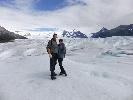
As you make your way around the ridge, you'll be well rewarded for what has been a pretty big first day on the trail. At 177m, Mt Crozier would barely rate as a hill anywhere else, but in the Murray Sunset NP, it's big enough to see for days, and the view is stunning!
While taking in the view, we were surprised by a couple who had come up by 4wd. They told us about the camp below and enquired about our walk. These were the last people we'd see on the whole hike.
From the top of Mt Crozier, you'll head down some steep steps and come to a fork in the track. Left will take you to the second water tank and the hikers camp, right will take you to the 4wd accessible campsite, which has an excellent drop toilet, some fire pits, and some picnic tables (but no water). The two camps are only a few hundred metres apart, and you could camp at either.
We ended up camping at the hikers camp, with the water close by and walking to use the drop toilet. Both camps were empty, so we had our run of the place! The hikers camp had a couple of nice makeshift campfire spots, so we set up, had a nap, then lit the fire and settled in for a lovely night.
PXL_20210711_052115185.jpeg
PXL_20210711_052115185.jpeg (150.02 KiB) Viewed 17793 times
PXL_20210711_053517178.jpeg
PXL_20210711_053517178.jpeg (140.55 KiB) Viewed 17793 times


Day 2 - Mt Crozier to Mt Jess Track (we continued on 3km past the track)
21.85km, 5h30min, 177m ascent
413aeedb.jpg

Starting the morning in the shadow of Mt Crozier, you'll head out of camp and head East on the track through the quite varied bush with the odd pine tree making an appearance through the Mallee scrub. Before long, you'll reach far more exposed savannah-like bush, which will dominate the days hike.
The sparse bushland is genuinely stunning and had us amazed for the rest of the day. But even in the middle of winter, we felt the hot, dry sun.
Somewhat counterintuitively, the more sparse and dry the bush, the more birdlife we came across with parrots, galahs, and many smaller birds flying around us as we walked.
As the path continues west through saltbush flats and dried water holes, after about 10km, you'll eventually come to the Mopoke Hut Track. We stopped near here on a nice log for lunch, taking in the surrounding silence. We saw and heard no other signs of humans that day, none at all.
PXL_20210712_010904710.PANO.jpeg
PXL_20210712_010904710.PANO.jpeg (3.13 MiB) Viewed 17793 times

After Mopoke Hut Track, the path begins to bend southwards as you head around the bend in the "P" that makes up the shape of the walk. Another few kilometres through the bush, you'll come across an abandoned camp with what looks like 40-50-year-old cans and oil drums scattered around. It's quite an eerie sight.
You'll come to Honeymoon Hut Track, a 4wd track that heads to the Honeymoon Hut. The original homestead for the Sunset Pastoral Co now provides hostel-style accommodation through Parks Vic. Something I'll be keen to check out one day.
After Honeymoon Hut Track, you'll keep going through the sparse Mallee desert. It's incredible how these landscapes continue to change, and about now, you should be getting into the rhythm of noticing the subtle changes in the landscape and getting to know all the different types of sand, bush, trees, and birds.
After another few kilometres, about 19 in total since you started today, you'll reach the water tank and official camp for night 2. As with the other water tanks, this tank is in excellent condition and well maintained. There is a small camp area just beyond the tank with a campfire spot. Mt Jess Track is a few hundred metres further on.
As with day one, it was only mid-afternoon when we arrived at the tank/camp, so we decided to resupply water and keep on for a few kilometres to make day three a bit shorter. So with all our bottles and bladders full, we continued, finding a place to rough camp along the track in some low lying bush.
Rain was threatening on night two, so after dinner and a nightcap, we retired early, but the rain never came, and the cloud cover kept us pretty warm all night, although strangely, it seemed to me that by morning it was warmer outside than in my tent!
PXL_20210712_213618198.jpeg
PXL_20210712_213618198.jpeg (131.95 KiB) Viewed 17793 times


Day 3 - Mt Jess Track to Lake Becking
20km, 5h, 156m ascent
6ec41201.jpg

Starting day three, you'll be heading west along the bottom of the "P" curve to the intersection with the fence line.
We were meeting our ride at 4 pm at Lake Becking. Then on to a booking at the Royal Hotel in Sea Lake for Parma night. We had plenty of time to get there, but the promise of a Parma put an extra hop in our step, and we were making great time.
The track west is another completely remarkable display of different kinds of bush, starting with undulating dunes, quite exposed, but each hill gives a great view around.
After some more exposed plains, we moved into a forest that looked like it had recently burnt, but only partially. Something burned the dead trees at the base, but all the leaves were intact, with new sprouts coming out the bottom. Again, somewhat counterintuitively, the birdlife here was very active!
The bush continues to change like this, with little sections of mixed plants and burnt areas as the track comes to Mt Crozier Track. This 4wd track heads up to the Mt Crozier campground from night one.
After the track, you'll be in a fascinating, varied section of bushland for a short time before you move into an extensive area of native pine forest. This transition is probably the starkest change to the landscape you'll find and is unlike anything you've seen thus far. A keen eye on the top of Mt Crozier would have spotted this stand of pines, an entirely different shade of green to the surrounding eucalypts. The floor was also completely different in the forest, much less scrub, much more open space and shade.
PXL_20210712_235910088.jpeg
PXL_20210712_235910088.jpeg (136.68 KiB) Viewed 17793 times

We found a pleasant spot for lunch, lingering to enjoy a hot chocolate after lunch, to finish off our rations and because we were making a great time.
After a short while, you'll reach the fence line and the crossroads where the track heads south, back to Lake Becking.
As you head south, towards the water tank from day one, it feels like the tank is just over each rise, then the next, but it comes into view after a few kilometres.
We paused here for a short break and to top up our water ( as I'd forgotten there was a water tank at Lake Becking ). We hatched a plan to take a different route back to Lake Becking for something different.
The standard track continues south and turns west to join Lake Becking at the lake's southwest corner, finishing the walk as it started.
At the water tank, we instead went East to join a 4wd track that skirts the edge of the Salt Bush Flat. Then we headed south to meet the top point of Lake Becking. This diversion required a short distance of off-track walking, which was reasonably easy in the sparse bush.
Meeting Lake Becking at the top corner provided a whole other perspective on the lake. The thick salt made an exciting walking surface, although I found out the hard way when you hit a thin section, the mud underneath is like black tar, and did my boots no favours!
Skirting the edge of the lake, we were back at the trailhead by 3 pm, feeling satisfaction from our accomplishment and processing the incredible adventure we'd just had.
Now it was time for a shower and a Parma!
PXL_20210713_042034411.jpeg
PXL_20210713_042034411.jpeg (126.41 KiB) Viewed 17793 times
PXL_20210713_042034411.jpeg
PXL_20210713_042034411.jpeg (126.41 KiB) Viewed 17793 times
Last edited by BakerSailor on Thu 15 Jul, 2021 7:01 pm, edited 2 times in total.
BakerSailor
Nothofagus gunnii
Nothofagus gunnii
 
Posts: 10
Joined: Fri 04 Jun, 2021 2:07 pm
Region: Victoria
Gender: Male

Re: Sunset Remote Walk - Murray Sunset NP - The VIC Outback!

Postby Eremophila » Wed 14 Jul, 2021 10:12 pm

Great report, thanks BS.
As an aside - I believe the pub at Sea Lake was bought by the community. It has been very nicely restored.
User avatar
Eremophila
Phyllocladus aspleniifolius
 
Posts: 936
Joined: Mon 24 Oct, 2011 5:15 pm
Location: SW Vic
Region: Victoria
Gender: Female

Re: Sunset Remote Walk - Murray Sunset NP - The VIC Outback!

Postby stry » Thu 15 Jul, 2021 9:17 am

Thanks for the detailed report.

I've been in the general area a couple of times with "the big green machine" (in summer :( ) and a couple of times privately, but never overnight walking.

An interesting and different part of the state.
stry
Athrotaxis selaginoides
 
Posts: 1422
Joined: Mon 10 Jun, 2013 6:28 pm
Region: Victoria
Gender: Male

Re: Sunset Remote Walk - Murray Sunset NP - The VIC Outback!

Postby Baeng72 » Thu 15 Jul, 2021 10:06 am

Nice report BakerSailor.
Looks great.
29c in winter, I'd be cooked. :)
Baeng72
Athrotaxis selaginoides
 
Posts: 1213
Joined: Wed 07 Aug, 2019 2:29 pm
Region: Victoria
Gender: Male

Re: Sunset Remote Walk - Murray Sunset NP - The VIC Outback!

Postby Joris » Mon 05 Aug, 2024 5:46 pm

Solo walked the Murray Sunset Remote Trail between 31 July and 2 August last week in perfect walking conditions with clear, cool weather and frosty mornings. The trail, and the wider Murray-Sunset National Park, is part of an Aboriginal cultural landscape that includes traditional Country of the Latji Latji, Ngintait and Nyeri Nyeri Peoples. Checked in with the PV Underbool office ahead of time to inquire after the state of the track and the water tanks along it in particular.

Camped the first night at Lake Becking, sharing the place with two old-timers who were on their way home after a month spent in the outback. Surrounded by Bluebonnets, Mallee Ringnecks and an unending circus of raucous Galahs, classic campfire yarns ensued under a stunning Milky Way, further aided by the gracefully offered (and gratefully received by me) red wine and rum. Several meteors from the active showers currently passing through added to the festive mood.

Owlet-Nightjar calling at night and heard Emu from the tent before sunrise. Frosty start to the day, gorgeous morning light, took my time packing up and after a fond farewell started off on the trail by mid-morning. Not been out with a pack for a few months and although of a fit disposition there is always this brief moment when, an hour into a hike, when one’s body sort of goes, “really, we are doing this, …again?”. Once away from the lake the birdlife in particular was bustling and I had close up encounters with Southern Scrub-robin, Chestnut Quail-thrush and Chestnut-rumped Thornbill. Noticed prints of Dingo, Emu and Malleefowl and scared the bejeezus out of a lone, feral Goat.

After an hour the trail passes the Salt Bush Flat water tank, a nice spot for a future camp, overlooking the open, tree-adorned flats. Somewhat unfortunately the trail was joined here by recent evidence of a gang of no less than 3 trail bikes. These made the next 10km to Mount Crozier somewhat of a slog on occasion as the churned up trail crosses numerous sand dunes. The last push up Mount Crozier was steep enough, but not so steep as to having defeated the bikes – the tracks went all the way up, where the steep steps down to the campsite apparently did manage to give the hoons pause. Not to worry, of course, as it is always possible to head along the dune crest a bit further, find a more compliant slope and just smash through the native vegetation instead.

Imagine having a huge national park with hundreds of kilometres of accessible 4WD trails and associated facilities, and yet being so absolutely self-centred that you feel the need to have a go at the sole bushwalking trail in the area and leaving it behind trashed. In absolutely no news to anyone here: people suck.

The views from Mount Crozier on the other hand do not suck at all and with Mallee woodland stretching to the horizon provide a real sense of quite how remote, for Victorian standards, this part of the state is. Got to the Mount Crozier walker’s water tank by late arvo and could have bush camped there, but with the large nearby 4WD campground effectively empty bar one elderly couple I opted to camp at the latter site. Bonus points for water and toilet access as well as a firepit. With a veggie laksa (Strive), a fire and further Milky Way extravaganza it was a good end to the day.

Another frosty start when up at first light the next morning to get ready for a long-ish day. Rejoined the trail as well as the bike tracks, but walking generally a lot easier as the soils along this section are more solid and less sandy. Great views of White-browed Babblers, Splendid Fairy-wrens and calling Pink Cockatoos while crossing through various Mallee vegetation communities, including Buloke woodland and stands of Native Pine. Red and Grey Kangaroos aplenty, the first Mallee trees in flower (just follow your nose) and heard the exceedingly pleasant tones of Crested Bellbird at several locations. It quickly warmed up a bit and even though the temperature peaked at about 17 degrees the relative lack of consistent shelter does get you a fair bit of exposure.

To cut down on the walk out the next day (and the associated huge drive back to Melbourne) I opted to by-pass the far eastern section of the trail and took a small shortcut along the Mopoke and Mount Jess Tracks, rejoining the trail again where it crosses the latter. The first few km after this are still very much recovering from a bushfire but at least finally a section of the trail where the bikes had not been! Twice flushed Malleefowl at close range, the second time a pair, indicating that a nest mound was probably not too far off. A plethora of Dingo, Emu and kangaroo prints on one of the last sand dunes of the day before setting up camp in a stand of Native Pines an hour or so before sunset. A 25km day, not bad.

Up before first light the next morning, cold breakfast, packed up pretty quickly and on the move at sunrise. Beautiful morning light, with the temperature merely close to freezing, though a cold wind definitely put some chill in the air. Turned off at Salt Bush Flats to mix things up and went off-track for the last km to reach the northern shore of Lake Becking 48 hours after setting off.

In all a great walk, and I will definitely be back to spend more time here at some point.
Joris
Nothofagus gunnii
Nothofagus gunnii
 
Posts: 42
Joined: Fri 09 Jan, 2015 12:13 pm
Region: Victoria

Re: Sunset Remote Walk - Murray Sunset NP - The VIC Outback!

Postby Baeng72 » Tue 06 Aug, 2024 9:56 am

Nice report Joris!
It's been on my to-do list for years now.
Did you contact the Rangers to see how much water was in the tanks?
Good time of year, and the temperature would make big distance feasible, although more daylight would help my slow pace.
You're a bit of ornithologist (spelling?). I think I'd be stumped after Emu (big chook), and Mallee Foul (bush chook).
I recognize some parrots (cockatoos and rosellas) I guess. :)
Baeng72
Athrotaxis selaginoides
 
Posts: 1213
Joined: Wed 07 Aug, 2019 2:29 pm
Region: Victoria
Gender: Male

Re: Sunset Remote Walk - Murray Sunset NP - The VIC Outback!

Postby peregrinator » Tue 06 Aug, 2024 12:26 pm

Baeng72 wrote:Nice report Joris!
It's been on my to-do list for years now.
Did you contact the Rangers to see how much water was in the tanks?
Good time of year, and the temperature would make big distance feasible, although more daylight would help my slow pace.
You're a bit of ornithologist (spelling?). I think I'd be stumped after Emu (big chook), and Mallee Foul (bush chook).
I recognize some parrots (cockatoos and rosellas) I guess. :)


Nah, the Mallee Foul is the species wrecking the walking tracks with, as Joris notes, their selfishness and utter stupidity.

Very informative report, Joris. It is a wonderful park—apart from that one menace. I'll keep going back. It's not hard to spend quite a bit of the time doing off-track navigation.
peregrinator
Athrotaxis selaginoides
 
Posts: 1822
Joined: Fri 15 Apr, 2011 2:50 pm
Region: Victoria

Re: Sunset Remote Walk - Murray Sunset NP - The VIC Outback!

Postby ggorgeman » Tue 06 Aug, 2024 2:14 pm

Thanks Joris (and BakerSailor)! Great to have your reports, it's now on my to-do list. Appreciate you taking the time to post.
ggorgeman
Athrotaxis cupressoides
 
Posts: 245
Joined: Wed 23 May, 2012 9:50 pm
Region: Victoria
Gender: Male

Re: Sunset Remote Walk - Murray Sunset NP - The VIC Outback!

Postby Baeng72 » Tue 06 Aug, 2024 3:45 pm

peregrinator wrote:
Nah, the Mallee Foul is the species wrecking the walking tracks with, as Joris notes, their selfishness and utter stupidity.


I do suck at spelling. :D
Baeng72
Athrotaxis selaginoides
 
Posts: 1213
Joined: Wed 07 Aug, 2019 2:29 pm
Region: Victoria
Gender: Male

Re: Sunset Remote Walk - Murray Sunset NP - The VIC Outback!

Postby Bill P » Tue 06 Aug, 2024 4:56 pm

Thanks for a beaut trip report and great photos!
User avatar
Bill P
Athrotaxis cupressoides
 
Posts: 268
Joined: Sun 05 Jul, 2009 9:30 pm
Gender: Male

Re: Sunset Remote Walk - Murray Sunset NP - The VIC Outback!

Postby Joris » Wed 07 Aug, 2024 9:05 am

Baeng72 wrote:Nice report Joris!
It's been on my to-do list for years now.
Did you contact the Rangers to see how much water was in the tanks?
Good time of year, and the temperature would make big distance feasible, although more daylight would help my slow pace.
You're a bit of ornithologist (spelling?). I think I'd be stumped after Emu (big chook), and Mallee Foul (bush chook).
I recognize some parrots (cockatoos and rosellas) I guess. :)


Yep, they appreciate a heads up in advance for this walk given its remoteness and water availability. Tank water being the main query - the three trail tanks are not rainwater fed but rather topped up - hence important to check in. I still carried 4 litres each day. There is also a similar tank at Lake Becking, as well as a tank on the Mount Crozier Campground (which I think may have been connected to the toilet block roof). I used Katadyn tablets for every top up, just in case. Contact best via the PV Underbool office - it is where the ranger directly responsible for the trail works from. I have got contact details if you want.

Main thing to consider is to take your time with travel as well - it is a long way to go and timing your itinerary is important to get the most fun out of it. If you have the time I would camp at Lake Becking or possibly the Salt Bush Flats tank on your first day. Doing a big stint of walking after a 6+ hours drive is not great, imo. Camping at Becking on the last night would also be good, but would blow out the trip to 5 days, which you may or may not have available.

Also FYI - remote enough to bring a PLB or similar, I reckon. Phone reception (1 bar of 4G) on most sand dune ridges as far as I could tell.

And yes, I am indeed an ornithologist / ecologist / birdo. :-D

peregrinator wrote:Nah, the Mallee Foul is the species wrecking the walking tracks with, as Joris notes, their selfishness and utter stupidity.

Very informative report, Joris. It is a wonderful park—apart from that one menace. I'll keep going back. It's not hard to spend quite a bit of the time doing off-track navigation.


Yes, could be interesting to to off-track it from e.g. Mount Crozier to Mopoke Hut over about 10km and the next day swing southeast to catch the trail (and the tank) near Mount Jess again. Plenty of adventure to be had!
Joris
Nothofagus gunnii
Nothofagus gunnii
 
Posts: 42
Joined: Fri 09 Jan, 2015 12:13 pm
Region: Victoria


Return to VIC Trip Reports & Track Notes

Who is online

Users browsing this forum: No registered users and 13 guests