Trip reports, stories, track notes. Multiple/large photos are OK in this forum.
Forum rules
Posting large/multiple images in this forum is OK. Please start topic titles with the name of the location or track.
For topics focussed on photos rather than the trip, please consider posting in the 'Gallery' forum instead.
This forum is for posting information about trips you have done, not for requesting information about a track or area.
Mon 18 Aug, 2014 8:23 am
As mentioned elsewhere an opportunity arose last week to visit a natural feature deep in the Wolgan Valley that I had been wanting to see for years. Known as the Totem Pole it was first described by the explorer Carne around the turn of last century and was rediscovered by bushwalkers in the 1970's. I heard about it then and tried without success to locate it on a trip down the Wolgan and up the Capertee valleys in the early 1980's. I then forgot all about it until an article in the Bushwalker magazine a few years back reignited my interest.
I decided to go in from the car park at the Glow Worm tunnel high above the valley. There are in fact two tunnels, you drive through the first and then walk through the second. They were built about 1906 as part of the Newnes Railway. Stretching over 30 miles from the Great Western line near Clarence to the Shale Oil works in the valley at Newnes, this was the most ambitious private railway project in Australia to that time. Built in only 18 months it was quite an achievement negotiating a route for a railway through the pagoda cliffs that guard the Wolgan Valley. The total descent of the line is over 700 meters!
I set off just after 8:00 having driven up from Sydney early in the morning. The track follows the old line of the railway which immediately leads across a giant causeway which has dammed Tunnel Ck far below.
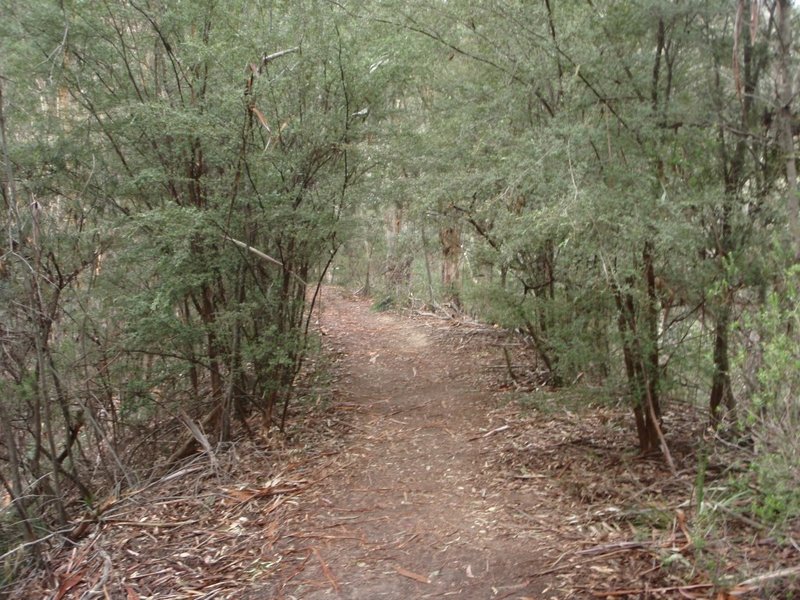
- The track follows the railway easement.
On the approach to the tunnel there are several cuttings. This makes for a very pleasant grade.
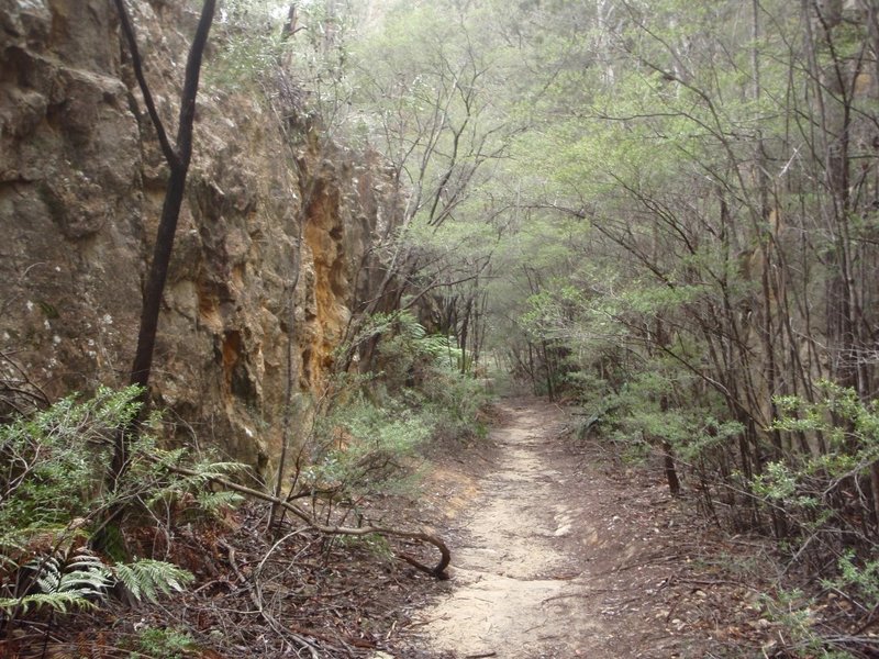
- Track enters cutting.
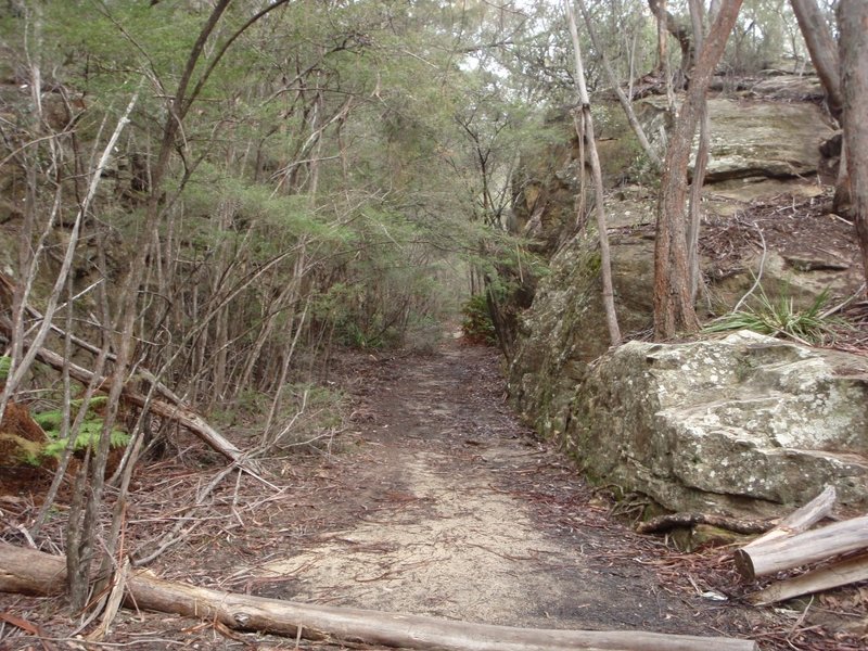
- Just imagine the locomotives working through here.
The track then enters the tunnel which because it is curved is pitch black in the middle.

- View back out the tunnel portal.
Once out the other side there is a fern glade known as Bell's Grotto.
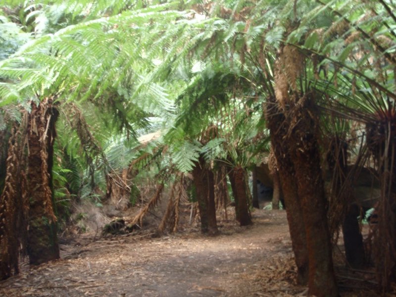
- Bells Grotto.
Apparently some of the adventurous passengers would disembark here and walk around the creek and meet the train on the other side of the tunnel.
from here the tunnel hugs the high Wolgan cliffs as it begins its long descent into the valley.
TBC.
K.
Mon 18 Aug, 2014 9:25 am
Been wanting to visit that area for a long time too. Did you park on Wolgan Rd, next to Wolgan River and then walked in via the Old Coach Rd? Or did you enter via the Gloworm Tunnel Rd from the south side?
Mon 18 Aug, 2014 10:24 am
I entered from the Glow worm Tunnel road up on the plateau and then followed the old line all the way down into the valley. About half way down it crosses the route of the Old Coach Rd. On the return trip I followed the Old Coach Rd. up out of the valley (this is an experience in itself). I then took the Pagoda track back to the old railway line and thence back to the car. It is a really excellent trip.
K.
Mon 18 Aug, 2014 10:42 am
Thanks K for the tip! Look forward to making it there myself. Just a bit of a drive and needs to be in the holidays.
Mon 18 Aug, 2014 11:00 am
You wont regret it. Fascinating area. Great history and great scenery.
K.
Mon 18 Aug, 2014 11:10 am
Have you walked up to Donkey Mtn and camped up top? That outcrop in the valley fascinated me! Will get there one day.
Mon 18 Aug, 2014 12:24 pm
You mean this Donkey Mt? I took that shot on the walk in last week. No I haven't but I hear it is very interesting indeed.
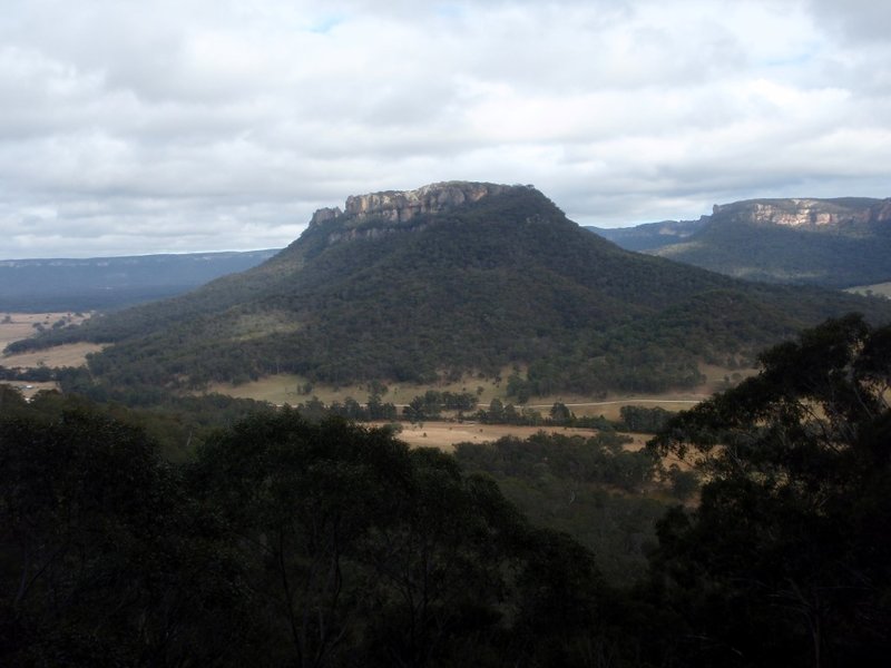
- Donkey Mt.
K.
Mon 18 Aug, 2014 12:47 pm
Yes, that's the one! But I have to say that I have never seen it from your camera angle. Nice! I researched it a while back and understand that it has 2 access routes to the top. On top, it's a bit of a maze. It'd be a great 2-3 days trip. Along with the gloworm area you explored, Wolgan area is fascinating.
Mon 18 Aug, 2014 12:53 pm
Mon 18 Aug, 2014 2:18 pm
Because it is a railway easement the grade is very steady down into the valley and makes for pleasant walking.
Then the Old Coach Rd mentioned above is crossed where there is some signage.

- Where the Old Coach Rd. crosses.
Once down in the valley there are causeways and cuttings.
K.
Mon 18 Aug, 2014 3:01 pm
You actually like a constant incline? Don't find it a bit boring? Did you encounter many people on the tracks?
Mon 18 Aug, 2014 3:30 pm
I do actually. It helps me get into a rhythm. I saw no-one the whole two days. But then it was midweek.
K.
Mon 18 Aug, 2014 3:41 pm
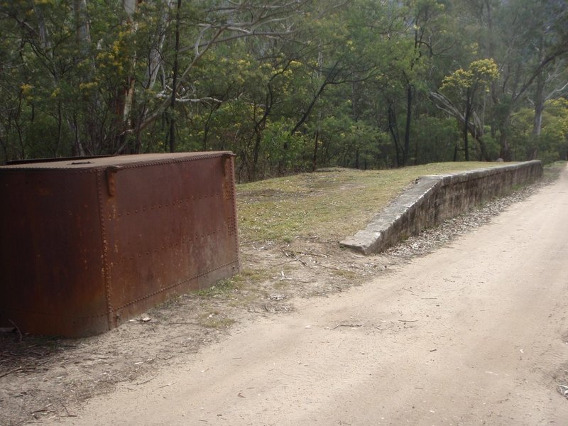
Once down in the valley there are a few relics to be found.
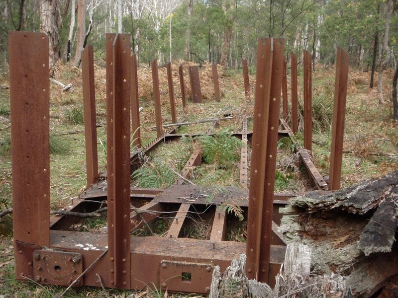
- Not sure what this was?
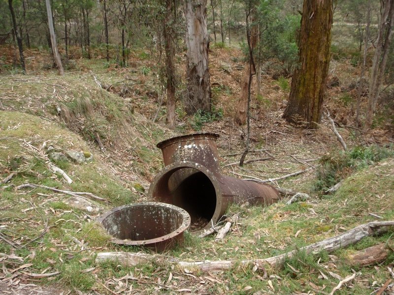
- Nor this?
Then the road from the village of Newnes comes in on the left.
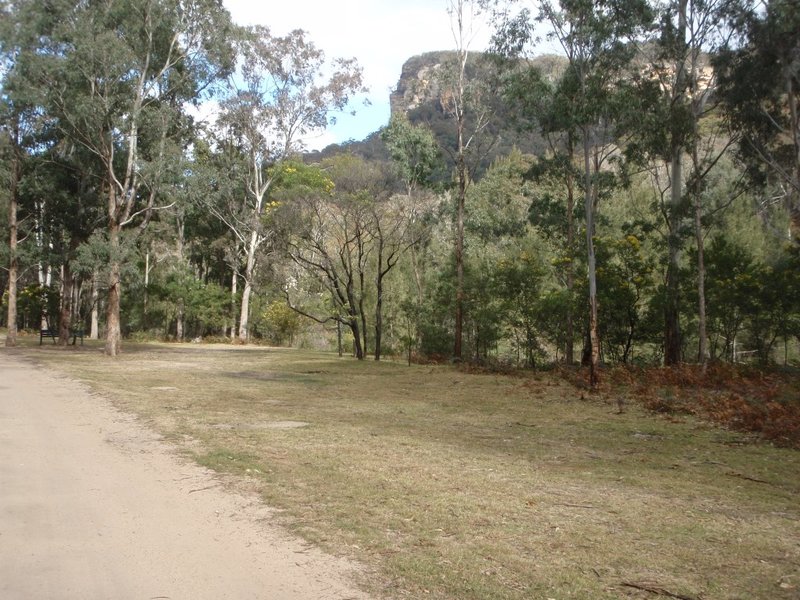
- Valley scene near the ford at Newnes.
Then at 10:30 AM this old engine pulled into the now abandoned station of Newnes.
- Newnes Platform.
A little further on one enters the ruins of the industrial site, in its day one of the largest in Australia.
TBC
K.
Mon 18 Aug, 2014 4:16 pm
Isn't that the remnant of a railway carriage, without its bogies and roof?
Mon 18 Aug, 2014 4:23 pm
Thanks for the report. Incredible to see some of the engineering that was done back then.
Mon 18 Aug, 2014 4:31 pm
GPS I'm not so sure? Hard to say but the steel didn't seem thick enough for that. Perhaps a water tank? Just guessing really.
K.
Mon 18 Aug, 2014 4:55 pm
Hang on you mean the first one? I thought you meant the one on the platform. Yes the steel in the first one would certainly have been strong enough to support a railway carriage. Thinking about it, it would have been about the right dimensions too.
K.
Mon 18 Aug, 2014 5:21 pm
Yes, the first of two photos. The presumed 3 "holes" at the end of that would match the typical structure of a railway carriage, for the coupling and buffers.
Mon 18 Aug, 2014 5:36 pm
Yes I see that now. In fact on the left hand side I think you can make out the circular outline of the buffer?
K.
Mon 18 Aug, 2014 5:53 pm
Whilst camped at Newnes many years ago we were meant to do the walk up to the Glowworm Tunnel. It was raining non-stop so we gave up on the idea and just sat around eating and drinking all weekend. Still haven't got back to do the Glowworm Tunnel yet.
Looking forward to the rest of your journey.
Mon 18 Aug, 2014 9:43 pm
K, a question. What was the road like going up to to Gloworm Tunnel parking area? Unpaved I understand. Decent for 2WDs?
Tue 19 Aug, 2014 8:32 am
Yes it is dirt road all the way from the highway turn off at Clarence. And whilst it was a bit greasy after the rain and a bit churned up by the logging trucks it is no problem at all for 2WD vehicles. I actually found the drive out there very pleasant particularly near the end.
K.
Tue 19 Aug, 2014 9:35 am
Thanks K! I'll try to schedule it for the Sep/Oct school holidays and would be most suitable for the family. In the meantime, looking forward to more of your trips for ideas.
Tue 19 Aug, 2014 10:03 am
Mate they will love it. Great camping spots on either side of the river. Terrific walks. Interesting ruins. Quiet and secluded. Not sure how old your kids are but take their bikes. It's at the end of the road so no through traffic. The old hotel is set up as a museum and there is even some cabins there now. Solar powered.
K.
Tue 19 Aug, 2014 10:23 am
Once past Newnes station the line heads into the ruins of the old industrial area. There is still quite a lot to be found on the site as the following photos reveal.
Hard to imagine now that up till the 1930's this was a bustling industrial area.
TBC
K.
Tue 19 Aug, 2014 10:30 am
Put a few budda statues in those wall recesses and we can call it the Angkor Wat of the Southern Continent. Might even attract Indiana Jones and Angelina Joli!
Tue 19 Aug, 2014 10:39 am
I thought the same thing when I was there. Or Michu Picau sp.?
Is this all that will be left of our own much vaunted civilisation in a few hundred years?
K.
Tue 19 Aug, 2014 10:48 am
Good question. But given inner Sydney real estate value, I suspect my present home would have been flattened a few time and some futuristic construction taking its place. No ruins. But yes, it's just wonderful when bushwalks can help one find a perspective on life and the world. That's why I walk!
Tue 19 Aug, 2014 10:53 am
More ruins.
That chimney is the only one still standing on the site. Originally there were several. A couple very tall.
TBC.
K.
Tue 19 Aug, 2014 10:58 am
Whilst scouring other sites on maps and GoogleEarth, I note that there are many old ruins and mines dotted around the bush with chimneys. Most are now quite inaccessible. They must have built them strong!
© Bushwalk Australia and contributors 2007-2013.
