https://bushwalk.com/forum/viewtopic.php?f=47&t=41655&p=453420#p453420
For clarity I suggest reading that first
Zooming in across the valley you can just make out the white cross on Psalm Rock at Lost World Lookout, a spot I've visited several times.
- Zooming across to Psalm Rock
After lunch I backtracked to where the Greens Rd trail splits and followed the left branch to its end under a large power line tower.
- End of Power Line trail
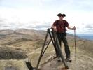
Sussing around I found the pad that I had seen on a previous visit, which my mapping app suggested could get me to the Florabella Pass.
- The way forward
After a short distance the pad splits into two options. I tried both for a short distance but the RH one seemed less precipitous so I opted for that.
(Note that I'm continuing to work on getting my total knee replacement to full strength ~8 months post op, so wanted to protect my investment)
After a bit of pretty steep downhill in places it didn't take very long to arrive at the Florabella Pass, which I had walked a number of times before, although not since Covid.
- Arrival at Florabella Pass
The veg changes considerably down in this section of the pass. Pretty, rainforesty with the occasional shelter cave and creek crossing, old cut stone steps, many now falling into disrepair.
- Shelter Cave
- Creek crossing
Continuing there is some up and down until eventually linking with Pippas Pass, which I followed to its end at Blaxland, then a short walk out to the railway station for the trip home.
- Pond on Pippas Pass
A successful day out and a reminder that it was worth the effort to seek preservation of access to this lovely area on the fringes of the Blue Labyrinth.