Page 1 of 1
Rees-Dart Track

Posted:
Tue 15 Jan, 2013 11:32 pmby Schmeed
I have recently completed a few of the tracks in New Zealand (Kepler, Milford x2, Routeburn and Caples) and I was wondering about the Rees-Dart track. From what I can see it is a tough track, I was just wondering what experience you would have prior to this to complete it? I was thinking of doing it in November/ December 2013, but depending on the experience required might do the Hollyford, can anyone help me out with this?
Re: Rees-Dart Track

Posted:
Wed 16 Jan, 2013 4:19 amby wayno
its not that tough at all, the main problem is the rain, heavy rain makes it impassable due to rising side rivers . and the rees can flood the track itself
depends what photos you've seen , you may have confused the cascade saddle side trip photos with the rees dart trip, the cascade saddle is a rougher track, but not overly difficult. its slower going over a riverbed and up a scree slope. again its subject to rain and not to be attempted in heavy rain, the upper dart and the side streams are very prone to flash flooding..
but if its relatively dry its straight forward on the dart side.
Re: Rees-Dart Track

Posted:
Wed 16 Jan, 2013 6:45 amby forest
Hi Schmeed
If you have done those walks I would highly recommend the rees dart. It's a great track, pretty easy to follow. Probably a little harder in spots than the great walks though and you will most definately get wet feet in the rees valley at the start on the cattle flats. Plenty of bog and mud to play in, most days you will get wet boots. It's not at all like the great walks where every little trickle has a bridge over it. There are a few bridges but they are mainly over the larger rivers.
I can only agree with what Wayno said. Respect the water courses there big time. If it's raining just be wary and avoid some area's, you might even have to wait it out in the huts for a day or 2.
Early Nov last year there was a lot of snow and avalanch danger still around, Late Nov no so big a deal.
I read all the warnings and listened to people about the rivers, even the small creeks. Add some rain in that steep country and what is a tiny trickle turns into a ragging torrent.
Fortuately I had great weather on my walk in April last year but you do need to be aware rain can cause issues.
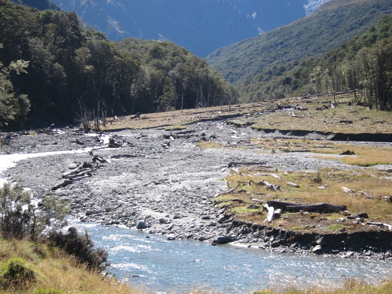
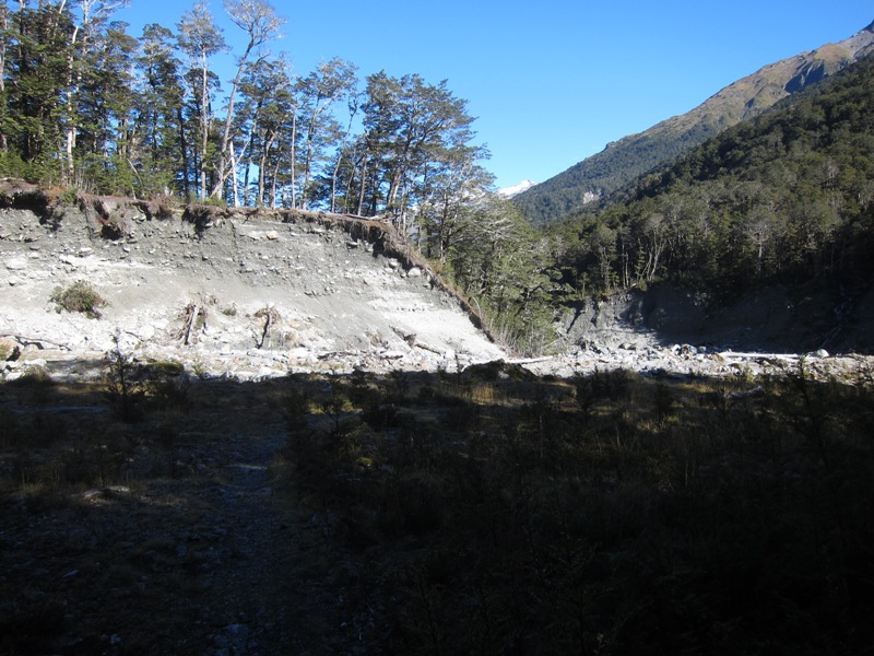
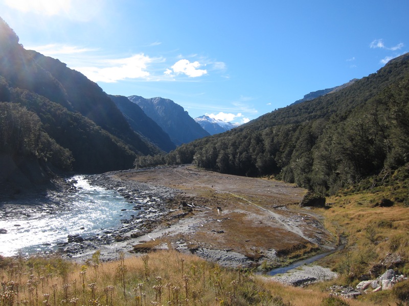
These are just a few crossings, obviously fine in the dry but you can see what happens when it rains.

- IMG_3626.JPG (250.14 KiB) Viewed 15203 times

- IMG_3878.JPG (190.2 KiB) Viewed 15203 times

- IMG_3881.JPG (178.5 KiB) Viewed 15203 times
If the weather allows definatly allow a day to do Cascade saddle return from Dart hut. It's spectactular.
Here's my report and pictures.
viewtopic.php?f=43&t=9464
Re: Rees-Dart Track

Posted:
Wed 16 Jan, 2013 6:54 amby wayno
streams that are easy to cross or stepover in the dry can rise massively in rain, you can see from the debris and boulders in the riverbeds and the erosion on the banks the force of the water in flood. they can come up fast and go down just as fast, in a few hours it can go full circle from dry to impassable to dry again... if you've done the routeburn, i did that track , between mackenzie and the falls hut the steams were right up to the level of the bridges with water in heavy rain... i was wading over one of the bridges, soil is thin, it doesnt take much to saturate it then before long all teh water just runs off the surface and the mountains just catch it all an funnel it to the water courses
Re: Rees-Dart Track

Posted:
Wed 16 Jan, 2013 7:10 amby wayno
here you can see one of the little side streams how it was in flood
the rest are before and after shots from the rain on the routeburn, its indicative of the area and nz.
Re: Rees-Dart Track

Posted:
Wed 16 Jan, 2013 7:13 amby wayno
second shot after teh rain looking in same direction as one of teh shots in the above entry
Re: Rees-Dart Track

Posted:
Wed 16 Jan, 2013 11:59 amby Schmeed
Cheers guys,
I have been looking at heaps of photos of the track and noticed the watercourses and the range with them flooding. Its good to see pictures like this and advice as many of the tramping books suggest that it is a harder track and wasn't sure about the difficulty.
Thanks heaps.
Re: Rees-Dart Track

Posted:
Wed 16 Jan, 2013 12:08 pmby wayno
this is not lake wakatipu. this is the dart river in flood, .... bank to bank....
Re: Rees-Dart Track

Posted:
Wed 16 Jan, 2013 12:50 pmby forest
Schmeed wrote:Its good to see pictures like this and advice as many of the tramping books suggest that it is a harder track and wasn't sure about the difficulty.
By all means don't be turned off, just be aware that high rainfall can/does occur and might cause an issue. The track is great, it's just not a great walk that's all.
If there's one walk I recommend to people used to bushwalking it's the Rees Dart. It's an awesome tramp and the huts are right up there with the great walks. Just no lights.
If I'm back in the area with friends I'll do it again for sure.
Re: Rees-Dart Track

Posted:
Wed 16 Jan, 2013 1:18 pmby wayno
just take extra food and enjoy extra down time in the hut.... the doc rangers will radio to doc who you're booked with for transport and they will advise them you'll be delayed and your shuttle will be waiting for you when you eventually get out.... sorry no pizza delivery with that....
buckley transport are the best.
Re: Rees-Dart Track

Posted:
Sun 20 Jan, 2013 8:54 pmby roysta
The Rees Dart is a great track and for any seasoned Aussie hiker as easy as.
Most people seem to do it starting on the Rees but I reckon it's nice doing it in reverse, starting in the Dart with the first hut being Daleys Flat.
A bit of care is needed though if you do it early in the season and there's a lot of snow up on Rees Saddle. That said the views are magnificent, particularly if you climb the hill off the Saddle.
Going down from the Saddle into the Rees Valley can be a bit dicky on the icy snow grass.
Crampons and a pole would make it a doddle.
Re: Rees-Dart Track

Posted:
Mon 04 Mar, 2013 8:08 pmby Sasha
Apparently a booking system is going to be introduced by DOCS by summer 2013 - 14 for Dart Hut...it gets particularly crowded as many people stay two nights there so they can do a day walk up to Cascade saddle and back; also it gets people coming in from the Weat Matukituli Valley over Cascade saddle a well as trampers from the Rees and Dart valleys.
I agree with all the previous posts..it's not that hard a walk, rising rivers and creeks are the main hazard. in the last couple of years at least two people have drowned crossing flooded creeks on this walk.
I found the Gillespie Pass walk much harder, and more scenically spectacular too.
Re: Rees-Dart Track

Posted:
Tue 05 Mar, 2013 4:49 amby wayno
the last two deaths on the track were from people slipping and falling on snow or ice and going over blufffs on the matukituki side, the last drowning was several years ago... the majority of accidents and deaths are on the climb to the pylon from the matukituki side, most years thers broken bones at least. and a death every few years.
one death was a month after i climbed over the saddle.
you cant walk up a mountain tht steep in snow or ice safely without an ice axe and or crampons or microspikes.
its generally free of snow and ice over summer and into autumn. snow can still anytime of year..
the last drowning was december 2008. her remains werent found for nine months. it took a special search and rescue dog to find them..
there are stories of people experiencing massive flash floods walking down the upper dart and having to run for their lives...
pay special attention to the weather...
i dont know what flash floods do to people in aus, but in nz. people subject to them often don't survive , the force can rip all your clothes from you so victims are often found totally naked with significant injuries.