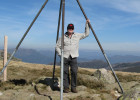
Long time lurker, first time poster.
First I'd like to say this is a terrific site. It has helped me immensely choosing gear and most importantly, the trip reports to help pick where to go next!
I found the trip reports on the Prom Northern Circuit extremely helpful in planning my most recent solo hike, so I thought I would register to do the same. Hopefully someone finds it useful. These are just the notes that I made for Parks Vic as I went along. They ask that hikers on this route please report back to them on the track condition and water supply as they don't get up there very often themselves.
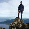
I did the circuit anti-clockwise in three nights/four days (hoped for three days - but that would have been flogging myself after Chinaman's Swamp). April 17th-20th.
Camped at:
Night 1 - Johnny Suey Cove
Night 2 - Tin Mine Cove
Night 3 - Lower Barry Creek
1. Five mile road to Johnny Suey Cove
Water at five mile beach was brackish/salty in the estuary. Wasn't sure if there was a fresh stream nearby so continued through to Johnny Suey. Climb up track on other side of estuary quite overgrown. Descent to cove much clearer. Regular tape was present all the way from five mile beach to JS and track easy enough to follow.
The area available to pitch a tent at Johnny Suey was very small. I expect you would be lucky to get any more than three one man tents side by side.
Evidence of a recent camp fire here
There was some flow from both streams at JS. Very brown with tannins and a bit mucky tasting but OK.
2. Lighthouse point to Chinaman's Long Beach
Some hikers seem to be using the unlocked metal box at the bottom of the lighthouse as a rubbish dump.
Much of the eastern part of this track(lighthouse point end) is heavily overgrown. Often dragging my feet along the track without being able to see them because of all the foliage. However, I only lost the track once and backtracked to reconnect. I did use the GPS a couple of times to check that I was still on the track and not an animal trail! A couple of trees down required a bypass. There is no visible flagging tape, and only very occasional reflectors on trees for the entire track. The Western half of the track is quite clear and easy walking.
Track from Chinamens long beach to Tin mine cove is clear and easy walking.
Tin mine camping area is much more generous than JS.
Creek at tin mine cove is running. Heavily colored with tannins and microbial blue oils.
There was a couple of other people boat camping on the beach.
3. Chinaman long beach to Lower Barry.
Swamp was completely dry. Nowhere to refill water until Lower Barry.
Track started out well for first few hundred metres then became progressively harder to follow. No flagging tape. The next white pole is impossible to spot from the last, usually due to growth obstructing the view. Some of the more sturdy orange poles that come later in the track were knocked down or obscured from view until almost on top of them. Lost the path many, many times and bush bashed to find the path many times. At one point I climbed a tree to find the next white pole 50m on the other side of some imprenetrable thicket!
The last 2.5km or so was quite clear and new flagging tape had been recently placed quite regularly, so the track was easy to find.
Took me 5 hours for the 6km from the beach to camp.
Clear running water at Lower Barry Camp. Clean and plenty of space.
Disappointing to see some rubbish in the middle of nowhere during this section in the swamp wilderness zone (disposable drink bottles and tuna can). I am always confused when I see rubbish left in a place of natural beauty, by people that supposedly come to experience the place because of its beauty and lack of rubbish!
An excellent hike and I will definitely be doing it again, but I'd probably not attempt the swamp again until some track clearing had been done. I can't imagine doing it wet