My partner and I are heading to Tasmania in a couple of weeks and are looking at completing the Mount Anne circuit. We're both in our 20s and I have a reasonable amount of bushwalking experience, but my partner is not quite as experienced. I've done quite a few trips in the Victorian high country such as Mt Howitt/Bogong/Feathertop (and I did Frenchman's cap a few years ago) and I've done a bit of ski touring so I'd say I'm reasonably comfortable with general exposure, dealing with adverse weather, nav, etc etc. My partner, however, is not quite as experienced and has only done a handful of short overnight hikes. All of our gear is up to scratch; quality 3/4 season tent, good rain jackets/first aid kit (I've done my wilderness first aid)/sleeping bags/nav skills and we're carrying an inreach - the whole shebang.
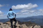
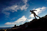
I've researched the Mount Anne circuit in a lot of detail but I want a bit more clarity on the degree of exposure particularly between Shelf camp and Lightning Ridge/Lonely Tarns. All of the info I've found is pretty vague and there aren't a lot of photos. From the looks of it, you're walking along a fairly narrow ridge in sections but are there any 'crux moves' that are required other than The Notch? Pretty much the only thing we're not game for is technical/awkward maneuvers over cliffs apart from the Notch - we have basically written off attempting to summit Mount Anne itself because of the awkwardly slanted slab just before the summit: scrambling is OK, but rock climbing we're not so keen on.
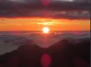
We would only move beyond Shelf Camp if the forecast is reasonable and yes, I know the weather is highly variable in SW Tas.
I know this is a bit of an airy fairy, 'how-long's-a-piece-of-string' post, but some more description of the track between Shelf Camp and Mt Lot would be greatly appreciated.
Thanks in advance - I really appreciate it