GAME: Where am I?
Forum rules
Only administrators may post new topics to this forum. Registered users can post replies.
Only administrators may post new topics to this forum. Registered users can post replies.
-

north-north-west - Lagarostrobos franklinii

- Posts: 15490
- Joined: Thu 14 May, 2009 7:36 pm
- Location: The Asylum
- ASSOCIATED ORGANISATIONS: Social Misfits Anonymous
- Region: Tasmania
- Last
- Lagarostrobos franklinii

- Posts: 2457
- Joined: Thu 23 Jun, 2016 3:43 pm
- Region: Tasmania
Re: GAME: Where am I?
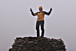
Clue? that mountain at back is a distinctive shape. It"s an abel. I'm between 2 others.
noen ganger er det godt å være alene i villmarken
- Last
- Lagarostrobos franklinii

- Posts: 2457
- Joined: Thu 23 Jun, 2016 3:43 pm
- Region: Tasmania
Re: GAME: Where am I?
Almost looks like a staircase.....
noen ganger er det godt å være alene i villmarken
- Last
- Lagarostrobos franklinii

- Posts: 2457
- Joined: Thu 23 Jun, 2016 3:43 pm
- Region: Tasmania
Re: GAME: Where am I?
Old Pelion Copper Mine Track?
- inwaver
- Nothofagus cunninghamii

- Posts: 6
- Joined: Fri 17 Nov, 2023 7:26 pm
- Region: New South Wales
Re: GAME: Where am I?
inwaver wrote:Old Pelion Copper Mine Track?
Alas no. Some distance south of there.
noen ganger er det godt å være alene i villmarken
- Last
- Lagarostrobos franklinii

- Posts: 2457
- Joined: Thu 23 Jun, 2016 3:43 pm
- Region: Tasmania
Re: GAME: Where am I?
Are you on the Clear Hill plains looking at Stepped Hills?
-

L_Cham_67 - Athrotaxis selaginoides

- Posts: 1079
- Joined: Thu 17 Dec, 2015 6:43 pm
- Region: Tasmania
- Gender: Male
Re: GAME: Where am I?
correct, on the way to The Thumbs
noen ganger er det godt å være alene i villmarken
- Last
- Lagarostrobos franklinii

- Posts: 2457
- Joined: Thu 23 Jun, 2016 3:43 pm
- Region: Tasmania
Re: GAME: Where am I?
Anyone else can jump in.
-

L_Cham_67 - Athrotaxis selaginoides

- Posts: 1079
- Joined: Thu 17 Dec, 2015 6:43 pm
- Region: Tasmania
- Gender: Male
Re: GAME: Where am I?
I will take the chance then!
Where is this tent?
Where is this tent?
-

creeping_moses - Athrotaxis cupressoides

- Posts: 272
- Joined: Wed 18 May, 2011 9:43 am
- Region: Tasmania
- Gender: Male
Re: GAME: Where am I?
Shadow suggests the Frenchman
-

eggs - Lagarostrobos franklinii

- Posts: 10833
- Joined: Fri 23 May, 2008 2:58 pm
- Location: Para Vista, South Australia
- Region: South Australia
Re: GAME: Where am I?
Excellent shadow recognition!
It is Frenchmans.
It is Frenchmans.
-

creeping_moses - Athrotaxis cupressoides

- Posts: 272
- Joined: Wed 18 May, 2011 9:43 am
- Region: Tasmania
- Gender: Male
Re: GAME: Where am I?
The background did help, though I did not have that view when I was up there.
Next
Next
Last edited by eggs on Mon 15 Jan, 2024 8:17 pm, edited 1 time in total.
-

eggs - Lagarostrobos franklinii

- Posts: 10833
- Joined: Fri 23 May, 2008 2:58 pm
- Location: Para Vista, South Australia
- Region: South Australia
Re: GAME: Where am I?
I can see Thhumbs and Wright in the back but you're on dolerite. Mueller?
"Mit der Dummheit kämpfen Götter selbst vergebens."
-

north-north-west - Lagarostrobos franklinii

- Posts: 15490
- Joined: Thu 14 May, 2009 7:36 pm
- Location: The Asylum
- ASSOCIATED ORGANISATIONS: Social Misfits Anonymous
- Region: Tasmania
Re: GAME: Where am I?
Not Mueller
-

eggs - Lagarostrobos franklinii

- Posts: 10833
- Joined: Fri 23 May, 2008 2:58 pm
- Location: Para Vista, South Australia
- Region: South Australia
-

north-north-west - Lagarostrobos franklinii

- Posts: 15490
- Joined: Thu 14 May, 2009 7:36 pm
- Location: The Asylum
- ASSOCIATED ORGANISATIONS: Social Misfits Anonymous
- Region: Tasmania
Re: GAME: Where am I?
Much closer but not quite
-

eggs - Lagarostrobos franklinii

- Posts: 10833
- Joined: Fri 23 May, 2008 2:58 pm
- Location: Para Vista, South Australia
- Region: South Australia
Re: GAME: Where am I?
Been too long since I was there. Mawson?
"Mit der Dummheit kämpfen Götter selbst vergebens."
-

north-north-west - Lagarostrobos franklinii

- Posts: 15490
- Joined: Thu 14 May, 2009 7:36 pm
- Location: The Asylum
- ASSOCIATED ORGANISATIONS: Social Misfits Anonymous
- Region: Tasmania
Re: GAME: Where am I?
Getting further away...
-

eggs - Lagarostrobos franklinii

- Posts: 10833
- Joined: Fri 23 May, 2008 2:58 pm
- Location: Para Vista, South Australia
- Region: South Australia
Re: GAME: Where am I?
Florentine, then. Or Rodway.
"Mit der Dummheit kämpfen Götter selbst vergebens."
-

north-north-west - Lagarostrobos franklinii

- Posts: 15490
- Joined: Thu 14 May, 2009 7:36 pm
- Location: The Asylum
- ASSOCIATED ORGANISATIONS: Social Misfits Anonymous
- Region: Tasmania
Re: GAME: Where am I?
Just stick with Florentine - I am on the edge here you know...
-

eggs - Lagarostrobos franklinii

- Posts: 10833
- Joined: Fri 23 May, 2008 2:58 pm
- Location: Para Vista, South Australia
- Region: South Australia
Re: GAME: Where am I?
Oops. I think that's supposed to mean that I'm up. Not that I could get a photo to load until now.
This just happens to be where I'm up to with reworking some old material.
This just happens to be where I'm up to with reworking some old material.
"Mit der Dummheit kämpfen Götter selbst vergebens."
-

north-north-west - Lagarostrobos franklinii

- Posts: 15490
- Joined: Thu 14 May, 2009 7:36 pm
- Location: The Asylum
- ASSOCIATED ORGANISATIONS: Social Misfits Anonymous
- Region: Tasmania
Re: GAME: Where am I?
Mt Oana?
-

eggs - Lagarostrobos franklinii

- Posts: 10833
- Joined: Fri 23 May, 2008 2:58 pm
- Location: Para Vista, South Australia
- Region: South Australia
Re: GAME: Where am I?
Why do I even bother when you're around? Yes, Oana; that was a good walk.
"Mit der Dummheit kämpfen Götter selbst vergebens."
-

north-north-west - Lagarostrobos franklinii

- Posts: 15490
- Joined: Thu 14 May, 2009 7:36 pm
- Location: The Asylum
- ASSOCIATED ORGANISATIONS: Social Misfits Anonymous
- Region: Tasmania
Re: GAME: Where am I?
You bother because
* it's fun
* you have the broadest range of photos.
* I often don't respond quickly
* I often get things wrong.
As it was, this took some work, but using Barn Bluff I could draw a useful line on a map.
Next then
* it's fun
* you have the broadest range of photos.
* I often don't respond quickly
* I often get things wrong.
As it was, this took some work, but using Barn Bluff I could draw a useful line on a map.
Next then
-

eggs - Lagarostrobos franklinii

- Posts: 10833
- Joined: Fri 23 May, 2008 2:58 pm
- Location: Para Vista, South Australia
- Region: South Australia
Re: GAME: Where am I?
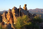
This was from a couple of weeks ago.
My objective on a short visit was to see the scoparia in flower - which turned out to be mostly gone.
We did see some better spots and this was one of them.
It was the last dash site so no hiking - the car was next to us.
There is a glimpse of a man made object amongst the scrub in view.
My objective on a short visit was to see the scoparia in flower - which turned out to be mostly gone.
We did see some better spots and this was one of them.
It was the last dash site so no hiking - the car was next to us.
There is a glimpse of a man made object amongst the scrub in view.
-

eggs - Lagarostrobos franklinii

- Posts: 10833
- Joined: Fri 23 May, 2008 2:58 pm
- Location: Para Vista, South Australia
- Region: South Australia
Re: GAME: Where am I?
It's not looking up at the Sentinel Range is it? Maybe the object is the initial footpad from the car park?
John W
In Nature's keeping they are safe, but through the agency of man destruction is making rapid progress - John Muir c1912
In Nature's keeping they are safe, but through the agency of man destruction is making rapid progress - John Muir c1912
-

johnw - Lagarostrobos franklinii

- Posts: 9682
- Joined: Wed 23 Jan, 2008 11:59 am
- Location: Macarthur Region - SW Sydney
- Region: New South Wales
- Gender: Male
Re: GAME: Where am I?
Rethinking, maybe not jagged enough for the Sentinels.
It does resemble Mt Roland, though I'm not sure of the approach point.
Maybe from the end of Kings Road?
It does resemble Mt Roland, though I'm not sure of the approach point.
Maybe from the end of Kings Road?
John W
In Nature's keeping they are safe, but through the agency of man destruction is making rapid progress - John Muir c1912
In Nature's keeping they are safe, but through the agency of man destruction is making rapid progress - John Muir c1912
-

johnw - Lagarostrobos franklinii

- Posts: 9682
- Joined: Wed 23 Jan, 2008 11:59 am
- Location: Macarthur Region - SW Sydney
- Region: New South Wales
- Gender: Male
Re: GAME: Where am I?
Neither - there is not much "up" in the looking. I am on the tops along with the road.
You have to be high to see this scoparia
Reposting:
You have to be high to see this scoparia
Reposting:
-

eggs - Lagarostrobos franklinii

- Posts: 10833
- Joined: Fri 23 May, 2008 2:58 pm
- Location: Para Vista, South Australia
- Region: South Australia
Re: GAME: Where am I?
Lake Mackenzie?
- tassietramper
- Nothofagus gunnii

- Posts: 37
- Joined: Mon 23 Oct, 2023 9:03 am
- Location: Tasmania
- Region: Tasmania
Return to Games and Competitions
Who is online
Users browsing this forum: No registered users and 1 guest
