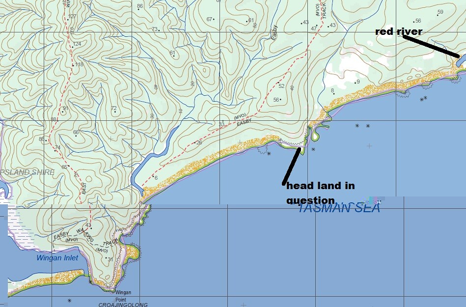
Hey Happycamper you could try the non track part between Red River and the Benadore River (between Mallacoota and Wingan Inlet). The part I mean is along the coast not the 4WD/walking track. The main part is easy along a great sandy beach (heading from Red River) then you have to diverge inland for some part as the cliffs are un-passable. It took us 5 hours several years ago, very interesting coast line though.
You could also try walking into red river from the highway side as part of an off track which could get you to water.
BUT the scrub is very thick in places and may be very hard to off track it in the route you plan so you will need to have a good escape route not far from where you want to walk (there are lots of very old tracks around in that area).
I'm wondering whether Marty or anyone else can supply more details about this area. I phoned the Mallacoota NP office last March and spoke to Darryl the ranger, who told me that several tracks which were previously management vehicle only haven't been maintained for several years and are overgrown. These include Easby Tk, Red River Tk and Wingan Tk. He also said navigation would be difficult on the walking track east of the Red River to Sand Patch Tk. This conversation occurred however before a large area between Red River and Benedore River had a prescribed burn in autumn this year. (Note that a larger area between Benedore River and Shipwreck Creek had a 2010 prescribed burn. See http://nremap-sc.nre.vic.gov.au/MapShare.v2/imf.jsp?site=forestexplorer .)
I'm planning a walk for September, so any information would be useful. By the way, when I said to Darryl that burn-offs usually meant I'd stay away for a long time afterwards, he said that the 2010 "low intensity" burn had not done a lot of damage, there was very rapid regrowth, and he thought the landscape looked good. I hope so.


