Does anyone know the reason for Huts being removed from Tasmanian Google Maps
corvus
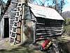
Should have done more personal research some huts are still visible
![]() by corvus » Fri 27 Jan, 2012 5:14 pm
by corvus » Fri 27 Jan, 2012 5:14 pm


![]() by tastrax » Fri 27 Jan, 2012 5:31 pm
by tastrax » Fri 27 Jan, 2012 5:31 pm


![]() by corvus » Fri 27 Jan, 2012 6:38 pm
by corvus » Fri 27 Jan, 2012 6:38 pm
![]() by flyfisher » Fri 27 Jan, 2012 9:21 pm
by flyfisher » Fri 27 Jan, 2012 9:21 pm

![]() by corvus » Fri 27 Jan, 2012 10:06 pm
by corvus » Fri 27 Jan, 2012 10:06 pm
![]() by tastrax » Sat 28 Jan, 2012 3:19 pm
by tastrax » Sat 28 Jan, 2012 3:19 pm
![]() by flyfisher » Sat 28 Jan, 2012 5:36 pm
by flyfisher » Sat 28 Jan, 2012 5:36 pm
![]() by corvus » Sat 28 Jan, 2012 6:55 pm
by corvus » Sat 28 Jan, 2012 6:55 pm
![]() by tastrax » Sat 28 Jan, 2012 7:48 pm
by tastrax » Sat 28 Jan, 2012 7:48 pm
![]() by corvus » Sat 28 Jan, 2012 8:00 pm
by corvus » Sat 28 Jan, 2012 8:00 pm
![]() by tas-man » Mon 30 Jan, 2012 8:42 pm
by tas-man » Mon 30 Jan, 2012 8:42 pm

Return to Bushwalking Discussion
Users browsing this forum: Google [Bot] and 6 guests