by Borbs » Thu 04 Apr, 2013 7:40 pm
As promised:
Water:
Aplenty atm. Water in smaller gullies is receding but main sources and creeks are flowing well. Got water from smaller sources: SE of Howitt/Crosscut intersection, Mt Despair/Razor Saddle, etc.
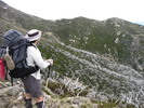
Track:
*Track has been beautifully cleared by Parks between Catherine Saddle and the Viking. Logs chain-sawed, grass and shrubs slashed. Looks recent. AAWT signs are particularly prominent here (a little over-zealous actually, considering the signs about, 'you are entering a wilderness area, no signs', etc.)
*Only rough spot is the direct drop-off from Spec to CS (maybe they're encouraging walker to use the closed road)
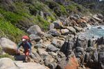
*Don't expect a footpad from South Viking to the Wonnangatta. There are some clear pads where the crest of the spur is narrow enough to be unmissable and where there are no rocks and no re-growth, but at that point who cares if there's a track, so follow the spur and take it as it comes. If you follow the route along the crown of the spur near the bottom as it bends further E, even when it becomes indistinct, you shouldn't have trouble with blackberries, just thick scrub. (If you miss it, there's plenty along the river, so try to nav it right.)
Fire damage:
The 2ha spot fire on Spec is near the knoll on the NE spur en route to CS (UTM 692 922). There is little immediate danger to walkers as the trees are of no significant size, but, as always, be careful.
As for the rest, I took a spur up from the Wonnangatta to the fat sponge of a knoll at Mac Springs that runs up from about 3k W of the river campsite, but to respect the rules of this forum I will not discuss this. If you are interested, you can message me privately.
Have fun.