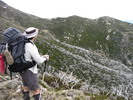
After an aborted attempt (all my friends piked) last Easter, I again have plans to do the Viking Circuit this Easter.
It seems that it's been pretty dry in the area over the last month. Hopefully some significant precipitation will come in the next couple of days. If not though, do you think water will be flowing at Viking Saddle or should we carry extra from Speculation? Last time I was at Viking Saddle (Cup Weekend a few years ago) it wasn't much of a flow.
We're also considering a start/finish at Upper Howqua Camp Ground instead of Howitt Plains. Might save an hour of driving, but would call for a much longer last day. Looks more like a 5 day walk I think...
Thoughts?
Thanks
Water at Viking Saddle
Forum rules
Victoria specific bushwalking discussion. Please avoid publishing details of access to sensitive areas with no tracks.
Victoria specific bushwalking discussion. Please avoid publishing details of access to sensitive areas with no tracks.
14 posts
• Page 1 of 1
Water at Viking Saddle
![]() by Drew » Wed 25 Mar, 2015 12:00 pm
by Drew » Wed 25 Mar, 2015 12:00 pm
- Drew
- Phyllocladus aspleniifolius

- Posts: 788
- Joined: Fri 13 Jan, 2012 11:16 am
- Region: Victoria
- Gender: Male
Re: Water at Viking Saddle
![]() by wander » Wed 25 Mar, 2015 12:34 pm
by wander » Wed 25 Mar, 2015 12:34 pm
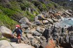
My experience is you just go further down to gully to get the water. When very dry we have found the water is on the South side (but this was many years ago now) rather than the normally accessed North side.
- wander
- Phyllocladus aspleniifolius
- Posts: 943
- Joined: Mon 26 Oct, 2009 11:19 am
- Region: South Australia
- Gender: Male
Re: Water at Viking Saddle
![]() by gbedford » Wed 25 Mar, 2015 6:16 pm
by gbedford » Wed 25 Mar, 2015 6:16 pm
Went from Upper Howqua Campground last January. Five days but hat included Helicopter Spur. Had to go a couple of hundred metres down the South side of Viking Saddle to find water. Great trip. Search this forum and you will find other accounts including variants out of the Wonnangatta.
- gbedford
- Athrotaxis cupressoides

- Posts: 112
- Joined: Tue 28 Sep, 2010 6:53 pm
- Region: Victoria
- Gender: Male
Re: Water at Viking Saddle
![]() by Drew » Thu 26 Mar, 2015 9:34 am
by Drew » Thu 26 Mar, 2015 9:34 am
wander wrote:My experience is you just go further down to gully to get the water. When very dry we have found the water is on the South side (but this was many years ago now) rather than the normally accessed North side.
Thanks wander. Do you think then it's a case of there nearly almost being water in one of those gullies, just a bit more work to find it in dry times? We did have to go at least a couple of hundred metres down the north gully last time I was there.
gbedford wrote:Went from Upper Howqua Campground last January. Five days but hat included Helicopter Spur. Had to go a couple of hundred metres down the South side of Viking Saddle to find water. Great trip. Search this forum and you will find other accounts including variants out of the Wonnangatta.
Yep, I was thinking it would be up Helicopter and down Howitt Spur to mix it up. But that definitely looks like it would need 5 days, especially with mixed fitness levels in the group. It's a lot of extra walking to save an hour of driving! I'm keen to try one of the "untracked" spurs up out of the Wonnangatta (I much prefer some bush bashing to that road slog) but it might depend how other members of the party feel at that stage. Splashing up a creek through blackberries mightn't go down too well...
- Drew
- Phyllocladus aspleniifolius
- Posts: 788
- Joined: Fri 13 Jan, 2012 11:16 am
- Region: Victoria
- Gender: Male
Re: Water at Viking Saddle
![]() by wander » Thu 26 Mar, 2015 10:36 am
by wander » Thu 26 Mar, 2015 10:36 am
We found it as a soak that was dribbling. Take plates and cups on the water gathering wander.
We have started to have rain here in SA, if we get rain, Vic normally get's and more. So look the rainfall stats for the last 2 weeks for the area. If there has been 5mm+ you should not have too much drama finding water, but possibly a longish wander down and up. Pretty country so treat as part of the wander and not a chore.
There is a very old hand drawn map published by the Something Walking Club (I can't remember the details and the map is at home, hopefully someone can post better details, it is a well known map) that has a lot of water points in this area marked, and we have found these very reliable over the years. Not all of them are in obvious to the lie of the land locations.
- wander
- Phyllocladus aspleniifolius
- Posts: 943
- Joined: Mon 26 Oct, 2009 11:19 am
- Region: South Australia
- Gender: Male
Re: Water at Viking Saddle
![]() by wildlight » Thu 26 Mar, 2015 12:02 pm
by wildlight » Thu 26 Mar, 2015 12:02 pm
Was that the Victorian Mountain Tramping Club map? By Stuart Brookes?
My edition of it is umpteen years old- as in over two decades... He did write great little supplementary notes on water and campsites. I might even get up there myself this Easter, sounds a plan. There's water just beyond the top of the Viking, this has been discussed elsewhere on the forum.
Cheers
WildLight
- wildlight
- Athrotaxis cupressoides
- Posts: 212
- Joined: Tue 24 Mar, 2009 2:03 pm
-
dplanet - Phyllocladus aspleniifolius
- Posts: 569
- Joined: Thu 04 Oct, 2007 8:21 pm
- Location: Ormond-Caulfield, Melbourne
- Region: Victoria
- Gender: Female
Re: Water at Viking Saddle
![]() by wildlight » Thu 26 Mar, 2015 7:02 pm
by wildlight » Thu 26 Mar, 2015 7:02 pm
Thanks for posting that link dplanet. Hopefully I can get up there this Easter, and take a look around. It's been over 20 years since the last visit, although I've stood at "the edge" and gazed into the Terrible Hollow many times.
Cheers
WildLight
Cheers
WildLight
- wildlight
- Athrotaxis cupressoides
- Posts: 212
- Joined: Tue 24 Mar, 2009 2:03 pm
Re: Water at Viking Saddle
![]() by Drew » Fri 27 Mar, 2015 1:12 pm
by Drew » Fri 27 Mar, 2015 1:12 pm
Almost 20mm of rain at Buller yesterday. That should put an end to any water worries.
- Drew
- Phyllocladus aspleniifolius
- Posts: 788
- Joined: Fri 13 Jan, 2012 11:16 am
- Region: Victoria
- Gender: Male
Re: Water at Viking Saddle
![]() by wander » Fri 27 Mar, 2015 1:32 pm
by wander » Fri 27 Mar, 2015 1:32 pm
wildlight wrote:Was that the Victorian Mountain Tramping Club map? By Stuart Brookes?
That's the one. I have now found my copy and it does not detail water points at Viking Saddle, nevertheless it is a very useful resource as to other water points in the greater area. Bearing in mind most has been burnt and subject to regrowth since the map was produced in 1986 and this may have impacted some water points.
- wander
- Phyllocladus aspleniifolius
- Posts: 943
- Joined: Mon 26 Oct, 2009 11:19 am
- Region: South Australia
- Gender: Male
Re: Water at Viking Saddle
![]() by Drew » Tue 07 Apr, 2015 4:06 pm
by Drew » Tue 07 Apr, 2015 4:06 pm
Almost 20mm of rain at Buller yesterday. That should put an end to any water worries.
Or not... The whole area was very dry. After finding just a trickle at Mac Springs and hearing that Hellfire Creek and Catherine Saddle were both dry, we decided to carry 2 days worth of water from Camp Creek. Once we'd arrived at Viking Saddle I went down the north gully to satisfy my curiosity. The spot I'd found water at last time (about 250 metres down) was bone dry. I went down another 250 metres or so and found nothing. With plenty of bush bashing to come on the walk I gave up and headed back up.
There was a group from MUMC camped there too and a few of them had headed off down the north gully earlier. After 2.5 hours they returned bearing water! I believe they'd gone all the way down to Buffalo River! Just as well too, as a man with his two teenage suns had arrived with only 2 litres left. We gave them 1 litre and the MUMC group donated a few litres too. He had tried going down the south gully but hadn't found any water.
- Drew
- Phyllocladus aspleniifolius
- Posts: 788
- Joined: Fri 13 Jan, 2012 11:16 am
- Region: Victoria
- Gender: Male
Re: Water at Viking Saddle
![]() by madmacca » Sun 12 Apr, 2015 2:21 pm
by madmacca » Sun 12 Apr, 2015 2:21 pm
Drew wrote:Or not... The whole area was very dry. After finding just a trickle at Mac Springs and hearing that Hellfire Creek and Catherine Saddle were both dry
Actually, MacSprings is just a trickle nearly all of the time - it certainly was even when I was there in November. Volume is not always a predictor for reliability.
- madmacca
- Phyllocladus aspleniifolius
- Posts: 514
- Joined: Fri 14 Oct, 2011 11:18 pm
- Region: Victoria
- Gender: Male
Re: Water at Viking Saddle
![]() by Drew » Mon 13 Apr, 2015 5:48 pm
by Drew » Mon 13 Apr, 2015 5:48 pm
Actually, MacSprings is just a trickle nearly all of the time - it certainly was even when I was there in November. Volume is not always a predictor for reliability.
That's true - but it was a less vigorous trickle this time than other times I've been there!
- Drew
- Phyllocladus aspleniifolius
- Posts: 788
- Joined: Fri 13 Jan, 2012 11:16 am
- Region: Victoria
- Gender: Male
Re: Water at Viking Saddle
![]() by MartyGwynne » Wed 15 Apr, 2015 4:06 pm
by MartyGwynne » Wed 15 Apr, 2015 4:06 pm
Don't forget you can get water if it has been wet on the back of the Viking turning off the AAWT to the right before the allocated drop off to Barry saddle and go down a km or two and follow the rocks there has been water there. Also between mt despair and the razor in the gully leading sort of South ish there can be water there too but on a dry summer/autumn you may be out of luck. Always carry a tarp so you can gather water when it rains (well it always rains on me).
-
MartyGwynne - Athrotaxis cupressoides
- Posts: 339
- Joined: Sun 30 Jan, 2011 4:31 am
- Region: Victoria
- Gender: Male
14 posts
• Page 1 of 1
Who is online
Users browsing this forum: No registered users and 1 guest