I just responded to someone else via PM about Iceland and I thought I'd copy and paste here as it might interest you as well:
The side walks from Landsmannalaugar I did were the climb to the summit of Blahnukur - short trip about 4km south of the hut at Landsmannalaugar. Then the same day did the Brennisteinsalda. The Skalli circuit is about 15kms or so, and you can go either clockwise or anticlockwise. You could probably do the summit of Blahnukur on the same day as it is south of the huts. And then the hike north to the Ljottipollur crater lake is about 15km return. I did this in the clockwise direction. I think you could walk around the lake as well, but I didn't. I walked maybe around the southern side of the lake for around 4-5km, and came back on the southern road to the huts. On the walk check out the volcanic rock formations (rock trolls) on the crest of hils. There was one that from the right angle was the Batman's cowl.
The ranger station is pretty big at Landsmannalaugar so they can point you in the right direction. They let you charge devices for a fee as well if you need.
There was another 20km trip to Sudurnamur and Haalda peaks to Storihver but I didn't do that. You pass throgh Storihver on the way to Aftavan but the side trip leads you west of Landsmannalaugar huts if you had time.
From Aftavan, there is about a short 5km trip to Torfahlaup gorge which is pretty nice (about 3 hours round trip from the hut).
From Emstrur huts (Botnaaskali) you have to go to the Markafljotsglijufur canyon. It is a mouthful and I can't pronounce it correctly but really pretty. There is a rock formation that looks like a rhino you have to look out for on the horizon. but if it is a clear day, the views of the surrounding glaciers are really nice. The lady warden at the Emstrur hut has a nice black labradour that came for the walk to the canyon. I lost the dog when we got to the canyon, but he scooted back to the hut on his own. It was a short trip to the canyon from the hut - about 4km loop - but you can make it a bit longer if you go up.
Some other tips:
The icelandic huts were pretty nice. I didn't need a sleeping mat as they had mattresses and had full kitchens with everything you need. You had to bring your own food, but some people left "free food" as extras from their trip, like pasta, oats and tea/coffee which was nice.
Camping wise, I think for some of the southern routes (Fallaback and Thorsmork) you were restricted to specific campsites but check with the link I posted. Camping fees for near the huts meant you could use their facilities. There's no power to these sites though. So you need a solar charger or battery pack for your kit.
There's a few stores in Reykjavik to get supplies like food and gas (they have the pierced cannisters that aren't compatible with my stoves, but some had the screw-in variety as well). There is a shopping centre Kringlan south east of Reykjavik that you can get to by bus and it has a few camping stores (nothing really cheap in Iceland though - you are better off getting it here or from the US before you go), and there are some stores in Reykjavik that hire out camping gear. One I recall reasonably priced was north east of the main shopping street, near the water.
Alcohol is ridiculously priced - bring some Duty free if you want to go down that route. I bought some overpriced icelandic moss vodka but boy that was a horrible decision.
A prepaid sim is relatively cheap. I got a Vodafone one with 3gb data. Reception was good for most of the city areas and on the Ring road. Less so in the mountains. The hut wardens were good for weather updates when the data didn't work. I bought my sim from the Kringlan shopping centre as I didn't find an outlet with the prepaid data sim in town.
Map wise, if you have a Garmin GPS, grab that topo map I mentioned. It is user generated, but pretty good. I had a 1:50000 map with an overview of the route, and shared a 1:25000 topo map. Most of the route was reasonably well signed, but parts when you get into the volcanic rock and across the glacier it can be hard to see where to go. Be careful crossing glaciers (with really slippery black ice) and ice bridges (over and under), and the river crossings were all ok, but cold in September. Another source for Icelandic Garmin maps is
http://www.gpsmap.is. Their IMG file is donation ware, the mapsource version is USD $25 or so. YOu need to register on the site to download. I've downloaded the IMG file but haven't had time to compare it against the other topo I used.
Oh, a water tip, there are usually tanks that you can use from the huts, but if you fill up from lakes, it might be nice to use a filter. I ran out of water on one of the legs, and filled up directly from a river and my bottle was full of really annoying black volcanic grit. I was told in summer some of the rivers I crossed were pretty low.
If you like the hot springs, I thought the Reykjavik Blue Lagoon was a ripoff. I went to the swimming pool at Laugardalur which has thermal spas and mainly Icelanders were here, not many tourists. Another option is the Geothermal Beach at Nautholsvik. The change rooms were closed in as it was off season when I went, and the tide had come in, so the water around the pool was *&%$#! freezing.
Around Hveragerdi about 40-50kms east of Reykjavik there are a few hot spring hikes close to town that leads to rivers and hotsprings. The one I went on started at the end of the road north of this place
http://dalakaffi.is/ Found a nice junction of a river meeting a hot spring that wasn't too hot . It was around 37C, but further upstream, closer to the hot spring it was over 40C. About 7km round trip but the weather was really crap that day. Had on full wet weather mountain gear and it was down under 10C and drizzling so when stripped off to jump in the springs I had to cover the pack and clothes up.
Other things I did that you might not have time for are like glacier walk and ice climbing which was fun, but relatively crappy day when I did it. Oragnised from the hostel out of Reykjavik
Also did the diving at Silfra. Some people I met at the hostel did the flights over the exploding Bardabunga volcano, but I couldn't justify the cost so skipped it. they did take some nice pics of the volcano eruptions though. Some girls I met also did the Icelandic horse riding thing but it is slow trail riding. If you go to the Hveragerdi, I passed a group on the trail to the hot springs doing this.
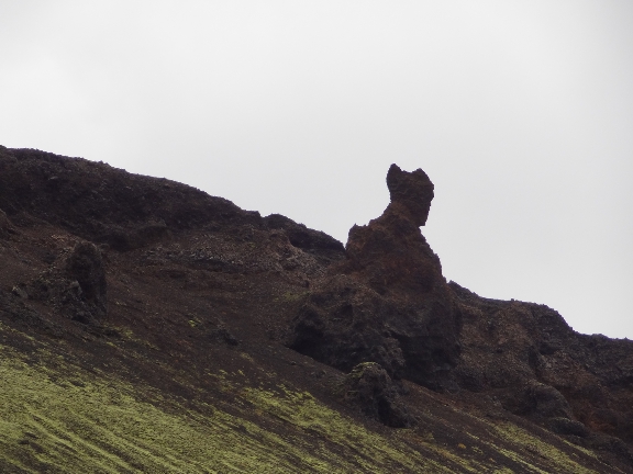
- It reallly looked like Batman
- Batman Troll Rock.jpg (150.19 KiB) Viewed 67493 times
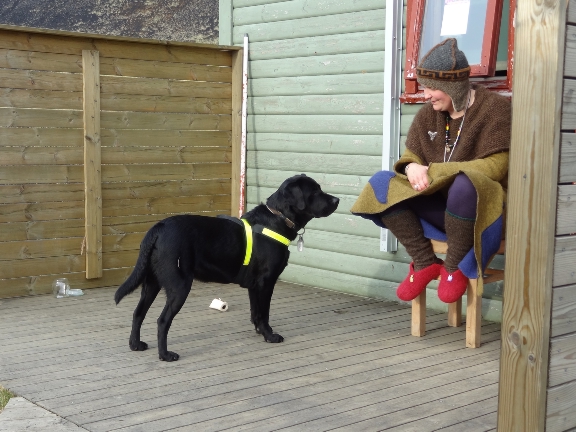
- Warden and her dog
- Emstrur Warden.jpg (211.99 KiB) Viewed 67493 times
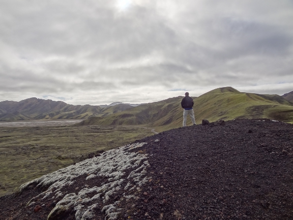
- Can't remember the name of this peak on the way to the lake
- Hill on the way to Ljotipollur.jpg (182.34 KiB) Viewed 67493 times
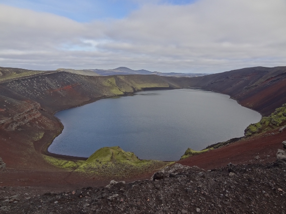
- Ljotipollor lake.jpg (164.86 KiB) Viewed 67493 times
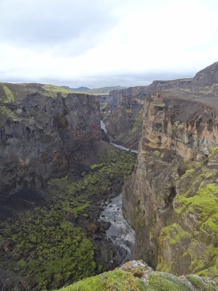
- Markafljotsglijufur Canyon.jpg (201.25 KiB) Viewed 67493 times


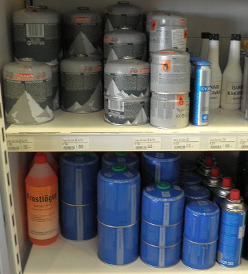 not my pic but gas bottles available at petrol stations in Iceland.