Eagle Peaks from Sheepyard flat
Victoria specific bushwalking discussion. Please avoid publishing details of access to sensitive areas with no tracks.
Eagle Peaks from Sheepyard flat
![]() by damoprz » Tue 07 Jun, 2016 4:15 pm
by damoprz » Tue 07 Jun, 2016 4:15 pm
- damoprz
- Athrotaxis cupressoides

- Posts: 182
- Joined: Mon 04 May, 2015 7:51 pm
- Region: Victoria
- Gender: Male
Re: Eagle Peaks from Sheepyard flat
![]() by Earwig » Wed 08 Jun, 2016 11:47 am
by Earwig » Wed 08 Jun, 2016 11:47 am
MY HIKING BLOG http://ian-folly.blogspot.com/
-

Earwig - Athrotaxis cupressoides
- Posts: 289
- Joined: Wed 11 Nov, 2009 3:25 pm
- Location: NE Victoria
- Region: Victoria
- Gender: Male
Re: Eagle Peaks from Sheepyard flat
![]() by damoprz » Wed 08 Jun, 2016 6:10 pm
by damoprz » Wed 08 Jun, 2016 6:10 pm
I'll post a trip report if I make it out there.
- damoprz
- Athrotaxis cupressoides
- Posts: 182
- Joined: Mon 04 May, 2015 7:51 pm
- Region: Victoria
- Gender: Male
Re: Eagle Peaks from Sheepyard flat
![]() by north-north-west » Wed 08 Jun, 2016 6:40 pm
by north-north-west » Wed 08 Jun, 2016 6:40 pm
-

north-north-west - Lagarostrobos franklinii

- Posts: 15493
- Joined: Thu 14 May, 2009 7:36 pm
- Location: The Asylum
- ASSOCIATED ORGANISATIONS: Social Misfits Anonymous
- Region: Tasmania
Re: Eagle Peaks from Sheepyard flat
![]() by paidal_chalne_vala » Wed 08 Jun, 2016 9:00 pm
by paidal_chalne_vala » Wed 08 Jun, 2016 9:00 pm
- paidal_chalne_vala
- Lagarostrobos franklinii
- Posts: 2754
- Joined: Sun 22 Jan, 2012 10:30 pm
- ASSOCIATED ORGANISATIONS: VNPA.BTAC.Friends of Baw Baw.Mt.Bogong Club.
- Region: Victoria
- Gender: Male
Re: Eagle Peaks from Sheepyard flat
![]() by damoprz » Thu 09 Jun, 2016 12:20 am
by damoprz » Thu 09 Jun, 2016 12:20 am
The last walk we did was: Day 1: Upper-Howqua to MacAlister Springs via Helicopter Spur, Day 2: Mac Springs down the unnamed NE spur, along the river and half way up the Viking, Day 3: The rest of the Viking to Mt Spec, and Day 4: Mt Spec along the Crosscut to Highett and back to upper Howqua. My friends won't be too happy if I back that up with a hike of similar difficulty.
- damoprz
- Athrotaxis cupressoides
- Posts: 182
- Joined: Mon 04 May, 2015 7:51 pm
- Region: Victoria
- Gender: Male
Re: Eagle Peaks from Sheepyard flat
![]() by Stew63 » Thu 09 Jun, 2016 8:50 am
by Stew63 » Thu 09 Jun, 2016 8:50 am
Mt.Buller-4MileSpur-DavonsFlat-EaglePeaks-EightMileGap-RefridgeratorGap-TheBluff...etc.
http://www.gser100.com.au
I'd expect many of the elite Ultra runners will start training on various sections of the course including EaglePeaks over the next year or so.
- Stew63
- Athrotaxis cupressoides
- Posts: 390
- Joined: Sat 03 Mar, 2012 2:53 am
- Location: Eltham, Victoria
- Region: Other Country
- Gender: Male
Re: Eagle Peaks from Sheepyard flat
![]() by paidal_chalne_vala » Thu 09 Jun, 2016 10:31 am
by paidal_chalne_vala » Thu 09 Jun, 2016 10:31 am
- paidal_chalne_vala
- Lagarostrobos franklinii
- Posts: 2754
- Joined: Sun 22 Jan, 2012 10:30 pm
- ASSOCIATED ORGANISATIONS: VNPA.BTAC.Friends of Baw Baw.Mt.Bogong Club.
- Region: Victoria
- Gender: Male
Re: Eagle Peaks from Sheepyard flat
![]() by Stew63 » Thu 09 Jun, 2016 11:19 am
by Stew63 » Thu 09 Jun, 2016 11:19 am
Almost 2000m of only vertical on an overgrown track seldom used but (what should be) a classic Australian hike.
- Stew63
- Athrotaxis cupressoides
- Posts: 390
- Joined: Sat 03 Mar, 2012 2:53 am
- Location: Eltham, Victoria
- Region: Other Country
- Gender: Male
Re: Eagle Peaks from Sheepyard flat
![]() by damoprz » Thu 09 Jun, 2016 11:21 am
by damoprz » Thu 09 Jun, 2016 11:21 am
- damoprz
- Athrotaxis cupressoides
- Posts: 182
- Joined: Mon 04 May, 2015 7:51 pm
- Region: Victoria
- Gender: Male
Re: Eagle Peaks from Sheepyard flat
![]() by Stew63 » Thu 09 Jun, 2016 11:26 am
by Stew63 » Thu 09 Jun, 2016 11:26 am
damoprz wrote:That is an epic marathon.
Yeah - I'm guessing there'll be at least a 2 dozen hardened Aussie alpine runners that will run the entire length of 170km - the rest in teams.
I'm thinking of running it in a team - but I'd prefer to run Leg 3.
- Stew63
- Athrotaxis cupressoides
- Posts: 390
- Joined: Sat 03 Mar, 2012 2:53 am
- Location: Eltham, Victoria
- Region: Other Country
- Gender: Male
Re: Eagle Peaks from Sheepyard flat
![]() by surly 17 » Thu 09 Jun, 2016 1:32 pm
by surly 17 » Thu 09 Jun, 2016 1:32 pm
- surly 17
- Atherosperma moschatum

- Posts: 66
- Joined: Fri 20 Apr, 2012 8:31 pm
- Region: Victoria
- Gender: Male
Re: Eagle Peaks from Sheepyard flat
![]() by damoprz » Thu 09 Jun, 2016 4:08 pm
by damoprz » Thu 09 Jun, 2016 4:08 pm
surly 17 wrote:I went up the lickhole creek track a couple of years ago there is a fair amount of scrub. but track was fairly easy to follow long pants might be good we camped of the track near the summit of mount Darling. Due to my friend having appalling blisters we returned via the same route. I would love to finish the circuit at some point .
Thanks, I will take Gaiters and long pants then. How bad was the scrub? Is it just rough in parts, or hundreds of meters of pushing through thick scrub?
Did you haul water in preparation for day 2, or can you just bash down into the creek from Mt Darling/Lickhole Gap?
- damoprz
- Athrotaxis cupressoides
- Posts: 182
- Joined: Mon 04 May, 2015 7:51 pm
- Region: Victoria
- Gender: Male
Re: Eagle Peaks from Sheepyard flat
![]() by surly 17 » Thu 09 Jun, 2016 9:18 pm
by surly 17 » Thu 09 Jun, 2016 9:18 pm
- surly 17
- Atherosperma moschatum
- Posts: 66
- Joined: Fri 20 Apr, 2012 8:31 pm
- Region: Victoria
- Gender: Male
Re: Eagle Peaks from Sheepyard flat
![]() by damoprz » Tue 28 Jun, 2016 6:18 pm
by damoprz » Tue 28 Jun, 2016 6:18 pm

I walked with my partner and after we slept in she wasn't feeling up to the Eagle Peaks, especially in the slippery melting snow, so we just walked back out the way we came. I hope to get back there later in the year and do a Eagle Peaks, The Governers, Mitchel's hut, Mt Mac walk, probably with a car shuttle.
- damoprz
- Athrotaxis cupressoides
- Posts: 182
- Joined: Mon 04 May, 2015 7:51 pm
- Region: Victoria
- Gender: Male
Re: Eagle Peaks from Sheepyard flat
![]() by Hoogy » Thu 13 Jul, 2017 10:52 pm
by Hoogy » Thu 13 Jul, 2017 10:52 pm
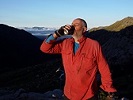
Given the departure to German lands of our good friend and former team leader Damoprz we decided conduct the inaugural ‘Damoprz Type II Memorial Extravaganza’. A small weekend trip between the of 4 of us who have most endured/enjoyed the Type II fun (https://kellycordes.com/2009/11/02/the-fun-scale/) thrown at us by his truly. Our destination was Eagle peaks, to tick this off our list after reluctantly deciding that we were underprepared for the attempt last time given the large amount of snow. 13 months later and although small amounts of snow was forecasted it was clear that levels were much lower than last time. We planned for a circuit starting and ending at seven-mile campsite. Leaving the big smoke around 6pm on Fri we arrived late after a nutritious food stop at ‘AmbleInn’ in Yea. We camped in the area close to the road as the rise and massive pothole on the opposing side of the first ford looked a bit much for ol’ ‘Rustbucket’ my hardy 92’ Toyota Corolla
After packing up camp in the morning we set off at around 9:15 am taking the high/low tracks down toward sheepyard flat. Not far in the track headed into the river. Barely even warm, we were reluctant to chill our legs for an unnecessary crossing. So commenced the first instance of bush bashing much earlier than anticipated. Soon sick of the stupidity of fighting through bush with a functional carefree road only 100 meters away, we soon joined back with civilisation. We found the marked track to what I guess should be called five-mile spur. There was a blue ribbon and clear way forward up the spur. The ribbon was soon forgotten and no more were spotted again but the way was clear and obvious up until the peak at 953m. From here until the eagle peaks track the vegetation was less welcoming and we deployed our well-developed type II bush bashing skills. We reached the track at 12:45pm in time to enjoy a view of the advancing weather.
From here on in the track was super easy to follow. Mr Weather soon joined us, as too did our rainjackets which did not separate from our bodies for the rest of the day. Lunch was held at the peak at 1236m although not for too long as without activity the cold crept into our bones and depressed our mood. At some point above 1300m we hit our first patches of snow which eventually grew although not too overly significant levels.
The ridgeline was followed and although we could kind of get a feel for the steep drop off either side the full extent was lost in a haze. Would love to come back on a clear day.
At some point, we realised that we had passed our intended turnoff. A few minutes reorientation with the GPS using unresponsive hands headed us back. It seems that the most interesting section of track lies further eastwards then the track junction so we weren’t disappointed with our mistake. It turns out that the junction is marked where there is an orange triangle pointing eastwards A steep decent down the ridgeline followed which eventually levelled out. Around 5pm with hazy twilight upon us we decided to camp near a rise at 1296 where we had already had tentative plans to camp, terrain obliging. After some unfortunate rice spillage on my behalf, a warm dinner was prepared to be subsequently consumed within the warmer confines of one of the tents. Chocolate pudding brandy, more chocolate and games of 500 ensured a pleasant evening. Alternating bursts of aggressive weather hit us through the night although tree cover protected us from the worst of the gusts. In the morning, we woke up to the realisation that we had been lightly dusted in the snowy stuff.
Following a hot cup of coffee and some more excellent breakfast slice the squad headed further on its way following the track down to its interception with the road at eight-mile gap. The point-woman was far out in head and managed to surprise a hunter parked at the road. It was suggested to her that our planned way ahead was difficult and we should follow the road until it intersected the track we were heading towards. Further consultation with the map revealed a choice. 6.5 km with 4 km of boring road or…. 1.5 Kms of good ol’ type II fun. Given the purpose of the extravaganza, the choice was obvious to all. Indeed, the way was not easy but nor was it exceptionally difficult either. A real key was learning to weave oneself in, out and under the stems and branches. Although through all this we received many face whips, scratches as well as becoming quite wet. We were able to get some views of the Bluff which looked like it would be fun to climb in such a white blanket.
Reaching eight-mile spur we had lunch looking out over the lower 4/5ths of Mt Buller with the cold again hurrying us up. Super easy walk down the spur got us down to eight-mile campsite and the high track this time took us all the way through to seven-mile campsite and back to rustbucket with plenty of daylight to spare. As has now become tradition we stopped off at Mansfield Thai for our re-acclimatisation to the delights of the modern world...
- Hoogy
- Nothofagus cunninghamii

- Posts: 1
- Joined: Mon 26 Sep, 2016 9:20 pm
- Region: Victoria
- Gender: Male
Re: Eagle Peaks from Sheepyard flat
![]() by neilmny » Fri 14 Jul, 2017 5:51 pm
by neilmny » Fri 14 Jul, 2017 5:51 pm
-
neilmny - Lagarostrobos franklinii
- Posts: 2576
- Joined: Fri 03 Aug, 2012 11:19 am
- Region: Victoria
- Gender: Male
Re: Eagle Peaks from Sheepyard flat
![]() by Biggles » Tue 18 Jul, 2017 2:53 pm
by Biggles » Tue 18 Jul, 2017 2:53 pm
—Oscar Wilde, 1890.
-

Biggles - Phyllocladus aspleniifolius

- Posts: 512
- Joined: Thu 14 May, 2009 12:14 pm
- Location: Castlemaine & Geelong
- Region: Victoria
- Gender: Male
Re: Eagle Peaks from Sheepyard flat
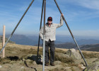
![]() by bigkev » Sun 23 Jul, 2017 6:15 pm
by bigkev » Sun 23 Jul, 2017 6:15 pm
Here's the view you missed, I went up from Eight Mile Gap yesterday
- Looking across to The Bluff from the outlier knoll to the south of the main Eagles Peaks ridge line.
- Mt McDonald in the distance.
- My climbing ridge up from Eight Mile Gap.
-
bigkev - Athrotaxis cupressoides
- Posts: 445
- Joined: Sat 30 Jun, 2012 6:44 pm
- Region: Victoria
- Gender: Male
Re: Eagle Peaks from Sheepyard flat
![]() by Stew63 » Tue 25 Jul, 2017 1:27 pm
by Stew63 » Tue 25 Jul, 2017 1:27 pm
- Stew63
- Athrotaxis cupressoides
- Posts: 390
- Joined: Sat 03 Mar, 2012 2:53 am
- Location: Eltham, Victoria
- Region: Other Country
- Gender: Male
Re: Eagle Peaks from Sheepyard flat
![]() by Pink Cap » Sat 25 Dec, 2021 1:58 pm
by Pink Cap » Sat 25 Dec, 2021 1:58 pm
- Pink Cap
- Atherosperma moschatum
- Posts: 61
- Joined: Tue 21 Apr, 2020 10:59 am
- Region: Australia
- Gender: Female
Re: Eagle Peaks from Sheepyard flat
![]() by paidal_chalne_vala » Sat 25 Dec, 2021 5:34 pm
by paidal_chalne_vala » Sat 25 Dec, 2021 5:34 pm
A VNPA trip leader told me that bits of that route on the Lickhole track are hard going and it was not much fun.
- paidal_chalne_vala
- Lagarostrobos franklinii
- Posts: 2754
- Joined: Sun 22 Jan, 2012 10:30 pm
- ASSOCIATED ORGANISATIONS: VNPA.BTAC.Friends of Baw Baw.Mt.Bogong Club.
- Region: Victoria
- Gender: Male
Re: Eagle Peaks from Sheepyard flat
![]() by Pink Cap » Thu 30 Dec, 2021 6:25 am
by Pink Cap » Thu 30 Dec, 2021 6:25 am
The Eagle Peaks trail on the Davons Flat side was very overgrown in some parts but I never had difficulty finding the trail except near the highest point where you turn sharply to descend to Eight Mile Gap, I had a lot of trouble locating the start of that track. Other minor side tracks on the way up that were marked on my map did not seem to exist at all. The initial descent was quite unpleasantly steep, in other words the bit P-C-V that you did going up.
- Pink Cap
- Atherosperma moschatum
- Posts: 61
- Joined: Tue 21 Apr, 2020 10:59 am
- Region: Australia
- Gender: Female
Re: Eagle Peaks from Sheepyard flat
![]() by Bruns69 » Sun 20 Feb, 2022 8:13 pm
by Bruns69 » Sun 20 Feb, 2022 8:13 pm
I had a go at the Lickhole creek track this weekend and I have to say that I failed miserably.
I started from Frys flat and I had no difficulties at the beginning to follow it.
But I lost it well before the climb to Mount Darling. It just vanished behind a thick curtain of blackberries and fallen trees.
I tried to push through the bush in the direction of Mount Darling but after I realised I've lost too much time I decided to turn around and I went back to my car.
Just curious to see if other people had difficulties with that track or if I need a new pair of glasses or a new brain.
- Bruns69
- Nothofagus gunnii

- Posts: 10
- Joined: Mon 16 Oct, 2017 8:23 pm
- Region: Victoria
- Gender: Male
Re: Eagle Peaks from Sheepyard flat
![]() by stry » Mon 21 Feb, 2022 7:25 am
by stry » Mon 21 Feb, 2022 7:25 am
We have had strong spring and summer growth which will have had an effect, but I would be surprised if it is impassable, although some detouring and alternate route finding could have become necessary.
A person or persons unknown trim encroaching vegetation along the track from time to time.
- stry
- Athrotaxis selaginoides

- Posts: 1429
- Joined: Mon 10 Jun, 2013 6:28 pm
- Region: Victoria
- Gender: Male
Who is online
Users browsing this forum: Google Adsense [Bot] and 31 guests