Hi all
I have done the K to K before however from Kanangra to Katoomba direction.
I am considering a overnighter - Carlons Farm to Mobbs Swanp then down to Cox's to camp Konangaroo Clearing.
Could I get some approx distance, elevation / timeframe on this hike from any experienced members please, please, please.
Thanks in advance for any help and suggestions, Nick
Carlons Farm to Mobbs Swamp, camp at Konangaroo clearing
Forum rules
NSW & ACT specific bushwalking discussion. Please avoid publishing details of access to sensitive areas with no tracks.
NSW & ACT specific bushwalking discussion. Please avoid publishing details of access to sensitive areas with no tracks.
16 posts
• Page 1 of 1
Carlons Farm to Mobbs Swamp, camp at Konangaroo clearing
![]() by NickB » Sun 17 Mar, 2019 1:36 pm
by NickB » Sun 17 Mar, 2019 1:36 pm
- NickB
- Nothofagus gunnii

- Posts: 21
- Joined: Tue 01 Mar, 2016 12:25 pm
- Region: New South Wales
- Gender: Male
Re: Carlons Farm to Mobbs Swamp, camp at Konangaroo clearing
![]() by johnrs » Sun 17 Mar, 2019 3:26 pm
by johnrs » Sun 17 Mar, 2019 3:26 pm
Heh Nick
Look up six maps, use the contours and distsance tool
John
Look up six maps, use the contours and distsance tool
John
- johnrs
- Phyllocladus aspleniifolius

- Posts: 655
- Joined: Mon 09 Aug, 2010 6:09 pm
- Region: New South Wales
Re: Carlons Farm to Mobbs Swamp, camp at Konangaroo clearing
![]() by Walk_fat boy_walk » Sun 17 Mar, 2019 7:18 pm
by Walk_fat boy_walk » Sun 17 Mar, 2019 7:18 pm
Quite a few different routes you could take... Assuming you'll do carlons Ck + blackhorse Ridge. Certainly doable to kanongaroo in a day.
Sent from my F8131 using Tapatalk
Sent from my F8131 using Tapatalk
- Walk_fat boy_walk
- Lagarostrobos franklinii

- Posts: 2355
- Joined: Sat 21 Nov, 2009 6:59 am
- Gender: Male
Re: Carlons Farm to Mobbs Swamp, camp at Konangaroo clearing
![]() by jonnosan » Sun 17 Mar, 2019 8:02 pm
by jonnosan » Sun 17 Mar, 2019 8:02 pm
If you want to make a loop of it, I suggest this:
carlon creek -> breakfast creek -> cox's creek junction - takes me 3 hrs with a full pack. pretty much all down hill - after a steep start it's pretty gentle.
then follow the track downstream till kanangaroo - maybe 3-5 hrs. need to cross over several times which will mean wet feet. There are some people the NPWS pay to shoot feral pigs who ride their horses up and down that track so it may be pretty distinct but keep an eye out for anything that looks like a spot where horses may cross because if you overshoot a crossing you can end up bluffed out and either back tracking a fair way or having to cross over in waist deep or higher water.
Then come back via yellow pup/mobbs/firetrail.
There is pretty much always flowing water where breakfast creek crosses the firetrail (2km from medlow gap), but unless there's been heavy rain recently you'd be lucky to get anything at mobbs, or more than a few stagnant pools in the lower reaches of breakfast creek.
You could of course do this in reverse, and also there is a track down ironmonger spur to the breakfast creek/cox's river junction
-
jonnosan - Phyllocladus aspleniifolius
- Posts: 918
- Joined: Fri 27 Jan, 2012 4:06 pm
- Region: New South Wales
- Gender: Male
Re: Carlons Farm to Mobbs Swamp, camp at Konangaroo clearing
![]() by Walk_fat boy_walk » Mon 18 Mar, 2019 7:53 am
by Walk_fat boy_walk » Mon 18 Mar, 2019 7:53 am
jonnosan wrote:Y, and also there is a track down ironmonger spur to the breakfast creek/cox's river junction
That'd be better, and I'd personally prefer to avoid the fire trail from Medlow (yuck). A nice loop would be from Carlons -> Ironpot -> Ironmonger to the Breakfast Ck/Coxs River junction then downstream to Konongaroo... then come back via Yellow Pup -> Mobbs (sidetrip to Splendour Rock if you have time) -> then Blackhorse Ridge down to Carlons/Breakfast Ck junction.... then up green gully back to Carlons?
- Walk_fat boy_walk
- Lagarostrobos franklinii
- Posts: 2355
- Joined: Sat 21 Nov, 2009 6:59 am
- Gender: Male
Re: Carlons Farm to Mobbs Swamp, camp at Konangaroo clearing
![]() by jonnosan » Mon 18 Mar, 2019 4:49 pm
by jonnosan » Mon 18 Mar, 2019 4:49 pm
Walk_fat boy_walk wrote:jonnosan wrote:Y, and also there is a track down ironmonger spur to the breakfast creek/cox's river junction
That'd be better, and I'd personally prefer to avoid the fire trail from Medlow (yuck). A nice loop would be from Carlons -> Ironpot -> Ironmonger to the Breakfast Ck/Coxs River junction then downstream to Konongaroo... then come back via Yellow Pup -> Mobbs (sidetrip to Splendour Rock if you have time) -> then Blackhorse Ridge down to Carlons/Breakfast Ck junction.... then up green gully back to Carlons?
yep that route will probably be the best scenery, although does mean two steep descents (Ironmonger and Blackhorse) - personally I find my knees start complaining a bit now when doing those sort of descents with a full pack which is why I generally go for steeper ascents and flatter descents.
-
jonnosan - Phyllocladus aspleniifolius
- Posts: 918
- Joined: Fri 27 Jan, 2012 4:06 pm
- Region: New South Wales
- Gender: Male
Re: Carlons Farm to Mobbs Swamp, camp at Konangaroo clearing
![]() by Walk_fat boy_walk » Mon 18 Mar, 2019 9:11 pm
by Walk_fat boy_walk » Mon 18 Mar, 2019 9:11 pm
Just reverse the directionjonnosan wrote:Walk_fat boy_walk wrote:jonnosan wrote:Y, and also there is a track down ironmonger spur to the breakfast creek/cox's river junction
That'd be better, and I'd personally prefer to avoid the fire trail from Medlow (yuck). A nice loop would be from Carlons -> Ironpot -> Ironmonger to the Breakfast Ck/Coxs River junction then downstream to Konongaroo... then come back via Yellow Pup -> Mobbs (sidetrip to Splendour Rock if you have time) -> then Blackhorse Ridge down to Carlons/Breakfast Ck junction.... then up green gully back to Carlons?
yep that route will probably be the best scenery, although does mean two steep descents (Ironmonger and Blackhorse) - personally I find my knees start complaining a bit now when doing those sort of descents with a full pack which is why I generally go for steeper ascents and flatter descents.
Sent from my F8131 using Tapatalk
- Walk_fat boy_walk
- Lagarostrobos franklinii
- Posts: 2355
- Joined: Sat 21 Nov, 2009 6:59 am
- Gender: Male
Re: Carlons Farm to Mobbs Swamp, camp at Konangaroo clearing
![]() by NickB » Sat 23 Mar, 2019 3:05 pm
by NickB » Sat 23 Mar, 2019 3:05 pm
Wow thanks so much for the tips all. Much appreciated!!! The scenic way definitely preferred.
We have 2 nights now so also a few considerations - Kanangra to Carlons
VS Wog wog - Corang Peak - Burrumbeet Brook - Corang River - Goodsell Creeek - return
Any of you done that Budawang hike? Sounds like a good trip over 3 days.
Nick
We have 2 nights now so also a few considerations - Kanangra to Carlons
VS Wog wog - Corang Peak - Burrumbeet Brook - Corang River - Goodsell Creeek - return
Any of you done that Budawang hike? Sounds like a good trip over 3 days.
Nick
- NickB
- Nothofagus gunnii
- Posts: 21
- Joined: Tue 01 Mar, 2016 12:25 pm
- Region: New South Wales
- Gender: Male
Re: Carlons Farm to Mobbs Swamp, camp at Konangaroo clearing
![]() by michael_p » Sat 23 Mar, 2019 3:28 pm
by michael_p » Sat 23 Mar, 2019 3:28 pm
I've done the loop from Wog Wog as an overnight trip. Only difference to your route is we camped at Canowie Brook not Burrumbeet. It can be easily done as an overnighter. We did camp at Wog Wog the first night so we had an easy start to the walk.
You can stretch it two nights if you camp at Corang Cascades. Note that the area around the Cascades is private property and the owners have put up signs saying that people are not allowed to use the area anymore. There is a thread on here somewhere about this problem. EDIT: Found it- viewtopic.php?f=36&t=28209
Michael.
One foot in front of the other.
-
michael_p - Athrotaxis selaginoides

- Posts: 1393
- Joined: Sun 15 Nov, 2009 6:58 pm
- Location: Macarthur Region of Sydney.
- Region: New South Wales
- Gender: Male
Re: Carlons Farm to Mobbs Swamp, camp at Konangaroo clearing
![]() by NickB » Sat 23 Mar, 2019 7:48 pm
by NickB » Sat 23 Mar, 2019 7:48 pm
Did you rate the scenery / campsites Michael? We have a few less experienced guys in the group so not aiming for big kms days. Thinking better to do it over 3 days. Any pics of Canowie Brook ?
- NickB
- Nothofagus gunnii
- Posts: 21
- Joined: Tue 01 Mar, 2016 12:25 pm
- Region: New South Wales
- Gender: Male
Re: Wog Wog, Corang Peak, Burrumbeet, Corang Cascades, Wog W
![]() by michael_p » Sun 24 Mar, 2019 1:58 pm
by michael_p » Sun 24 Mar, 2019 1:58 pm
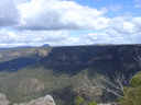
It's the Budawangs, of course the scenery is excellent.  The side trip up onto Corang Peak gives great views and Corang Arch is amazing up close. I wouldn't call the walk overly strenuous but YMMV and navigation is not hard as the tracks are well worn.
Wog Wog has a drop toilet, fire pits and that is it. Bring your own water or get it from the creek just down the walking track. Good as a Friday night pre-walk camp. One trip we camped at Wog Wog for four days and it worked well as a base camp. Just be prepared.
The campsites at Canowie are not official sites, they were just some clearings on the right before you cross the creek. Apparently there is a drop toilet at Burrumbeet but I can't confirm this personally. There are several spots to camp at Corang Cascades, just Google "Corang Cascades" and you'll find lots of photos.
Some useful photos here: viewtopic.php?f=47&t=19542
And here: https://ozultimate.com/tom/bushwalking/ ... hotos1.htm
Michael.
One foot in front of the other.
-
michael_p - Athrotaxis selaginoides
- Posts: 1393
- Joined: Sun 15 Nov, 2009 6:58 pm
- Location: Macarthur Region of Sydney.
- Region: New South Wales
- Gender: Male
Re: Carlons Farm to Mobbs Swamp, camp at Konangaroo clearing
![]() by NickB » Thu 25 Apr, 2019 1:27 pm
by NickB » Thu 25 Apr, 2019 1:27 pm
Thanks all. The support is greatly appreciated
- NickB
- Nothofagus gunnii
- Posts: 21
- Joined: Tue 01 Mar, 2016 12:25 pm
- Region: New South Wales
- Gender: Male
Re: Carlons Farm to Mobbs Swamp, camp at Konangaroo clearing
![]() by tom_brennan » Fri 26 Apr, 2019 9:52 am
by tom_brennan » Fri 26 Apr, 2019 9:52 am
There is a toilet at Burrumbeet Brook, marked on the map that accompanies this walk:
https://bushwalkingnsw.com/walk.php?nid=817
https://bushwalkingnsw.com/walk.php?nid=817
Bushwalking NSW - http://bushwalkingnsw.com
-
tom_brennan - Athrotaxis selaginoides
- Posts: 1431
- Joined: Wed 29 Sep, 2010 9:21 am
- Location: Sydney
- Region: New South Wales
- Gender: Male
Re: Carlons Farm to Mobbs Swamp, camp at Konangaroo clearing
![]() by Walk_fat boy_walk » Fri 26 Apr, 2019 2:23 pm
by Walk_fat boy_walk » Fri 26 Apr, 2019 2:23 pm
The toilet is visible from the main track, about 100m off the track. The caves at burumbeet are much better camping than canowi and imo. If you have 3 days you could walk into burumbeet on day one, check out yurnga lookout at the head of burumbeet Valley (well worth it) in the morning day 2 then over the to the cascades area for the afternoon, camping at the lagoon (private property but meh) or broula brook, or at the small campsite on canowie about 15 minutes back from the main cascades (at a creek Junction with good swimming hole... Probably nicer than the other options). Then walk out via goodsell on day 3. Three pretty easy and nice days.
Sent from my F8131 using Tapatalk
Sent from my F8131 using Tapatalk
- Walk_fat boy_walk
- Lagarostrobos franklinii
- Posts: 2355
- Joined: Sat 21 Nov, 2009 6:59 am
- Gender: Male
Re: Carlons Farm to Mobbs Swamp, camp at Konangaroo clearing
![]() by Walk_fat boy_walk » Fri 26 Apr, 2019 2:24 pm
by Walk_fat boy_walk » Fri 26 Apr, 2019 2:24 pm
Sorry meant to say walk in to burumbeet via corang peak/arch on day oneWalk_fat boy_walk wrote:The toilet is visible from the main track, about 100m off the track. The caves at burumbeet are much better camping than canowi and imo. If you have 3 days you could walk into burumbeet on day one, check out yurnga lookout at the head of burumbeet Valley (well worth it) in the morning day 2 then over the to the cascades area for the afternoon, camping at the lagoon (private property but meh) or broula brook, or at the small campsite on canowie about 15 minutes back from the main cascades (at a creek Junction with good swimming hole... Probably nicer than the other options). Then walk out via goodsell on day 3. Three pretty easy and nice days.
Sent from my F8131 using Tapatalk
Sent from my F8131 using Tapatalk
- Walk_fat boy_walk
- Lagarostrobos franklinii
- Posts: 2355
- Joined: Sat 21 Nov, 2009 6:59 am
- Gender: Male
Re: Carlons Farm to Mobbs Swamp, camp at Konangaroo clearing
![]() by wildwanderer » Mon 29 Apr, 2019 12:56 pm
by wildwanderer » Mon 29 Apr, 2019 12:56 pm
The route from the cascades (parallel to goodsells) back to the junction can be a little tricky nav wise. It's easy to miss the foot pad and struggle through scrub some metres to the side of the pad instead.
Though maybe more distinct now with increased foot traffic in the area.
Though maybe more distinct now with increased foot traffic in the area.
-

wildwanderer - Athrotaxis selaginoides
- Posts: 1637
- Joined: Tue 02 May, 2017 8:42 am
- Location: Out of lockdown \o/
- Region: New South Wales
- Gender: Male
16 posts
• Page 1 of 1
Return to New South Wales & ACT
Who is online
Users browsing this forum: No registered users and 51 guests