Hi all,
I'm considering this post not in violation of the usual off-track/sensitive areas posting rules as it describes a published and commonly used route. Mods, feel free to remove if you disagree.
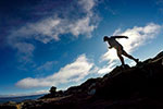
Thought I'd share some pics from our recent day trip out to Mt. Inglis, via Lake Will. General recommendation is that any trip to Mt. Inglis requires an overnight stay, but we had commitments on the Sunday and figured a 42km out-and-back trip - with most of that on the Overland Track - would be doable. But we'd need as much of the day as possible, so headed out from Dove Lake just after 4am.
Walked in darkness then mist as we came up the Chain Track, over Marions and towards Kitchen Hut. Things slowly started to lift as we sidled Cradle and came out onto the Cirque, a few fleeting glimpses of Emmett to the east. By the time we dropped down into Waterfall Valley only a bit of cloud lingered over Barn Bluff.
We crossed Innes Falls a bit before the 4 hr mark and headed west-nor-west, aiming for what appears to be the narrowest section of eucalypt forest and scrub to the south-east of the Fury Divide - what The Abels recommends when coming in from Lake Will. This section proved to be reasonably thick and required a certain amount of bush bashing, not horrible nor pleasant. Eventually we punched our way back out and onto the low vegetation of the Fury Divide and continued towards the ridge.
The Abels describes aiming 'more southerly than you think you need' when approaching the eastern ridge of Inglis to avoid the worst of the scoparia. I don't think this is quite correct, based on what we experienced. On the way up, following this advice, we found ourselves pushing through a lot of straggly, marsh scoparia until we hit the bush line... the initial climb was dense euc forest but soon gave way fagus forest, which with its open understorey, was much easier to move through. That then opened up into a lovely grove of pandani, then gave way back to low heath as the climb plateau'd.
There's a section of well-defined pad on the final approach but this soon disappears into shoulder-high scrub again if you aim straight for visible high point. Little tip - go south a bit at this point and life's easier. Final climb is surprisingly steep and being completely vegetated, rather than rocky, it actually quite tough going. You'll find yourself hanging off bushes a lot in the last 100m or so!
Mt. Inglis has a decidedly flat and fairly uninteresting top; the highest point is marked by a very half-hearted summit cairn (cue Forrest Gump "Sometimes there just aren't enough rocks"). The views however are fantastic, and give new perspectives on Barn, Cradle, Pelion West etc.
On the return trip we stayed further north down the ridge, and from the Fury Divide to Lake Will followed the creek line down to the noticeable green grass patch. This avoided all but maybe 5m of scoparia, and the button grass had plenty of open pads to work around. Much easier and faster.
All up 16hrs and 42km is a bigger day trip than most would recommend, but it's definitely doable!
Bit of a video I've put together.
[youtube]https://www.youtube.com/watch?v=tdr_krYtL5I&feature=emb_logo[/youtube]
Full report and photos:
http://www.benderandxing.com/2020/02/02/mt-inglis/
Mt. Inglis via Lake Will - February 8th 2020
Forum rules
Posting large/multiple images in this forum is OK. Please start topic titles with the name of the location or track.
For topics focussed on photos rather than the trip, please consider posting in the 'Gallery' forum instead.
This forum is for posting information about trips you have done, not for requesting information about a track or area.
2 posts
• Page 1 of 1
-

headwerkn - Phyllocladus aspleniifolius

- Posts: 661
- Joined: Sat 09 Nov, 2013 3:50 pm
- Region: Tasmania
- Gender: Male
Re: Mt. Inglis via Lake Will - February 8th 2020
Thanks for sharing. Sounds like an awesome day.
-

Rick - Atherosperma moschatum

- Posts: 99
- Joined: Fri 09 Jan, 2009 1:55 pm
- Region: Tasmania
2 posts
• Page 1 of 1
Return to TAS Trip Reports & Track Notes
Who is online
Users browsing this forum: No registered users and 3 guests
