It seemed that Howitt road was closed and the easiest way toward Mac Springs was from the Howqua, so I thought I'd do my bi-annual try and fail of the Helicopter Spur.
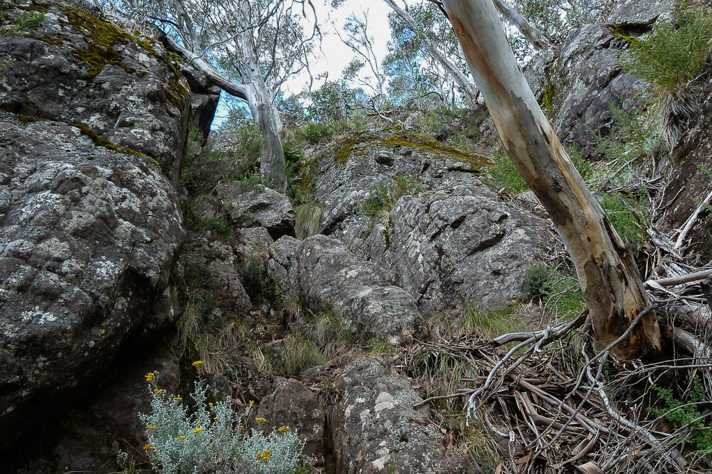
I got to the tricky bit on the second rock band and still had energy to keep going.
I started ascending on the right, but it is a sort of wedge shape, and basically seemed a bit tricky as the backpack was getting stuck in it when I was trying to lift myself up.
So, I backed out, went up the left, climbing up a bit till I hit a point where I'd have to commit to throwing myself up on a rock and if I didn't stick the landing, do some nasty falling on rock action.
I couldn't reach the higher snow Gum you see in the photo below.
I wasn't able to shimmy to the right from this point.
The photo seems very tame, but it was a bit precarious up there, I managed to remove my pack, and grab a small rope I'd brought for pack-hauling, but still couldn't see how I'd throw my fat *&%$#! up on the rock.
So, I took the coward's attack and retreated. Lowering the pack down, and then sliding down on my *&%$#!.
I remember walking down to the car, that on BigKev's Feral blog, he was able to reach the gum and get over the 'chockstone'.
He might be especially tall, but I'm guessing he also went up the right side, and thus was more or less directly under the tree.
So, is this how you do it? I'm unlikely to try again in a hurry, but my missus looked at the photo and thought I was complaining about nothing.
Is the track up to west peak of Mt Howitt easier?
It seems that it is, and in that case will probably be the track I take next time I'm starting from Upper Howqua campsite.
Related question for those with experience: is this climb more difficult or less than the Viking Chute ascent?
Assuming I went the right way up and just didn't have the cohones to complete, then I won't have them to complete the Viking Chute either if it's similar difficulty.
Anyway, thanks for any tips. I think I might need to recalibrate the level I aim for.
Two weeks ago I found the climbing around Mt Difficult Loop fine, but not this little pinch.
- Helicopter
- heli0128.png (343.66 KiB) Viewed 23916 times