Hi all,
I've done a few sections of the GNW an was wondering if there was such a walk going down to Wollongong from Sydney?
Specifically I would like to start at Hornsby and head to Albion Park (just south of Wollongong).
I was thinking either following GNW or Harbour to Hawkesbury , ferry to Circular Quay, down to Cronulla, across to Bundeena, through Royal National Park.
Then follow the coast down.
Has anyone done something like this or has any pointers, where to camp etc.
Thanks.
Great South Walk???
Forum rules
NSW & ACT specific bushwalking discussion. Please avoid publishing details of access to sensitive areas with no tracks.
NSW & ACT specific bushwalking discussion. Please avoid publishing details of access to sensitive areas with no tracks.
9 posts
• Page 1 of 1
Re: Great South Walk???
Bundeena to Otford could be considered the Great South Walk, it certainly is a great walk to do through Royal.
The Great South Walk ... if you know the history of NSW, was the desperation walk from Lake George to the country of Berridale when the Aborigines saved the settler's and their herds from starvation during the great drought of 1828.
I can detail the exact route if you are serious? It is not an easy route, but it is fascinating.
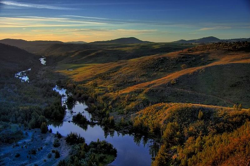
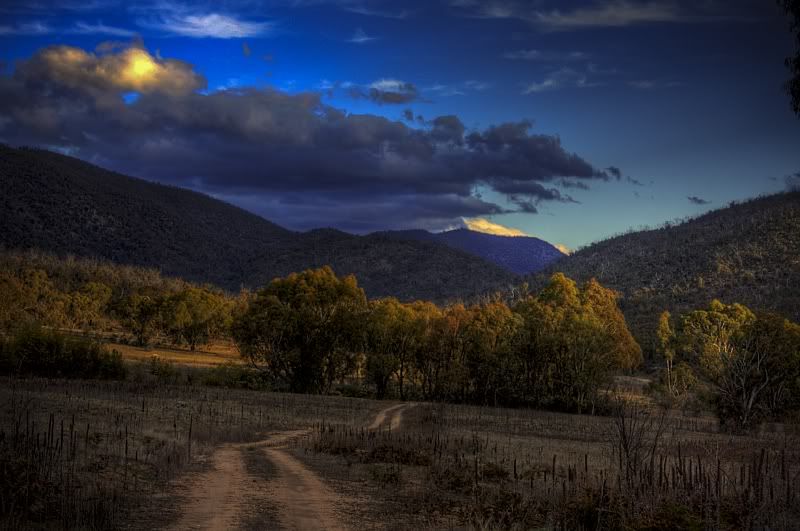
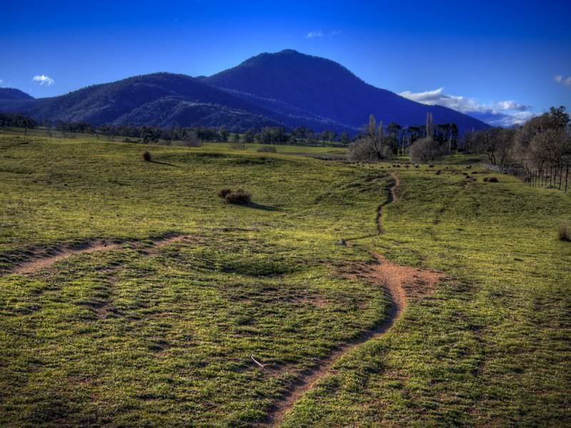
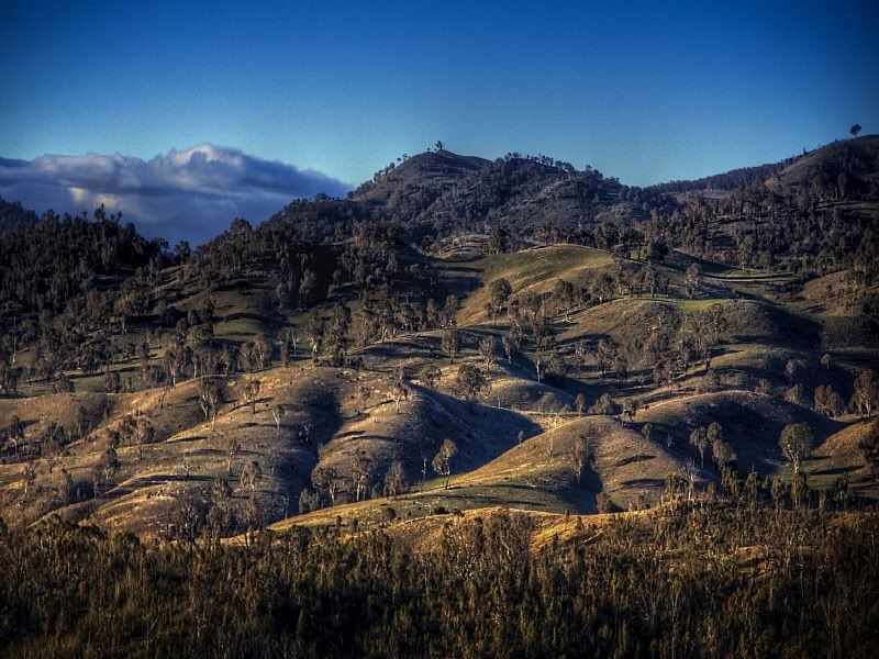
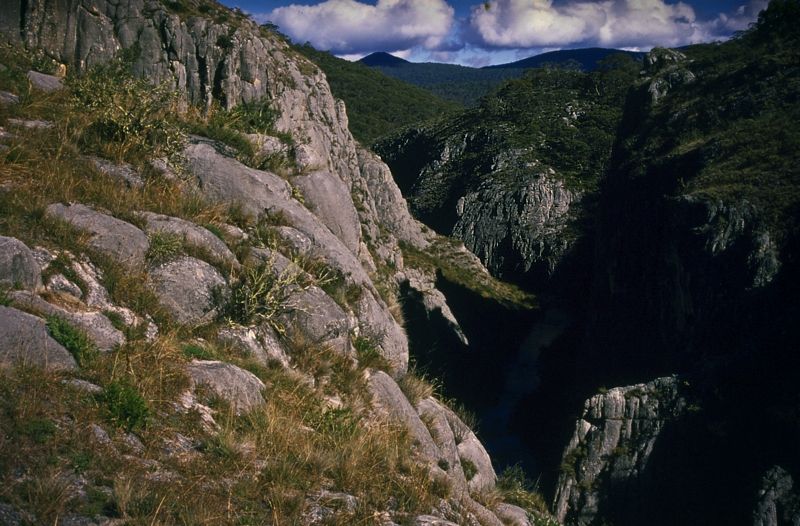
I'll stop at 5 images, about a third of the way along the route.
Warren.
The Great South Walk ... if you know the history of NSW, was the desperation walk from Lake George to the country of Berridale when the Aborigines saved the settler's and their herds from starvation during the great drought of 1828.
I can detail the exact route if you are serious? It is not an easy route, but it is fascinating.


I'll stop at 5 images, about a third of the way along the route.
Warren.
- WarrenH
- Phyllocladus aspleniifolius

- Posts: 990
- Joined: Thu 07 Jan, 2010 6:54 pm
- Region: Australian Capital Territory
Re: Great South Walk???
Warren,
Where is that last one taken from? Also when are you going to write a book? You could illustrate it with your photos.
K
Where is that last one taken from? Also when are you going to write a book? You could illustrate it with your photos.
K
- kanangra
- Athrotaxis selaginoides

- Posts: 1340
- Joined: Sun 25 May, 2008 3:52 pm
Re: Great South Walk???
Kanangra, G'day.
It is the deep limestone canyons of Nichole and Clarke Gorges on Caves Creek in Northern Kosciuszko NP. The area is called the Blue Waterholes and Cooleman Caves ... on the Cooleman Plain.
1:25,000 maps are Peppercorn and Rules Point, the gorges are where the maps join, typical. Fantastic huts here, Coolamine Homestead, Pocket's and my favourite Oldfields. The views are fantastic because the mountains here are approaching 1800 metres or above, like Mount Bimberi, Scabby and Morgan.
Warren.
- WarrenH
- Phyllocladus aspleniifolius

- Posts: 990
- Joined: Thu 07 Jan, 2010 6:54 pm
- Region: Australian Capital Territory
Re: Great South Walk???
Thank you. I know that area but had not seen from that angle before.
k.
k.
- kanangra
- Athrotaxis selaginoides

- Posts: 1340
- Joined: Sun 25 May, 2008 3:52 pm
Re: Great South Walk???
Thanks Warren, Bundeena to Otford is one part that is a goer for sure.
More interested in options from the harbour to cronulla and south of Stanwell Park.
Cheers.
More interested in options from the harbour to cronulla and south of Stanwell Park.
Cheers.
- rough60
- Nothofagus gunnii

- Posts: 18
- Joined: Sun 11 Jul, 2010 2:41 pm
- Region: New South Wales
Re: Great South Walk???
rough60 wrote:...I've done a few sections of the GNW an was wondering if there was such a walk going down to Wollongong from Sydney?
Specifically I would like to start at Hornsby and head to Albion Park (just south of Wollongong).
I was thinking either following GNW or Harbour to Hawkesbury , ferry to Circular Quay, down to Cronulla, across to Bundeena, through Royal National Park.
Then follow the coast down.
Has anyone done something like this or has any pointers, where to camp etc.
I don't have a simple answer for you but have walked various sections within reserves along that route. Unfortunately it's fragmented and I don't think you'd be able to avoid some urban/road walking.
Getting to Kurnell. If you haven't already seen it, take a look at Sydney's Great Coastal Walk - Barrenjoey to Royal National Park here:
http://www.walkingcoastalsydney.com.au/sydneys_great_coastal_walk.htm
North of Royal NP, I have in the past walked from Kurnell through Botany Bay NP to Boat Harbour approaching the southern extremeties of Wanda beach. I don't think it would be too much of a stretch to push on through to Gunnamatta Bay in Cronulla to pick up the ferry across to Bundeena and join the Coast Track. This would not be contiguous bushwalking though, if that's what you were hoping. Another thing is I don't know if there has been any impact on access south of Kurnell following the commissioning of the de-salination plant.
You obviously already know the Coast Track through Royal NP, which is a reasonable sized chunk of about 26km and contains the only designated walk-in/backpack campsite that I know of along your proposed route, at North Era. Public camp grounds exist at a couple of beaches north of Wollongong (car camping, caravan sites).
NPWS do have a "vision" of contiguous tracks through the Stanwell Park to Wollongong (Mt Keira) corridor. I remembered reading about their plans a few years back, so I managed to dig up the links below including the report that they commissioned. Have a good look at the maps starting on page 34 which show how you might be able to link the existing tracks. Forget the new/proposed ones, I doubt there's been any development on those. Certainly I've seen no evidence and I've walked parts of the Illawarra Escarpment quite recently.
http://www.environment.nsw.gov.au/resources/parks/illawarraEscarpmentTracksDraftMasterplan.pdf
http://www.environment.nsw.gov.au/parkmanagement/illawarraescarpmentwalkingtracksplansdraft.htm
Wollongong to Albion Park? Don't know without consulting the relevant topo maps. Happy to do that if it helps.
John W
In Nature's keeping they are safe, but through the agency of man destruction is making rapid progress - John Muir c1912
In Nature's keeping they are safe, but through the agency of man destruction is making rapid progress - John Muir c1912
-

johnw - Lagarostrobos franklinii

- Posts: 9684
- Joined: Wed 23 Jan, 2008 11:59 am
- Location: Macarthur Region - SW Sydney
- Region: New South Wales
- Gender: Male
Re: Great South Walk???
Thanks for the info, i'm not worried if it's not all bush for the walk down.
Just after camp sites etc at the places I'm not sure about.
Cheers.
Just after camp sites etc at the places I'm not sure about.
Cheers.
- rough60
- Nothofagus gunnii

- Posts: 18
- Joined: Sun 11 Jul, 2010 2:41 pm
- Region: New South Wales
Re: Great South Walk???
Hi rough60,
After you exit the south end of the Royal NP there are no designated 'walking' tracks as such but you could walk the beaches (and roads) if necessary down to Thirroul. (Nice little council camp site on Coledale beach.)
After Thirroul you could pick up the biketrack that runs all the way to Port Kembla (I think). Caravan parks with camping at Bulli & Fairy Meadow.
After Port Kembla you could more or less walk the beaches down to Kiama. (Caravan parks with camping at Windang and Shellharbour.)
After Shellharbour it starts to get very pretty, you have Killalea SRA and after that beautiful beaches down to Kiama. (Caravan park with camping at Kiama)
After Kiama there is a newly opened walking track (beautiful coast line) that hugs the coast line down to Shoalhaven Heads. (Camping at Shoalhaven Heads.)
Hope that helps a bit.
Melinda
'Life is either a daring adventure or nothing'
-

melinda - Phyllocladus aspleniifolius

- Posts: 580
- Joined: Mon 21 Sep, 2009 2:15 pm
- Location: Illawarra
- Region: New South Wales
- Gender: Female
9 posts
• Page 1 of 1
Return to New South Wales & ACT
Who is online
Users browsing this forum: No registered users and 29 guests
